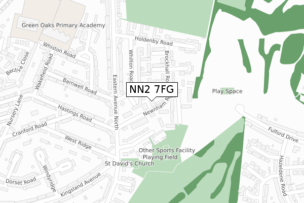
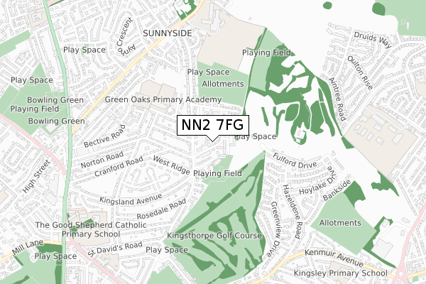
NN2 7FG is located in the Kingsthorpe South electoral ward, within the unitary authority of West Northamptonshire and the English Parliamentary constituency of Northampton North. The Sub Integrated Care Board (ICB) Location is NHS Northamptonshire ICB - 78H and the police force is Northamptonshire. This postcode has been in use since February 2018.


GetTheData
Source: OS Open Zoomstack (Ordnance Survey)
Licence: Open Government Licence (requires attribution)
Attribution: Contains OS data © Crown copyright and database right 2025
Source: Open Postcode Geo
Licence: Open Government Licence (requires attribution)
Attribution: Contains OS data © Crown copyright and database right 2025; Contains Royal Mail data © Royal Mail copyright and database right 2025; Source: Office for National Statistics licensed under the Open Government Licence v.3.0
| Easting | 476018 |
| Northing | 263528 |
| Latitude | 52.264685 |
| Longitude | -0.887522 |
GetTheData
Source: Open Postcode Geo
Licence: Open Government Licence
| Country | England |
| Postcode District | NN2 |
➜ See where NN2 is on a map ➜ Where is Northampton? | |
GetTheData
Source: Land Registry Price Paid Data
Licence: Open Government Licence
| Ward | Kingsthorpe South |
| Constituency | Northampton North |
GetTheData
Source: ONS Postcode Database
Licence: Open Government Licence
| Barnwell Road (Eastern Avenue North) | St Davids | 117m |
| Barnwell Road (Eastern Avenue North) | St Davids | 127m |
| Holdenby Road (Eastern Avenue North) | St Davids | 210m |
| Holdenby Road (Eastern Avenue North) | St Davids | 229m |
| West Ridge (Kingsland Avenue) | St Davids | 260m |
| Northampton Station | 3.3km |
GetTheData
Source: NaPTAN
Licence: Open Government Licence
| Median download speed | 100.0Mbps |
| Average download speed | 156.3Mbps |
| Maximum download speed | 350.00Mbps |
Ofcom does not currently provide upload speed data for NN2 7FG. This is because there are less than four broadband connections in this postcode.
GetTheData
Source: Ofcom
Licence: Ofcom Terms of Use (requires attribution)
GetTheData
Source: ONS Postcode Database
Licence: Open Government Licence


➜ Get more ratings from the Food Standards Agency
GetTheData
Source: Food Standards Agency
Licence: FSA terms & conditions
| Last Collection | |||
|---|---|---|---|
| Location | Mon-Fri | Sat | Distance |
| St Davids Tso | 17:30 | 12:15 | 72m |
| Cranford Road | 17:30 | 12:30 | 357m |
| Fulford Drive | 17:30 | 12:15 | 423m |
GetTheData
Source: Dracos
Licence: Creative Commons Attribution-ShareAlike
The below table lists the International Territorial Level (ITL) codes (formerly Nomenclature of Territorial Units for Statistics (NUTS) codes) and Local Administrative Units (LAU) codes for NN2 7FG:
| ITL 1 Code | Name |
|---|---|
| TLF | East Midlands (England) |
| ITL 2 Code | Name |
| TLF2 | Leicestershire, Rutland and Northamptonshire |
| ITL 3 Code | Name |
| TLF24 | West Northamptonshire |
| LAU 1 Code | Name |
| E07000154 | Northampton |
GetTheData
Source: ONS Postcode Directory
Licence: Open Government Licence
The below table lists the Census Output Area (OA), Lower Layer Super Output Area (LSOA), and Middle Layer Super Output Area (MSOA) for NN2 7FG:
| Code | Name | |
|---|---|---|
| OA | E00138522 | |
| LSOA | E01027231 | Northampton 009D |
| MSOA | E02005658 | Northampton 009 |
GetTheData
Source: ONS Postcode Directory
Licence: Open Government Licence
| NN2 7SF | Hellidon Close | 30m |
| NN2 7SD | Drayton Walk | 56m |
| NN2 7RE | Newnham Road | 63m |
| NN2 7SG | Badby Close | 73m |
| NN2 7SB | Whilton Road | 93m |
| NN2 7SQ | Churchfield Close | 123m |
| NN2 7QT | Newnham Road | 125m |
| NN2 7RY | Brockhall Road | 142m |
| NN2 7RD | Bondfield Avenue | 144m |
| NN2 7SE | Drayton Walk | 145m |
GetTheData
Source: Open Postcode Geo; Land Registry Price Paid Data
Licence: Open Government Licence