Property/Postcode Data Search:
NN2 7DW maps, stats, and open data
NN2 7DW is located in the Kingsthorpe South electoral ward, within the unitary authority of West Northamptonshire and the English Parliamentary constituency of Northampton North. The Sub Integrated Care Board (ICB) Location is NHS Northamptonshire ICB - 78H and the police force is Northamptonshire. This postcode has been in use since February 2020.
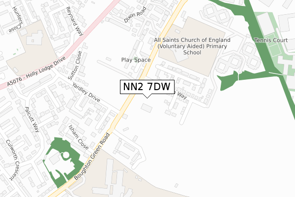
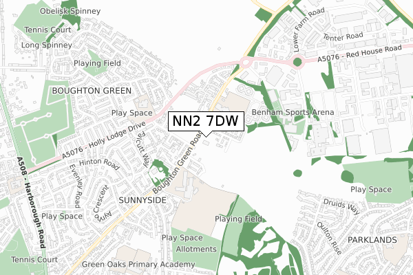
NN2 7DW maps


Source: OS Open Zoomstack (Ordnance Survey)
Licence: Open Government Licence (requires attribution)
Attribution: Contains OS data © Crown copyright and database right 2025
Source: Open Postcode Geo
Licence: Open Government Licence (requires attribution)
Attribution: Contains OS data © Crown copyright and database right 2025; Contains Royal Mail data © Royal Mail copyright and database right 2025; Source: Office for National Statistics licensed under the Open Government Licence v.3.0
Licence: Open Government Licence (requires attribution)
Attribution: Contains OS data © Crown copyright and database right 2025
Source: Open Postcode Geo
Licence: Open Government Licence (requires attribution)
Attribution: Contains OS data © Crown copyright and database right 2025; Contains Royal Mail data © Royal Mail copyright and database right 2025; Source: Office for National Statistics licensed under the Open Government Licence v.3.0
NN2 7DW geodata
| Easting | 476176 |
| Northing | 264514 |
| Latitude | 52.273526 |
| Longitude | -0.884985 |
Where is NN2 7DW?
| Country | England |
| Postcode District | NN2 |
Politics
| Ward | Kingsthorpe South |
|---|---|
| Constituency | Northampton North |
House Prices
Sales of detached houses in NN2 7DW
2023 18 AUG £370,500 |
2022 12 AUG £335,000 |
49, LAMPORT LANE, NORTHAMPTON, NN2 7DW 2022 25 MAR £360,950 |
47, LAMPORT LANE, NORTHAMPTON, NN2 7DW 2021 23 DEC £346,950 |
18, LAMPORT LANE, NORTHAMPTON, NN2 7DW 2021 3 DEC £346,950 |
22, LAMPORT LANE, NORTHAMPTON, NN2 7DW 2021 3 DEC £346,950 |
24, LAMPORT LANE, NORTHAMPTON, NN2 7DW 2021 29 OCT £425,950 |
64, LAMPORT LANE, NORTHAMPTON, NN2 7DW 2021 29 OCT £315,950 |
29, LAMPORT LANE, NORTHAMPTON, NN2 7DW 2021 30 SEP £293,950 |
31, LAMPORT LANE, NORTHAMPTON, NN2 7DW 2021 29 SEP £293,950 |
Source: HM Land Registry Price Paid Data
Licence: Contains HM Land Registry data © Crown copyright and database right 2025. This data is licensed under the Open Government Licence v3.0.
Licence: Contains HM Land Registry data © Crown copyright and database right 2025. This data is licensed under the Open Government Licence v3.0.
Transport
Nearest bus stops to NN2 7DW
| Student Centre (Campus Access Road) | Sunnyside | 91m |
| Student Centre (Campus Access Road) | Sunnyside | 97m |
| University Bus Interchange (Campus Access Road) | Sunnyside | 103m |
| Water Tower (Boughton Green Road) | Sunnyside | 107m |
| Upton Close (Yardley Drive) | Sunnyside | 178m |
Nearest railway stations to NN2 7DW
| Northampton Station | 4.3km |
Deprivation
46.2% of English postcodes are less deprived than NN2 7DW:Food Standards Agency
Three nearest food hygiene ratings to NN2 7DW (metres)
Sunnyside

Boughton Green Road
123m
Kings Pre-School

c/o All Saints CE Primary School
262m
Kingswood Education Catering

at Sunnyside Primary School
488m
➜ Get more ratings from the Food Standards Agency
Nearest post box to NN2 7DW
| Last Collection | |||
|---|---|---|---|
| Location | Mon-Fri | Sat | Distance |
| Yardley Drive | 17:30 | 11:45 | 184m |
| Hollylodge Drive | 17:30 | 11:30 | 538m |
| Hinton Road | 17:30 | 12:00 | 551m |
NN2 7DW ITL and NN2 7DW LAU
The below table lists the International Territorial Level (ITL) codes (formerly Nomenclature of Territorial Units for Statistics (NUTS) codes) and Local Administrative Units (LAU) codes for NN2 7DW:
| ITL 1 Code | Name |
|---|---|
| TLF | East Midlands (England) |
| ITL 2 Code | Name |
| TLF2 | Leicestershire, Rutland and Northamptonshire |
| ITL 3 Code | Name |
| TLF24 | West Northamptonshire |
| LAU 1 Code | Name |
| E07000154 | Northampton |
NN2 7DW census areas
The below table lists the Census Output Area (OA), Lower Layer Super Output Area (LSOA), and Middle Layer Super Output Area (MSOA) for NN2 7DW:
| Code | Name | |
|---|---|---|
| OA | E00169280 | |
| LSOA | E01027232 | Northampton 001D |
| MSOA | E02005650 | Northampton 001 |
Nearest postcodes to NN2 7DW
| NN2 7AG | Boughton Green Road | 122m |
| NN2 8TT | Hartwell Close | 187m |
| NN2 7AJ | Boughton Green Road | 215m |
| NN2 8TS | Upton Close | 256m |
| NN2 8XG | Jacorrin Close | 259m |
| NN2 8XH | Briscoe Close | 267m |
| NN2 8PE | Yardley Drive | 287m |
| NN2 8PJ | Sutton Close | 305m |
| NN2 7AQ | Isham Close | 311m |
| NN2 8XF | Jackson Close | 326m |