Property/Postcode Data Search:
NN17 5GL maps, stats, and open data
NN17 5GL is located in the Corby Rural electoral ward, within the unitary authority of North Northamptonshire and the English Parliamentary constituency of Corby. The Sub Integrated Care Board (ICB) Location is NHS Northamptonshire ICB - 78H and the police force is Northamptonshire. This postcode has been in use since November 2019.
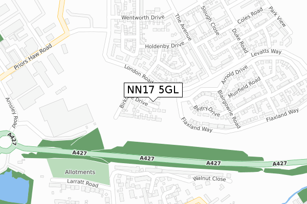
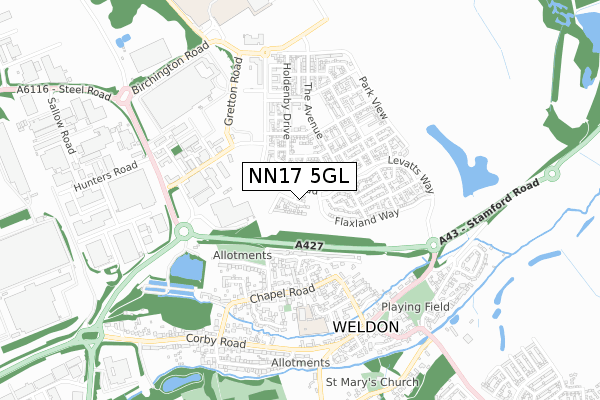
NN17 5GL maps


Source: OS Open Zoomstack (Ordnance Survey)
Licence: Open Government Licence (requires attribution)
Attribution: Contains OS data © Crown copyright and database right 2025
Source: Open Postcode Geo
Licence: Open Government Licence (requires attribution)
Attribution: Contains OS data © Crown copyright and database right 2025; Contains Royal Mail data © Royal Mail copyright and database right 2025; Source: Office for National Statistics licensed under the Open Government Licence v.3.0
Licence: Open Government Licence (requires attribution)
Attribution: Contains OS data © Crown copyright and database right 2025
Source: Open Postcode Geo
Licence: Open Government Licence (requires attribution)
Attribution: Contains OS data © Crown copyright and database right 2025; Contains Royal Mail data © Royal Mail copyright and database right 2025; Source: Office for National Statistics licensed under the Open Government Licence v.3.0
NN17 5GL geodata
| Easting | 492443 |
| Northing | 290084 |
| Latitude | 52.500849 |
| Longitude | -0.639598 |
Where is NN17 5GL?
| Country | England |
| Postcode District | NN17 |
Politics
| Ward | Corby Rural |
|---|---|
| Constituency | Corby |
House Prices
Sales of detached houses in NN17 5GL
18, BIRKDALE DRIVE, CORBY, NN17 5GL 2019 29 NOV £299,995 |
16, BIRKDALE DRIVE, CORBY, NN17 5GL 2019 29 NOV £282,995 |
Source: HM Land Registry Price Paid Data
Licence: Contains HM Land Registry data © Crown copyright and database right 2025. This data is licensed under the Open Government Licence v3.0.
Licence: Contains HM Land Registry data © Crown copyright and database right 2025. This data is licensed under the Open Government Licence v3.0.
Transport
Nearest bus stops to NN17 5GL
| Corby Gate (Priors Haw Road) | Weldon Industry | 455m |
| Corby Gate (Priors Haw Road) | Weldon Industry | 462m |
| Weldon North Industrial Estate (Steel Road) | Weldon Industry | 542m |
| Weldon North Industrial Estate (Steel Road) | Weldon Industry | 543m |
| Church View (High Street) | Weldon | 612m |
Nearest railway stations to NN17 5GL
| Corby Station | 3.6km |
Deprivation
31.2% of English postcodes are less deprived than NN17 5GL:Food Standards Agency
Three nearest food hygiene ratings to NN17 5GL (metres)
Ngoma's

222m
Weldon Village Hall

Village Hall
407m
Weldon Pre-School Nursery

Village Hall
407m
➜ Get more ratings from the Food Standards Agency
Nearest post box to NN17 5GL
| Last Collection | |||
|---|---|---|---|
| Location | Mon-Fri | Sat | Distance |
| Corby Road | 17:00 | 08:15 | 357m |
| Weldon Tso | 16:45 | 11:00 | 809m |
| Bulwick Tso | 16:00 | 10:30 | 2,330m |
NN17 5GL ITL and NN17 5GL LAU
The below table lists the International Territorial Level (ITL) codes (formerly Nomenclature of Territorial Units for Statistics (NUTS) codes) and Local Administrative Units (LAU) codes for NN17 5GL:
| ITL 1 Code | Name |
|---|---|
| TLF | East Midlands (England) |
| ITL 2 Code | Name |
| TLF2 | Leicestershire, Rutland and Northamptonshire |
| ITL 3 Code | Name |
| TLF25 | North Northamptonshire |
| LAU 1 Code | Name |
| E07000150 | Corby |
NN17 5GL census areas
The below table lists the Census Output Area (OA), Lower Layer Super Output Area (LSOA), and Middle Layer Super Output Area (MSOA) for NN17 5GL:
| Code | Name | |
|---|---|---|
| OA | E00137212 | |
| LSOA | E01026978 | Corby 003D |
| MSOA | E02005614 | Corby 003 |
Nearest postcodes to NN17 5GL
| NN17 3ED | Bramblewood Road | 254m |
| NN17 5EP | The Avenue | 290m |
| NN17 3EE | Walnut Close | 311m |
| NN17 3LR | Bakers Lane | 315m |
| NN17 5GA | Flaxland Way | 328m |
| NN17 5EH | Holdenby Drive | 331m |
| NN17 3HN | Gretton Road | 333m |
| NN17 5EE | The Avenue | 334m |
| NN17 5EG | Holdenby Drive | 356m |
| NN17 3HL | Larratt Road | 360m |