NN17 5GE maps, stats, and open data
NN17 5GE is located in the Corby Rural electoral ward, within the unitary authority of North Northamptonshire and the English Parliamentary constituency of Corby. The Sub Integrated Care Board (ICB) Location is NHS Northamptonshire ICB - 78H and the police force is Northamptonshire. This postcode has been in use since March 2018.
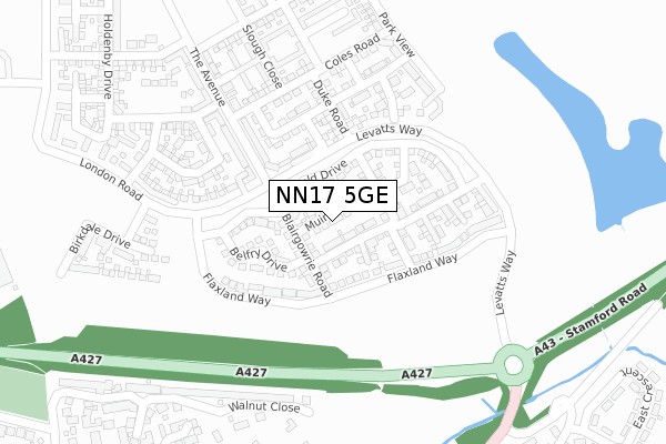
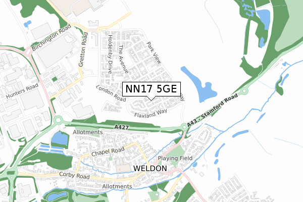
NN17 5GE maps


Licence: Open Government Licence (requires attribution)
Attribution: Contains OS data © Crown copyright and database right 2025
Source: Open Postcode Geo
Licence: Open Government Licence (requires attribution)
Attribution: Contains OS data © Crown copyright and database right 2025; Contains Royal Mail data © Royal Mail copyright and database right 2025; Source: Office for National Statistics licensed under the Open Government Licence v.3.0
NN17 5GE geodata
| Easting | 492740 |
| Northing | 290107 |
| Latitude | 52.501006 |
| Longitude | -0.635217 |
Where is NN17 5GE?
| Country | England |
| Postcode District | NN17 |
Politics
| Ward | Corby Rural |
|---|---|
| Constituency | Corby |
House Prices
Sales of detached houses in NN17 5GE
2025 15 APR £390,000 |
2021 3 DEC £395,000 |
1, MUIRFIELD ROAD, CORBY, NN17 5GE 2019 26 APR £249,995 |
7, MUIRFIELD ROAD, CORBY, NN17 5GE 2018 20 DEC £327,995 |
5, MUIRFIELD ROAD, CORBY, NN17 5GE 2018 20 DEC £251,995 |
3, MUIRFIELD ROAD, CORBY, NN17 5GE 2018 20 DEC £286,995 |
9, MUIRFIELD ROAD, CORBY, NN17 5GE 2018 19 DEC £327,995 |
2018 14 DEC £349,995 |
2018 14 DEC £351,995 |
6, MUIRFIELD ROAD, CORBY, NN17 5GE 2018 16 NOV £286,995 |
Licence: Contains HM Land Registry data © Crown copyright and database right 2025. This data is licensed under the Open Government Licence v3.0.
Transport
Nearest bus stops to NN17 5GE
| Deene End (Stamford Road) | Weldon | 401m |
| Deene End (Stamford Road) | Weldon | 422m |
| Church View (High Street) | Weldon | 603m |
| Church View (High Street) | Weldon | 620m |
| Hillside Crescent (Corby Road) | Weldon | 727m |
Nearest railway stations to NN17 5GE
| Corby Station | 3.9km |
Broadband
Broadband access in NN17 5GE (2020 data)
| Percentage of properties with Next Generation Access | 100.0% |
| Percentage of properties with Superfast Broadband | 100.0% |
| Percentage of properties with Ultrafast Broadband | 92.9% |
| Percentage of properties with Full Fibre Broadband | 92.9% |
Superfast Broadband is between 30Mbps and 300Mbps
Ultrafast Broadband is > 300Mbps
Broadband speed in NN17 5GE (2019 data)
Download
| Median download speed | 360.0Mbps |
| Average download speed | 360.0Mbps |
| Maximum download speed | 360.00Mbps |
Upload
| Median upload speed | 360.0Mbps |
| Average upload speed | 360.0Mbps |
| Maximum upload speed | 360.00Mbps |
Broadband limitations in NN17 5GE (2020 data)
| Percentage of properties unable to receive 2Mbps | 0.0% |
| Percentage of properties unable to receive 5Mbps | 0.0% |
| Percentage of properties unable to receive 10Mbps | 0.0% |
| Percentage of properties unable to receive 30Mbps | 0.0% |
Deprivation
31.2% of English postcodes are less deprived than NN17 5GE:Food Standards Agency
Three nearest food hygiene ratings to NN17 5GE (metres)


➜ Get more ratings from the Food Standards Agency
Nearest post box to NN17 5GE
| Last Collection | |||
|---|---|---|---|
| Location | Mon-Fri | Sat | Distance |
| Corby Road | 17:00 | 08:15 | 630m |
| Weldon Tso | 16:45 | 11:00 | 907m |
| Bulwick Tso | 16:00 | 10:30 | 2,051m |
NN17 5GE ITL and NN17 5GE LAU
The below table lists the International Territorial Level (ITL) codes (formerly Nomenclature of Territorial Units for Statistics (NUTS) codes) and Local Administrative Units (LAU) codes for NN17 5GE:
| ITL 1 Code | Name |
|---|---|
| TLF | East Midlands (England) |
| ITL 2 Code | Name |
| TLF2 | Leicestershire, Rutland and Northamptonshire |
| ITL 3 Code | Name |
| TLF25 | North Northamptonshire |
| LAU 1 Code | Name |
| E07000150 | Corby |
NN17 5GE census areas
The below table lists the Census Output Area (OA), Lower Layer Super Output Area (LSOA), and Middle Layer Super Output Area (MSOA) for NN17 5GE:
| Code | Name | |
|---|---|---|
| OA | E00137212 | |
| LSOA | E01026978 | Corby 003D |
| MSOA | E02005614 | Corby 003 |
Nearest postcodes to NN17 5GE
| NN17 5GA | Flaxland Way | 90m |
| NN17 5FY | Arnold Drive | 117m |
| NN17 5FX | Duke Road | 176m |
| NN17 5FW | Michaels Drive | 206m |
| NN17 5FT | Park View | 255m |
| NN17 3EE | Walnut Close | 281m |
| NN17 5EP | The Avenue | 308m |
| NN17 5FA | Ashby Street | 345m |
| NN17 3HR | Bridge Street | 383m |
| NN17 3HQ | Deeneside | 384m |