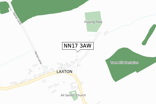
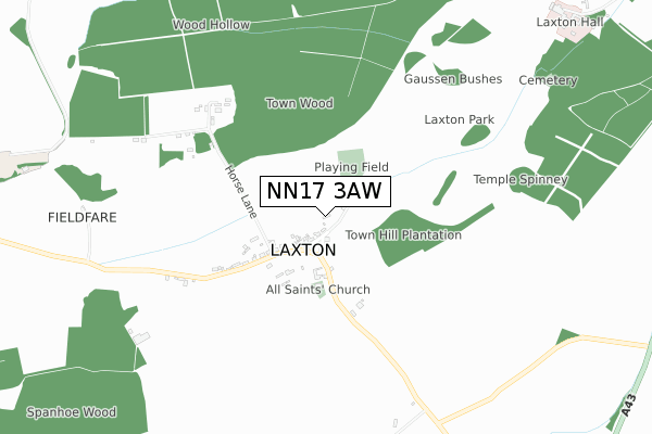
NN17 3AW is located in the Oundle electoral ward, within the unitary authority of North Northamptonshire and the English Parliamentary constituency of Corby. The Sub Integrated Care Board (ICB) Location is NHS Northamptonshire ICB - 78H and the police force is Northamptonshire. This postcode has been in use since August 2018.


GetTheData
Source: OS Open Zoomstack (Ordnance Survey)
Licence: Open Government Licence (requires attribution)
Attribution: Contains OS data © Crown copyright and database right 2025
Source: Open Postcode Geo
Licence: Open Government Licence (requires attribution)
Attribution: Contains OS data © Crown copyright and database right 2025; Contains Royal Mail data © Royal Mail copyright and database right 2025; Source: Office for National Statistics licensed under the Open Government Licence v.3.0
| Easting | 495086 |
| Northing | 296272 |
| Latitude | 52.556009 |
| Longitude | -0.598908 |
GetTheData
Source: Open Postcode Geo
Licence: Open Government Licence
| Country | England |
| Postcode District | NN17 |
➜ See where NN17 is on a map ➜ Where is Laxton? | |
GetTheData
Source: Land Registry Price Paid Data
Licence: Open Government Licence
| Ward | Oundle |
| Constituency | Corby |
GetTheData
Source: ONS Postcode Database
Licence: Open Government Licence
| Stafford Knot House (Main Street) | Laxton | 154m |
| Demand Responsive Area | Laxton | 157m |
| Stafford Knot House (Main Street) | Laxton | 160m |
| Forge Cottage (Main Street) | Laxton | 345m |
| Village Lane End (Stamford Road) | Laxton | 1,580m |
GetTheData
Source: NaPTAN
Licence: Open Government Licence
| Percentage of properties with Next Generation Access | 100.0% |
| Percentage of properties with Superfast Broadband | 100.0% |
| Percentage of properties with Ultrafast Broadband | 100.0% |
| Percentage of properties with Full Fibre Broadband | 100.0% |
Superfast Broadband is between 30Mbps and 300Mbps
Ultrafast Broadband is > 300Mbps
| Percentage of properties unable to receive 2Mbps | 0.0% |
| Percentage of properties unable to receive 5Mbps | 0.0% |
| Percentage of properties unable to receive 10Mbps | 0.0% |
| Percentage of properties unable to receive 30Mbps | 0.0% |
GetTheData
Source: Ofcom
Licence: Ofcom Terms of Use (requires attribution)
GetTheData
Source: ONS Postcode Database
Licence: Open Government Licence


➜ Get more ratings from the Food Standards Agency
GetTheData
Source: Food Standards Agency
Licence: FSA terms & conditions
| Last Collection | |||
|---|---|---|---|
| Location | Mon-Fri | Sat | Distance |
| Tixover | 16:00 | 09:00 | 5,141m |
| High Street | 16:00 | 09:00 | 5,799m |
| Highfields | 16:00 | 09:00 | 6,192m |
GetTheData
Source: Dracos
Licence: Creative Commons Attribution-ShareAlike
The below table lists the International Territorial Level (ITL) codes (formerly Nomenclature of Territorial Units for Statistics (NUTS) codes) and Local Administrative Units (LAU) codes for NN17 3AW:
| ITL 1 Code | Name |
|---|---|
| TLF | East Midlands (England) |
| ITL 2 Code | Name |
| TLF2 | Leicestershire, Rutland and Northamptonshire |
| ITL 3 Code | Name |
| TLF25 | North Northamptonshire |
| LAU 1 Code | Name |
| E07000152 | East Northamptonshire |
GetTheData
Source: ONS Postcode Directory
Licence: Open Government Licence
The below table lists the Census Output Area (OA), Lower Layer Super Output Area (LSOA), and Middle Layer Super Output Area (MSOA) for NN17 3AW:
| Code | Name | |
|---|---|---|
| OA | E00137558 | |
| LSOA | E01027043 | East Northamptonshire 001B |
| MSOA | E02005629 | East Northamptonshire 001 |
GetTheData
Source: ONS Postcode Directory
Licence: Open Government Licence
| NN17 3AT | Main Street | 332m |
| NN17 3AX | Bulwick Road | 355m |
| NN17 3AZ | 619m | |
| NN17 3AU | 1785m | |
| PE8 6YN | 1997m | |
| PE8 6YW | 2082m | |
| NN17 3DY | 2448m | |
| NN17 3BA | 2473m | |
| NN17 3EA | Millies Lane | 2506m |
| NN17 3EU | Blatherwycke Road | 2556m |
GetTheData
Source: Open Postcode Geo; Land Registry Price Paid Data
Licence: Open Government Licence