Property/Postcode Data Search:
NN15 7QR maps, stats, and open data
NN15 7QR is located in the Wicksteed electoral ward, within the unitary authority of North Northamptonshire and the English Parliamentary constituency of Kettering. The Sub Integrated Care Board (ICB) Location is NHS Northamptonshire ICB - 78H and the police force is Northamptonshire. This postcode has been in use since September 2019.
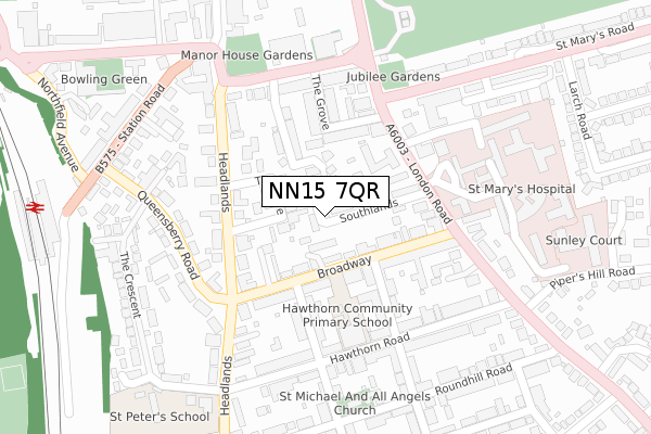
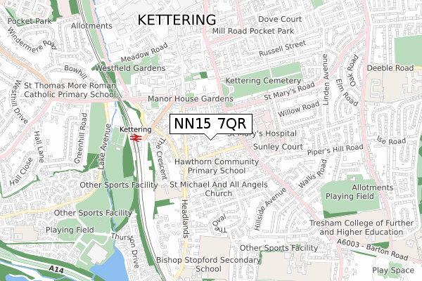
NN15 7QR maps


Source: OS Open Zoomstack (Ordnance Survey)
Licence: Open Government Licence (requires attribution)
Attribution: Contains OS data © Crown copyright and database right 2025
Source: Open Postcode Geo
Licence: Open Government Licence (requires attribution)
Attribution: Contains OS data © Crown copyright and database right 2025; Contains Royal Mail data © Royal Mail copyright and database right 2025; Source: Office for National Statistics licensed under the Open Government Licence v.3.0
Licence: Open Government Licence (requires attribution)
Attribution: Contains OS data © Crown copyright and database right 2025
Source: Open Postcode Geo
Licence: Open Government Licence (requires attribution)
Attribution: Contains OS data © Crown copyright and database right 2025; Contains Royal Mail data © Royal Mail copyright and database right 2025; Source: Office for National Statistics licensed under the Open Government Licence v.3.0
NN15 7QR geodata
| Easting | 486802 |
| Northing | 278033 |
| Latitude | 52.393461 |
| Longitude | -0.725804 |
Where is NN15 7QR?
| Country | England |
| Postcode District | NN15 |
Politics
| Ward | Wicksteed |
|---|---|
| Constituency | Kettering |
House Prices
Sales of detached houses in NN15 7QR
2023 29 AUG £477,000 |
1, BELLE VUE CLOSE, KETTERING, NN15 7QR 2021 30 JUN £495,000 |
3, BELLE VUE CLOSE, KETTERING, NN15 7QR 2021 29 JAN £465,000 |
5, BELLE VUE CLOSE, KETTERING, NN15 7QR 2020 4 DEC £450,000 |
2020 29 MAY £477,500 |
2, BELLE VUE CLOSE, KETTERING, NN15 7QR 2019 18 DEC £465,000 |
2019 18 DEC £445,000 |
Source: HM Land Registry Price Paid Data
Licence: Contains HM Land Registry data © Crown copyright and database right 2025. This data is licensed under the Open Government Licence v3.0.
Licence: Contains HM Land Registry data © Crown copyright and database right 2025. This data is licensed under the Open Government Licence v3.0.
Transport
Nearest bus stops to NN15 7QR
| Argyll Social Club (Argyll Street) | Kettering | 151m |
| 102 Broadway (Broadway) | Kettering | 164m |
| St Mary's Hospital (London Road) | Kettering | 168m |
| St Mary's Hospital (London Road) | Kettering | 183m |
| Argyll Social Club (Argyll Street) | Kettering | 185m |
Nearest railway stations to NN15 7QR
| Kettering Station | 0.4km |
Deprivation
51.4% of English postcodes are less deprived than NN15 7QR:Food Standards Agency
Three nearest food hygiene ratings to NN15 7QR (metres)
Broadway Stores

1 Broadway
116m
Gabriel Court Ltd

17-23 Broadway
116m
Ocean Takeaway

35 Broadway
127m
➜ Get more ratings from the Food Standards Agency
Nearest post box to NN15 7QR
| Last Collection | |||
|---|---|---|---|
| Location | Mon-Fri | Sat | Distance |
| Headlands | 17:15 | 11:30 | 264m |
| Green Lane | 17:15 | 12:15 | 571m |
| Station Road | 16:45 | 08:15 | 788m |
NN15 7QR ITL and NN15 7QR LAU
The below table lists the International Territorial Level (ITL) codes (formerly Nomenclature of Territorial Units for Statistics (NUTS) codes) and Local Administrative Units (LAU) codes for NN15 7QR:
| ITL 1 Code | Name |
|---|---|
| TLF | East Midlands (England) |
| ITL 2 Code | Name |
| TLF2 | Leicestershire, Rutland and Northamptonshire |
| ITL 3 Code | Name |
| TLF25 | North Northamptonshire |
| LAU 1 Code | Name |
| E07000153 | Kettering |
NN15 7QR census areas
The below table lists the Census Output Area (OA), Lower Layer Super Output Area (LSOA), and Middle Layer Super Output Area (MSOA) for NN15 7QR:
| Code | Name | |
|---|---|---|
| OA | E00137927 | |
| LSOA | E01027113 | Kettering 007C |
| MSOA | E02005645 | Kettering 007 |
Nearest postcodes to NN15 7QR
| NN15 7EX | The Drive | 68m |
| NN15 6DF | Broadway | 97m |
| NN15 7QH | St Pauls Court | 99m |
| NN15 6DE | Broadway | 102m |
| NN15 7ES | Headlands | 112m |
| NN15 6DD | Broadway | 113m |
| NN15 7QG | Southlands | 120m |
| NN15 7ET | Headlands | 127m |
| NN15 7QJ | Bowling Green Avenue | 129m |
| NN15 7HP | Headlands | 163m |