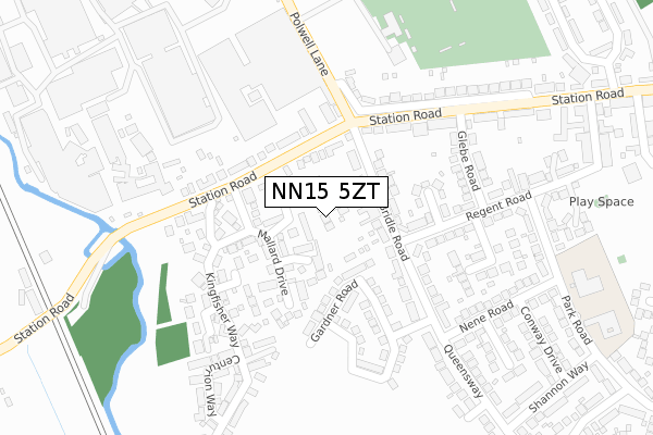
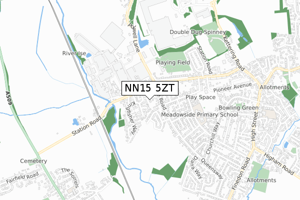
NN15 5ZT is located in the Burton and Broughton electoral ward, within the unitary authority of North Northamptonshire and the English Parliamentary constituency of Kettering. The Sub Integrated Care Board (ICB) Location is NHS Northamptonshire ICB - 78H and the police force is Northamptonshire. This postcode has been in use since December 2017.


GetTheData
Source: OS Open Zoomstack (Ordnance Survey)
Licence: Open Government Licence (requires attribution)
Attribution: Contains OS data © Crown copyright and database right 2025
Source: Open Postcode Geo
Licence: Open Government Licence (requires attribution)
Attribution: Contains OS data © Crown copyright and database right 2025; Contains Royal Mail data © Royal Mail copyright and database right 2025; Source: Office for National Statistics licensed under the Open Government Licence v.3.0
| Easting | 489181 |
| Northing | 274804 |
| Latitude | 52.364058 |
| Longitude | -0.691710 |
GetTheData
Source: Open Postcode Geo
Licence: Open Government Licence
| Country | England |
| Postcode District | NN15 |
➜ See where NN15 is on a map ➜ Where is Burton Latimer? | |
GetTheData
Source: Land Registry Price Paid Data
Licence: Open Government Licence
| Ward | Burton And Broughton |
| Constituency | Kettering |
GetTheData
Source: ONS Postcode Database
Licence: Open Government Licence
2024 5 FEB £375,000 |
2019 12 APR £350,000 |
2018 20 AUG £320,000 |
2, VINE GARDENS, BURTON LATIMER, KETTERING, NN15 5ZT 2018 3 JUL £385,000 |
3, VINE GARDENS, BURTON LATIMER, KETTERING, NN15 5ZT 2018 15 JUN £385,000 |
4, VINE GARDENS, BURTON LATIMER, KETTERING, NN15 5ZT 2017 20 NOV £325,000 |
GetTheData
Source: HM Land Registry Price Paid Data
Licence: Contains HM Land Registry data © Crown copyright and database right 2025. This data is licensed under the Open Government Licence v3.0.
| Station Road (Polwell Lane) | Burton Latimer | 225m |
| Glebe General Store (Glebe Road) | Burton Latimer | 227m |
| Glebe General Store (Glebe Road) | Burton Latimer | 237m |
| Shannon Way (Queensway) | Burton Latimer | 277m |
| Shannon Way (Queensway) | Burton Latimer | 428m |
| Kettering Station | 4.3km |
GetTheData
Source: NaPTAN
Licence: Open Government Licence
| Percentage of properties with Next Generation Access | 100.0% |
| Percentage of properties with Superfast Broadband | 100.0% |
| Percentage of properties with Ultrafast Broadband | 0.0% |
| Percentage of properties with Full Fibre Broadband | 0.0% |
Superfast Broadband is between 30Mbps and 300Mbps
Ultrafast Broadband is > 300Mbps
| Median download speed | 55.0Mbps |
| Average download speed | 45.2Mbps |
| Maximum download speed | 58.59Mbps |
| Median upload speed | 10.0Mbps |
| Average upload speed | 10.1Mbps |
| Maximum upload speed | 19.53Mbps |
| Percentage of properties unable to receive 2Mbps | 0.0% |
| Percentage of properties unable to receive 5Mbps | 0.0% |
| Percentage of properties unable to receive 10Mbps | 0.0% |
| Percentage of properties unable to receive 30Mbps | 0.0% |
GetTheData
Source: Ofcom
Licence: Ofcom Terms of Use (requires attribution)
GetTheData
Source: ONS Postcode Database
Licence: Open Government Licence


➜ Get more ratings from the Food Standards Agency
GetTheData
Source: Food Standards Agency
Licence: FSA terms & conditions
| Last Collection | |||
|---|---|---|---|
| Location | Mon-Fri | Sat | Distance |
| Church Street | 16:45 | 08:15 | 938m |
| Barton Seagrave Tso | 17:30 | 11:00 | 2,354m |
| Barton Road | 16:45 | 11:45 | 2,500m |
GetTheData
Source: Dracos
Licence: Creative Commons Attribution-ShareAlike
The below table lists the International Territorial Level (ITL) codes (formerly Nomenclature of Territorial Units for Statistics (NUTS) codes) and Local Administrative Units (LAU) codes for NN15 5ZT:
| ITL 1 Code | Name |
|---|---|
| TLF | East Midlands (England) |
| ITL 2 Code | Name |
| TLF2 | Leicestershire, Rutland and Northamptonshire |
| ITL 3 Code | Name |
| TLF25 | North Northamptonshire |
| LAU 1 Code | Name |
| E07000153 | Kettering |
GetTheData
Source: ONS Postcode Directory
Licence: Open Government Licence
The below table lists the Census Output Area (OA), Lower Layer Super Output Area (LSOA), and Middle Layer Super Output Area (MSOA) for NN15 5ZT:
| Code | Name | |
|---|---|---|
| OA | E00137815 | |
| LSOA | E01027092 | Kettering 011B |
| MSOA | E02005649 | Kettering 011 |
GetTheData
Source: ONS Postcode Directory
Licence: Open Government Licence
| NN15 5TF | Sandpiper Close | 56m |
| NN15 5NY | Station Road | 89m |
| NN15 5TH | Eider Close | 89m |
| NN15 5QP | Bridle Road | 95m |
| NN15 5TG | Mallard Drive | 113m |
| NN15 5TJ | Brent Close | 117m |
| NN15 5QS | Regent Close | 157m |
| NN15 5XP | Walden Road | 161m |
| NN15 5TN | Swan Close | 181m |
| NN15 5TD | Bunting Close | 183m |
GetTheData
Source: Open Postcode Geo; Land Registry Price Paid Data
Licence: Open Government Licence