Property/Postcode Data Search:
NN15 5ZP maps, stats, and open data
NN15 5ZP is located in the Burton and Broughton electoral ward, within the unitary authority of North Northamptonshire and the English Parliamentary constituency of Kettering. The Sub Integrated Care Board (ICB) Location is NHS Northamptonshire ICB - 78H and the police force is Northamptonshire. This postcode has been in use since September 2019.
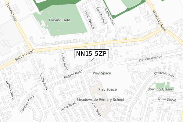
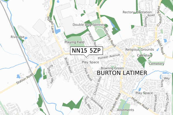
NN15 5ZP maps


Source: OS Open Zoomstack (Ordnance Survey)
Licence: Open Government Licence (requires attribution)
Attribution: Contains OS data © Crown copyright and database right 2025
Source: Open Postcode Geo
Licence: Open Government Licence (requires attribution)
Attribution: Contains OS data © Crown copyright and database right 2025; Contains Royal Mail data © Royal Mail copyright and database right 2025; Source: Office for National Statistics licensed under the Open Government Licence v.3.0
Licence: Open Government Licence (requires attribution)
Attribution: Contains OS data © Crown copyright and database right 2025
Source: Open Postcode Geo
Licence: Open Government Licence (requires attribution)
Attribution: Contains OS data © Crown copyright and database right 2025; Contains Royal Mail data © Royal Mail copyright and database right 2025; Source: Office for National Statistics licensed under the Open Government Licence v.3.0
NN15 5ZP geodata
| Easting | 489546 |
| Northing | 274895 |
| Latitude | 52.364816 |
| Longitude | -0.686327 |
Where is NN15 5ZP?
| Country | England |
| Postcode District | NN15 |
Politics
| Ward | Burton And Broughton |
|---|---|
| Constituency | Kettering |
House Prices
Sales of detached houses in NN15 5ZP
2024 9 JUL £275,000 |
2019 6 DEC £255,000 |
4, HAMLET GARDENS, BURTON LATIMER, KETTERING, NN15 5ZP 2019 18 OCT £260,000 |
2, HAMLET GARDENS, BURTON LATIMER, KETTERING, NN15 5ZP 2019 4 OCT £260,000 |
2019 13 SEP £260,000 |
Source: HM Land Registry Price Paid Data
Licence: Contains HM Land Registry data © Crown copyright and database right 2025. This data is licensed under the Open Government Licence v3.0.
Licence: Contains HM Land Registry data © Crown copyright and database right 2025. This data is licensed under the Open Government Licence v3.0.
Transport
Nearest bus stops to NN15 5ZP
| William Street (Station Road) | Burton Latimer | 136m |
| Glebe General Store (Glebe Road) | Burton Latimer | 151m |
| William Street (Station Road) | Burton Latimer | 156m |
| Glebe General Store (Glebe Road) | Burton Latimer | 160m |
| Infants School (Park Road) | Burton Latimer | 271m |
Nearest railway stations to NN15 5ZP
| Kettering Station | 4.4km |
Deprivation
55.1% of English postcodes are less deprived than NN15 5ZP:Food Standards Agency
Three nearest food hygiene ratings to NN15 5ZP (metres)
121 Station Road

The Willands
69m
Burton Oaks Residential Home

119 Station Road
74m
Glebe Stores

2 Glebe Road
163m
➜ Get more ratings from the Food Standards Agency
Nearest post box to NN15 5ZP
| Last Collection | |||
|---|---|---|---|
| Location | Mon-Fri | Sat | Distance |
| Church Street | 16:45 | 08:15 | 598m |
| Barton Road | 16:45 | 11:45 | 2,189m |
| Barton Seagrave Tso | 17:30 | 11:00 | 2,359m |
NN15 5ZP ITL and NN15 5ZP LAU
The below table lists the International Territorial Level (ITL) codes (formerly Nomenclature of Territorial Units for Statistics (NUTS) codes) and Local Administrative Units (LAU) codes for NN15 5ZP:
| ITL 1 Code | Name |
|---|---|
| TLF | East Midlands (England) |
| ITL 2 Code | Name |
| TLF2 | Leicestershire, Rutland and Northamptonshire |
| ITL 3 Code | Name |
| TLF25 | North Northamptonshire |
| LAU 1 Code | Name |
| E07000153 | Kettering |
NN15 5ZP census areas
The below table lists the Census Output Area (OA), Lower Layer Super Output Area (LSOA), and Middle Layer Super Output Area (MSOA) for NN15 5ZP:
| Code | Name | |
|---|---|---|
| OA | E00137815 | |
| LSOA | E01027092 | Kettering 011B |
| MSOA | E02005649 | Kettering 011 |
Nearest postcodes to NN15 5ZP
| NN15 5QX | Victoria Street | 65m |
| NN15 5PA | Station Road | 71m |
| NN15 5FA | Charles Court | 113m |
| NN15 5LN | William Street | 137m |
| NN15 5QR | Regent Road | 139m |
| NN15 5QU | Glebe Road | 162m |
| NN15 5NU | Station Road | 169m |
| NN15 5PE | South Avenue | 171m |
| NN15 5QT | Shakespeare Drive | 203m |
| NN15 5QS | Regent Close | 220m |