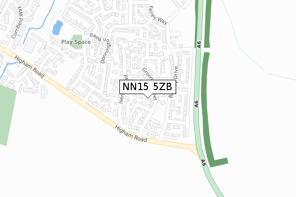
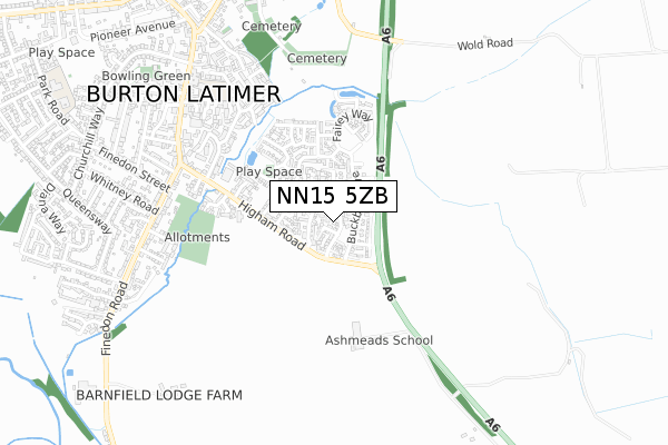
NN15 5ZB is located in the Burton and Broughton electoral ward, within the unitary authority of North Northamptonshire and the English Parliamentary constituency of Kettering. The Sub Integrated Care Board (ICB) Location is NHS Northamptonshire ICB - 78H and the police force is Northamptonshire. This postcode has been in use since October 2017.


GetTheData
Source: OS Open Zoomstack (Ordnance Survey)
Licence: Open Government Licence (requires attribution)
Attribution: Contains OS data © Crown copyright and database right 2025
Source: Open Postcode Geo
Licence: Open Government Licence (requires attribution)
Attribution: Contains OS data © Crown copyright and database right 2025; Contains Royal Mail data © Royal Mail copyright and database right 2025; Source: Office for National Statistics licensed under the Open Government Licence v.3.0
| Easting | 490651 |
| Northing | 274256 |
| Latitude | 52.358892 |
| Longitude | -0.670276 |
GetTheData
Source: Open Postcode Geo
Licence: Open Government Licence
| Country | England |
| Postcode District | NN15 |
➜ See where NN15 is on a map ➜ Where is Burton Latimer? | |
GetTheData
Source: Land Registry Price Paid Data
Licence: Open Government Licence
| Ward | Burton And Broughton |
| Constituency | Kettering |
GetTheData
Source: ONS Postcode Database
Licence: Open Government Licence
2022 26 APR £405,000 |
2021 7 APR £450,000 |
42, GROOME STREET, BURTON LATIMER, KETTERING, NN15 5ZB 2021 14 JAN £360,000 |
54, GROOME STREET, BURTON LATIMER, KETTERING, NN15 5ZB 2020 14 DEC £500,000 |
46, GROOME STREET, BURTON LATIMER, KETTERING, NN15 5ZB 2020 11 DEC £365,000 |
56, GROOME STREET, BURTON LATIMER, KETTERING, NN15 5ZB 2020 27 NOV £450,000 |
52, GROOME STREET, BURTON LATIMER, KETTERING, NN15 5ZB 2020 20 NOV £470,000 |
44, GROOME STREET, BURTON LATIMER, KETTERING, NN15 5ZB 2020 26 JUN £370,000 |
32, GROOME STREET, BURTON LATIMER, KETTERING, NN15 5ZB 2020 22 JUN £360,000 |
38, GROOME STREET, BURTON LATIMER, KETTERING, NN15 5ZB 2019 21 NOV £370,000 |
GetTheData
Source: HM Land Registry Price Paid Data
Licence: Contains HM Land Registry data © Crown copyright and database right 2025. This data is licensed under the Open Government Licence v3.0.
| Brooks Close (Higham Road) | Burton Latimer | 404m |
| Brooks Close (Higham Road) | Burton Latimer | 424m |
| Newman Street (High Street) | Burton Latimer | 662m |
| Newman Street (High Street) | Burton Latimer | 669m |
| Whitney Road (Finedon Road) | Burton Latimer | 680m |
| Kettering Station | 5.7km |
GetTheData
Source: NaPTAN
Licence: Open Government Licence
| Percentage of properties with Next Generation Access | 100.0% |
| Percentage of properties with Superfast Broadband | 100.0% |
| Percentage of properties with Ultrafast Broadband | 92.9% |
| Percentage of properties with Full Fibre Broadband | 92.9% |
Superfast Broadband is between 30Mbps and 300Mbps
Ultrafast Broadband is > 300Mbps
| Median download speed | 200.0Mbps |
| Average download speed | 216.7Mbps |
| Maximum download speed | 350.00Mbps |
Ofcom does not currently provide upload speed data for NN15 5ZB. This is because there are less than four broadband connections in this postcode.
| Percentage of properties unable to receive 2Mbps | 0.0% |
| Percentage of properties unable to receive 5Mbps | 0.0% |
| Percentage of properties unable to receive 10Mbps | 0.0% |
| Percentage of properties unable to receive 30Mbps | 0.0% |
GetTheData
Source: Ofcom
Licence: Ofcom Terms of Use (requires attribution)
GetTheData
Source: ONS Postcode Database
Licence: Open Government Licence


➜ Get more ratings from the Food Standards Agency
GetTheData
Source: Food Standards Agency
Licence: FSA terms & conditions
| Last Collection | |||
|---|---|---|---|
| Location | Mon-Fri | Sat | Distance |
| Church Street | 16:45 | 08:15 | 701m |
| Barton Road | 16:45 | 11:45 | 2,354m |
| Barton Seagrave Tso | 17:30 | 11:00 | 3,431m |
GetTheData
Source: Dracos
Licence: Creative Commons Attribution-ShareAlike
The below table lists the International Territorial Level (ITL) codes (formerly Nomenclature of Territorial Units for Statistics (NUTS) codes) and Local Administrative Units (LAU) codes for NN15 5ZB:
| ITL 1 Code | Name |
|---|---|
| TLF | East Midlands (England) |
| ITL 2 Code | Name |
| TLF2 | Leicestershire, Rutland and Northamptonshire |
| ITL 3 Code | Name |
| TLF25 | North Northamptonshire |
| LAU 1 Code | Name |
| E07000153 | Kettering |
GetTheData
Source: ONS Postcode Directory
Licence: Open Government Licence
The below table lists the Census Output Area (OA), Lower Layer Super Output Area (LSOA), and Middle Layer Super Output Area (MSOA) for NN15 5ZB:
| Code | Name | |
|---|---|---|
| OA | E00137854 | |
| LSOA | E01027101 | Kettering 011C |
| MSOA | E02005649 | Kettering 011 |
GetTheData
Source: ONS Postcode Directory
Licence: Open Government Licence
| NN15 5XU | Isemill Road | 118m |
| NN15 5WN | Donnington Road | 166m |
| NN15 5WP | Goodwood Close | 213m |
| NN15 5WG | Cadwell Close | 213m |
| NN15 5WH | Castle Coombe | 220m |
| NN15 5WL | Donnington Road | 223m |
| NN15 5WS | Mallory Way | 241m |
| NN15 5WF | Brands Hatch Close | 256m |
| NN15 5WR | Lydden Close | 260m |
| NN15 5XB | Rockingham Way | 266m |
GetTheData
Source: Open Postcode Geo; Land Registry Price Paid Data
Licence: Open Government Licence