NN14 4GL maps, stats, and open data
NN14 4GL is located in the Thrapston electoral ward, within the unitary authority of North Northamptonshire and the English Parliamentary constituency of Corby. The Sub Integrated Care Board (ICB) Location is NHS Northamptonshire ICB - 78H and the police force is Northamptonshire. This postcode has been in use since April 2019.
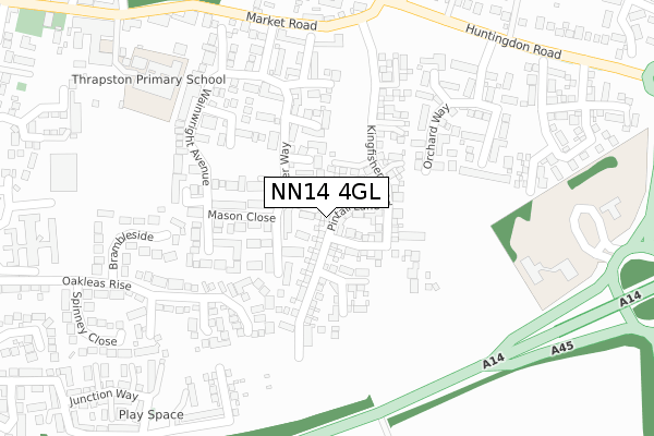
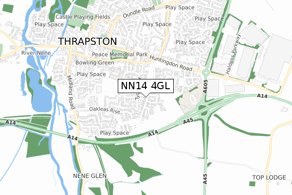
NN14 4GL maps


Licence: Open Government Licence (requires attribution)
Attribution: Contains OS data © Crown copyright and database right 2025
Source: Open Postcode Geo
Licence: Open Government Licence (requires attribution)
Attribution: Contains OS data © Crown copyright and database right 2025; Contains Royal Mail data © Royal Mail copyright and database right 2025; Source: Office for National Statistics licensed under the Open Government Licence v.3.0
NN14 4GL geodata
| Easting | 500068 |
| Northing | 278111 |
| Latitude | 52.391902 |
| Longitude | -0.530893 |
Where is NN14 4GL?
| Country | England |
| Postcode District | NN14 |
Politics
| Ward | Thrapston |
|---|---|
| Constituency | Corby |
House Prices
Sales of detached houses in NN14 4GL
2024 16 DEC £433,500 |
2024 4 OCT £345,000 |
2024 31 JUL £570,000 |
2022 29 JUL £620,000 |
27, PINTAIL LANE, THRAPSTON, KETTERING, NN14 4GL 2020 27 AUG £296,495 |
25, PINTAIL LANE, THRAPSTON, KETTERING, NN14 4GL 2020 23 JUL £390,995 |
40, PINTAIL LANE, THRAPSTON, KETTERING, NN14 4GL 2020 3 JUL £392,995 |
2020 13 FEB £365,995 |
32, PINTAIL LANE, THRAPSTON, KETTERING, NN14 4GL 2020 11 FEB £579,995 |
19, PINTAIL LANE, THRAPSTON, KETTERING, NN14 4GL 2019 20 DEC £334,995 |
Licence: Contains HM Land Registry data © Crown copyright and database right 2025. This data is licensed under the Open Government Licence v3.0.
Transport
Nearest bus stops to NN14 4GL
| Orchard Way (Huntingdon Road) | Thrapston | 417m |
| Nene Leisure Centre (Cedar Drive) | Thrapston | 439m |
| Thrapston House (Huntingdon Road) | Thrapston | 507m |
| Thrapston House (Huntingdon Road) | Thrapston | 523m |
| Faraday Court (Highfield Road) | Thrapston | 526m |
Broadband
Broadband access in NN14 4GL (2020 data)
| Percentage of properties with Next Generation Access | 100.0% |
| Percentage of properties with Superfast Broadband | 100.0% |
| Percentage of properties with Ultrafast Broadband | 100.0% |
| Percentage of properties with Full Fibre Broadband | 100.0% |
Superfast Broadband is between 30Mbps and 300Mbps
Ultrafast Broadband is > 300Mbps
Broadband limitations in NN14 4GL (2020 data)
| Percentage of properties unable to receive 2Mbps | 0.0% |
| Percentage of properties unable to receive 5Mbps | 0.0% |
| Percentage of properties unable to receive 10Mbps | 0.0% |
| Percentage of properties unable to receive 30Mbps | 0.0% |
Deprivation
2.5% of English postcodes are less deprived than NN14 4GL:Food Standards Agency
Three nearest food hygiene ratings to NN14 4GL (metres)


➜ Get more ratings from the Food Standards Agency
Nearest post box to NN14 4GL
| Last Collection | |||
|---|---|---|---|
| Location | Mon-Fri | Sat | Distance |
| Thrapston Tso | 17:15 | 10:30 | 483m |
| Mallows Drive | 16:45 | 08:30 | 4,701m |
| Keyston | 16:15 | 10:00 | 5,079m |
NN14 4GL ITL and NN14 4GL LAU
The below table lists the International Territorial Level (ITL) codes (formerly Nomenclature of Territorial Units for Statistics (NUTS) codes) and Local Administrative Units (LAU) codes for NN14 4GL:
| ITL 1 Code | Name |
|---|---|
| TLF | East Midlands (England) |
| ITL 2 Code | Name |
| TLF2 | Leicestershire, Rutland and Northamptonshire |
| ITL 3 Code | Name |
| TLF25 | North Northamptonshire |
| LAU 1 Code | Name |
| E07000152 | East Northamptonshire |
NN14 4GL census areas
The below table lists the Census Output Area (OA), Lower Layer Super Output Area (LSOA), and Middle Layer Super Output Area (MSOA) for NN14 4GL:
| Code | Name | |
|---|---|---|
| OA | E00137728 | |
| LSOA | E01027077 | East Northamptonshire 003E |
| MSOA | E02005631 | East Northamptonshire 003 |
Nearest postcodes to NN14 4GL
| NN14 4LG | Elm Court | 108m |
| NN14 4XF | Miller Close | 119m |
| NN14 4XA | Baker Court | 135m |
| NN14 4UE | Tyler Way | 138m |
| NN14 4UQ | Mason Close | 157m |
| NN14 4UD | Forrester Grove | 166m |
| NN14 4LP | Ash Court | 192m |
| NN14 4UB | Fisher Close | 216m |
| NN14 4UP | Cooper Court | 231m |
| NN14 4UJ | Fletcher Gardens | 256m |