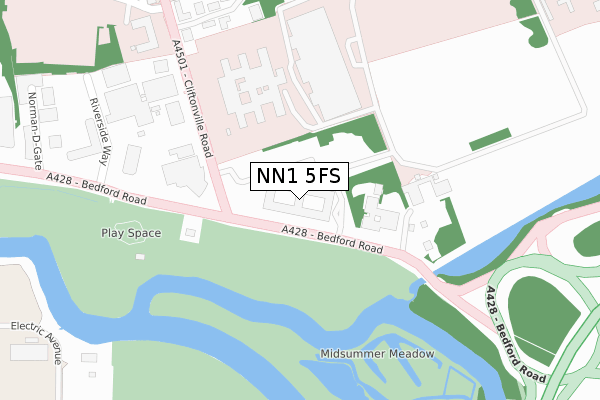
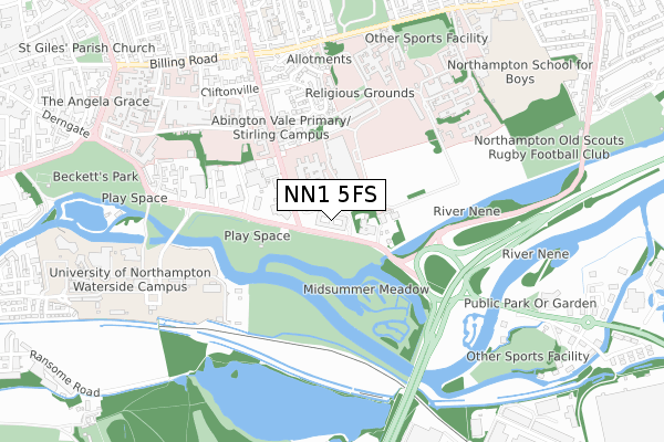
NN1 5FS is located in the Delapre and Rushmere electoral ward, within the unitary authority of West Northamptonshire and the English Parliamentary constituency of Northampton South. The Sub Integrated Care Board (ICB) Location is NHS Northamptonshire ICB - 78H and the police force is Northamptonshire. This postcode has been in use since October 2019.


GetTheData
Source: OS Open Zoomstack (Ordnance Survey)
Licence: Open Government Licence (requires attribution)
Attribution: Contains OS data © Crown copyright and database right 2025
Source: Open Postcode Geo
Licence: Open Government Licence (requires attribution)
Attribution: Contains OS data © Crown copyright and database right 2025; Contains Royal Mail data © Royal Mail copyright and database right 2025; Source: Office for National Statistics licensed under the Open Government Licence v.3.0
| Easting | 476866 |
| Northing | 259944 |
| Latitude | 52.232352 |
| Longitude | -0.875913 |
GetTheData
Source: Open Postcode Geo
Licence: Open Government Licence
| Country | England |
| Postcode District | NN1 |
➜ See where NN1 is on a map ➜ Where is Northampton? | |
GetTheData
Source: Land Registry Price Paid Data
Licence: Open Government Licence
| Ward | Delapre And Rushmere |
| Constituency | Northampton South |
GetTheData
Source: ONS Postcode Database
Licence: Open Government Licence
| Cliftonville House Park & Ride (Cliftonville Road) | Northampton | 73m |
| Cliftonville Road (Bedford Road) | Northampton | 205m |
| Cliftonville Road (Bedford Road) | Northampton | 221m |
| Cliftonville Middle School (Cliftonville Road) | Northampton | 287m |
| Cliftonville Middle School (Cliftonville Road) | Northampton | 291m |
| Northampton Station | 2.2km |
GetTheData
Source: NaPTAN
Licence: Open Government Licence
GetTheData
Source: ONS Postcode Database
Licence: Open Government Licence


➜ Get more ratings from the Food Standards Agency
GetTheData
Source: Food Standards Agency
Licence: FSA terms & conditions
| Last Collection | |||
|---|---|---|---|
| Location | Mon-Fri | Sat | Distance |
| Riverside Way | 17:45 | 11:30 | 326m |
| Billing Road | 17:45 | 11:30 | 676m |
| Cliftonville | 17:30 | 11:30 | 724m |
GetTheData
Source: Dracos
Licence: Creative Commons Attribution-ShareAlike
The below table lists the International Territorial Level (ITL) codes (formerly Nomenclature of Territorial Units for Statistics (NUTS) codes) and Local Administrative Units (LAU) codes for NN1 5FS:
| ITL 1 Code | Name |
|---|---|
| TLF | East Midlands (England) |
| ITL 2 Code | Name |
| TLF2 | Leicestershire, Rutland and Northamptonshire |
| ITL 3 Code | Name |
| TLF24 | West Northamptonshire |
| LAU 1 Code | Name |
| E07000154 | Northampton |
GetTheData
Source: ONS Postcode Directory
Licence: Open Government Licence
The below table lists the Census Output Area (OA), Lower Layer Super Output Area (LSOA), and Middle Layer Super Output Area (MSOA) for NN1 5FS:
| Code | Name | |
|---|---|---|
| OA | E00138513 | |
| LSOA | E01027224 | Northampton 025B |
| MSOA | E02005674 | Northampton 025 |
GetTheData
Source: ONS Postcode Directory
Licence: Open Government Licence
| NN1 5HN | The Nurseries | 331m |
| NN1 5NX | Riverside Way | 355m |
| NN1 5HQ | Cliftonville Road | 361m |
| NN1 5DD | The Avenue | 444m |
| NN1 5BT | The Avenue | 460m |
| NN1 5BJ | Berkeley Close | 585m |
| NN1 5BZ | Cliftonville Court | 588m |
| NN1 5NJ | Beckets View | 631m |
| NN1 5BX | Cliftonville Road | 636m |
| NN1 5BG | Cliftonville | 659m |
GetTheData
Source: Open Postcode Geo; Land Registry Price Paid Data
Licence: Open Government Licence