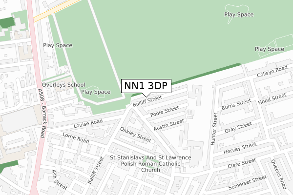
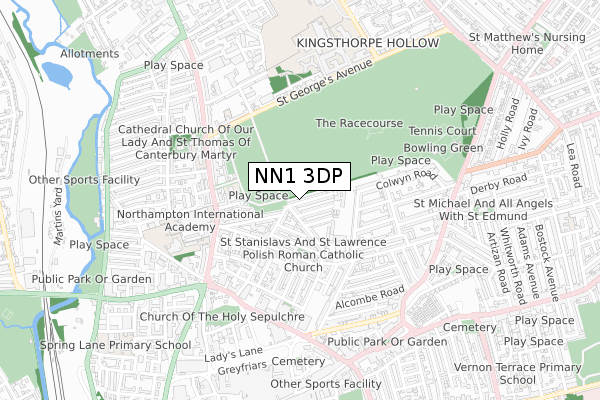
NN1 3DP is located in the Castle electoral ward, within the unitary authority of West Northamptonshire and the English Parliamentary constituency of Northampton South. The Sub Integrated Care Board (ICB) Location is NHS Northamptonshire ICB - 78H and the police force is Northamptonshire. This postcode has been in use since October 2018.


GetTheData
Source: OS Open Zoomstack (Ordnance Survey)
Licence: Open Government Licence (requires attribution)
Attribution: Contains OS data © Crown copyright and database right 2025
Source: Open Postcode Geo
Licence: Open Government Licence (requires attribution)
Attribution: Contains OS data © Crown copyright and database right 2025; Contains Royal Mail data © Royal Mail copyright and database right 2025; Source: Office for National Statistics licensed under the Open Government Licence v.3.0
| Easting | 475730 |
| Northing | 261428 |
| Latitude | 52.245849 |
| Longitude | -0.892211 |
GetTheData
Source: Open Postcode Geo
Licence: Open Government Licence
| Country | England |
| Postcode District | NN1 |
➜ See where NN1 is on a map ➜ Where is Northampton? | |
GetTheData
Source: Land Registry Price Paid Data
Licence: Open Government Licence
| Ward | Castle |
| Constituency | Northampton South |
GetTheData
Source: ONS Postcode Database
Licence: Open Government Licence
| Royal Mail Sorting Office (Barrack Road) | Semilong | 349m |
| Royal Mail Sorting Office (Barrack Road) | Semilong | 380m |
| Brick Kiln Lane (St Georges Avenue) | Semilong | 406m |
| Brick Kiln Lane (St Georges Avenue) | Semilong | 412m |
| Marriott Street (Barrack Road) | Semilong | 425m |
| Northampton Station | 1.4km |
GetTheData
Source: NaPTAN
Licence: Open Government Licence
GetTheData
Source: ONS Postcode Database
Licence: Open Government Licence


➜ Get more ratings from the Food Standards Agency
GetTheData
Source: Food Standards Agency
Licence: FSA terms & conditions
| Last Collection | |||
|---|---|---|---|
| Location | Mon-Fri | Sat | Distance |
| Louise Road | 17:30 | 11:30 | 89m |
| Burns Street | 17:30 | 11:30 | 376m |
| Somerset Street | 17:30 | 12:30 | 384m |
GetTheData
Source: Dracos
Licence: Creative Commons Attribution-ShareAlike
The below table lists the International Territorial Level (ITL) codes (formerly Nomenclature of Territorial Units for Statistics (NUTS) codes) and Local Administrative Units (LAU) codes for NN1 3DP:
| ITL 1 Code | Name |
|---|---|
| TLF | East Midlands (England) |
| ITL 2 Code | Name |
| TLF2 | Leicestershire, Rutland and Northamptonshire |
| ITL 3 Code | Name |
| TLF24 | West Northamptonshire |
| LAU 1 Code | Name |
| E07000154 | Northampton |
GetTheData
Source: ONS Postcode Directory
Licence: Open Government Licence
The below table lists the Census Output Area (OA), Lower Layer Super Output Area (LSOA), and Middle Layer Super Output Area (MSOA) for NN1 3DP:
| Code | Name | |
|---|---|---|
| OA | E00138133 | |
| LSOA | E01027155 | Northampton 023A |
| MSOA | E02005672 | Northampton 023 |
GetTheData
Source: ONS Postcode Directory
Licence: Open Government Licence
| NN1 3ER | Watkin Terrace | 42m |
| NN1 3ES | Beaconsfield Terrace | 65m |
| NN1 3EX | Poole Street | 74m |
| NN1 3EY | Austin Street | 117m |
| NN1 3EA | Bailiff Street | 124m |
| NN1 3ET | Military Road | 132m |
| NN1 3EP | Oakley Street | 144m |
| NN1 3EU | Military Road | 152m |
| NN1 3EZ | Craven Street | 176m |
| NN1 3EE | Military Road | 188m |
GetTheData
Source: Open Postcode Geo; Land Registry Price Paid Data
Licence: Open Government Licence