NG9 3TA maps, stats, and open data
NG9 3TA is located in the Bramcote electoral ward, within the local authority district of Broxtowe and the English Parliamentary constituency of Broxtowe. The Sub Integrated Care Board (ICB) Location is NHS Nottingham and Nottinghamshire ICB - 52R and the police force is Nottinghamshire. This postcode has been in use since August 2018.
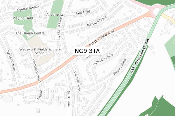
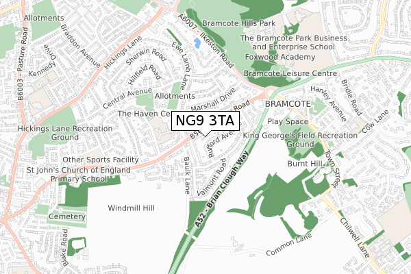
NG9 3TA maps


Licence: Open Government Licence (requires attribution)
Attribution: Contains OS data © Crown copyright and database right 2025
Source: Open Postcode Geo
Licence: Open Government Licence (requires attribution)
Attribution: Contains OS data © Crown copyright and database right 2025; Contains Royal Mail data © Royal Mail copyright and database right 2025; Source: Office for National Statistics licensed under the Open Government Licence v.3.0
NG9 3TA geodata
| Easting | 450091 |
| Northing | 337642 |
| Latitude | 52.933869 |
| Longitude | -1.256199 |
Where is NG9 3TA?
| Country | England |
| Postcode District | NG9 |
Politics
| Ward | Bramcote |
|---|---|
| Constituency | Broxtowe |
House Prices
Sales of detached houses in NG9 3TA
2024 10 DEC £290,000 |
2024 12 JUL £325,000 |
2, PENNY GARDENS, BRAMCOTE, NOTTINGHAM, NG9 3TA 2019 22 FEB £270,000 |
5, PENNY GARDENS, BRAMCOTE, NOTTINGHAM, NG9 3TA 2019 4 FEB £280,000 |
2019 11 JAN £270,000 |
3, PENNY GARDENS, BRAMCOTE, NOTTINGHAM, NG9 3TA 2018 3 DEC £270,000 |
Licence: Contains HM Land Registry data © Crown copyright and database right 2025. This data is licensed under the Open Government Licence v3.0.
Transport
Nearest bus stops to NG9 3TA
| Valmont Road (Derby Road) | Stapleford | 45m |
| Valmont Road (Derby Road) | Stapleford | 85m |
| Ewe Lamb Lane | Stapleford | 143m |
| Marshall Drive | Stapleford | 197m |
| Bembridge Court (Derby Road) | Stapleford | 316m |
Nearest underground/metro/tram to NG9 3TA
| Eskdale Drive Tram Stop (Eskdale Drive) | Chilwell | 1,743m |
| Bramcote Lane Tram Stop (Sandby Court) | Chilwell | 1,917m |
Nearest railway stations to NG9 3TA
| Attenborough Station | 3.5km |
| Beeston Station | 3.6km |
Broadband
Broadband access in NG9 3TA (2020 data)
| Percentage of properties with Next Generation Access | 100.0% |
| Percentage of properties with Superfast Broadband | 100.0% |
| Percentage of properties with Ultrafast Broadband | 0.0% |
| Percentage of properties with Full Fibre Broadband | 0.0% |
Superfast Broadband is between 30Mbps and 300Mbps
Ultrafast Broadband is > 300Mbps
Broadband speed in NG9 3TA (2019 data)
Download
| Median download speed | 72.2Mbps |
| Average download speed | 65.0Mbps |
| Maximum download speed | 79.98Mbps |
Upload
| Median upload speed | 20.0Mbps |
| Average upload speed | 17.9Mbps |
| Maximum upload speed | 20.00Mbps |
Broadband limitations in NG9 3TA (2020 data)
| Percentage of properties unable to receive 2Mbps | 0.0% |
| Percentage of properties unable to receive 5Mbps | 0.0% |
| Percentage of properties unable to receive 10Mbps | 0.0% |
| Percentage of properties unable to receive 30Mbps | 0.0% |
Deprivation
5.7% of English postcodes are less deprived than NG9 3TA:Food Standards Agency
Three nearest food hygiene ratings to NG9 3TA (metres)


➜ Get more ratings from the Food Standards Agency
Nearest post box to NG9 3TA
| Last Collection | |||
|---|---|---|---|
| Location | Mon-Fri | Sat | Distance |
| Valmont Road | 17:30 | 11:00 | 99m |
| Bramcote Post Office | 17:00 | 11:00 | 368m |
| Ewe Lamb Lane | 17:30 | 11:00 | 373m |
NG9 3TA ITL and NG9 3TA LAU
The below table lists the International Territorial Level (ITL) codes (formerly Nomenclature of Territorial Units for Statistics (NUTS) codes) and Local Administrative Units (LAU) codes for NG9 3TA:
| ITL 1 Code | Name |
|---|---|
| TLF | East Midlands (England) |
| ITL 2 Code | Name |
| TLF1 | Derbyshire and Nottinghamshire |
| ITL 3 Code | Name |
| TLF16 | South Nottinghamshire |
| LAU 1 Code | Name |
| E07000172 | Broxtowe |
NG9 3TA census areas
The below table lists the Census Output Area (OA), Lower Layer Super Output Area (LSOA), and Middle Layer Super Output Area (MSOA) for NG9 3TA:
| Code | Name | |
|---|---|---|
| OA | E00143120 | |
| LSOA | E01028087 | Broxtowe 007A |
| MSOA | E02005856 | Broxtowe 007 |
Nearest postcodes to NG9 3TA
| NG9 3JG | Rufford Avenue | 72m |
| NG9 3JH | Rufford Avenue | 102m |
| NG9 3JA | Derby Road | 118m |
| NG9 3JL | Valmont Road | 132m |
| NG9 3HX | Margarets Court | 150m |
| NG9 3LF | Ewe Lamb Lane | 159m |
| NG9 3JF | Russley Road | 178m |
| NG9 3JN | Derby Road | 180m |
| NG9 3LE | Marshall Drive | 193m |
| NG9 8BE | Nottingham Road | 208m |