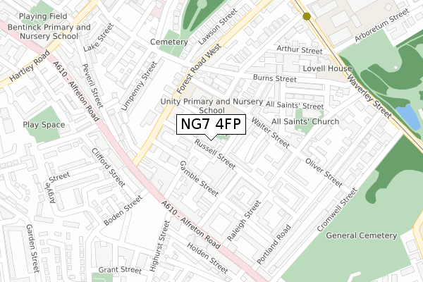
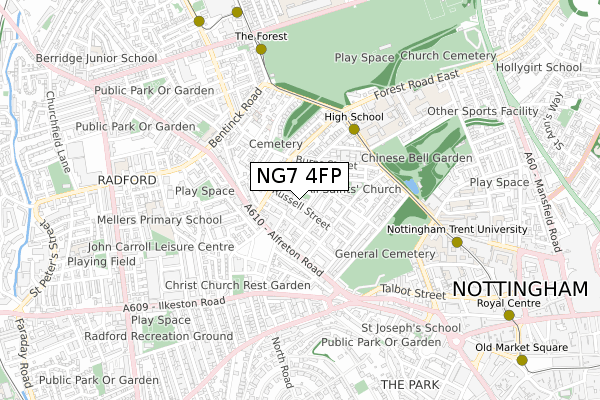
NG7 4FP is located in the Hyson Green & Arboretum electoral ward, within the unitary authority of Nottingham and the English Parliamentary constituency of Nottingham East. The Sub Integrated Care Board (ICB) Location is NHS Nottingham and Nottinghamshire ICB - 52R and the police force is Nottinghamshire. This postcode has been in use since September 2018.


GetTheData
Source: OS Open Zoomstack (Ordnance Survey)
Licence: Open Government Licence (requires attribution)
Attribution: Contains OS data © Crown copyright and database right 2025
Source: Open Postcode Geo
Licence: Open Government Licence (requires attribution)
Attribution: Contains OS data © Crown copyright and database right 2025; Contains Royal Mail data © Royal Mail copyright and database right 2025; Source: Office for National Statistics licensed under the Open Government Licence v.3.0
| Easting | 456200 |
| Northing | 340575 |
| Latitude | 52.959629 |
| Longitude | -1.164815 |
GetTheData
Source: Open Postcode Geo
Licence: Open Government Licence
| Country | England |
| Postcode District | NG7 |
➜ See where NG7 is on a map ➜ Where is Nottingham? | |
GetTheData
Source: Land Registry Price Paid Data
Licence: Open Government Licence
| Ward | Hyson Green & Arboretum |
| Constituency | Nottingham East |
GetTheData
Source: ONS Postcode Database
Licence: Open Government Licence
| Boden Street (Alfreton Road) | Radford | 175m |
| Southey Street H&r (Southey Street) | Hyson Green | 191m |
| Boden Street (Alfreton Road) | Radford | 192m |
| Newdigate Street (Alfreton Road) | Radford | 203m |
| Peveril Street (Alfreton Road) | Radford | 267m |
| High School Tram Stop (Waverley Street) | Arboretum | 388m |
| The Forest Tram Stop (Noel Street) | The Forest | 633m |
| Ntu Tram Stop (Goldsmith Street) | Nottingham Trent University In City Centre | 635m |
| Hyson Green Market Tram Stop (Radford Road) | Hyson Green | 828m |
| Noel Street Tram Stop (Noel Street) | Hyson Green | 880m |
| Nottingham Station | 1.9km |
| Bulwell Station | 4.9km |
| Beeston Station | 5.2km |
GetTheData
Source: NaPTAN
Licence: Open Government Licence
| Percentage of properties with Next Generation Access | 100.0% |
| Percentage of properties with Superfast Broadband | 100.0% |
| Percentage of properties with Ultrafast Broadband | 0.0% |
| Percentage of properties with Full Fibre Broadband | 0.0% |
Superfast Broadband is between 30Mbps and 300Mbps
Ultrafast Broadband is > 300Mbps
| Percentage of properties unable to receive 2Mbps | 0.0% |
| Percentage of properties unable to receive 5Mbps | 0.0% |
| Percentage of properties unable to receive 10Mbps | 0.0% |
| Percentage of properties unable to receive 30Mbps | 0.0% |
GetTheData
Source: Ofcom
Licence: Ofcom Terms of Use (requires attribution)
GetTheData
Source: ONS Postcode Database
Licence: Open Government Licence


➜ Get more ratings from the Food Standards Agency
GetTheData
Source: Food Standards Agency
Licence: FSA terms & conditions
| Last Collection | |||
|---|---|---|---|
| Location | Mon-Fri | Sat | Distance |
| Alfreton Road | 17:00 | 12:00 | 165m |
| Burns Street | 17:00 | 12:30 | 176m |
| Newdigate Street | 17:30 | 12:30 | 199m |
GetTheData
Source: Dracos
Licence: Creative Commons Attribution-ShareAlike
The below table lists the International Territorial Level (ITL) codes (formerly Nomenclature of Territorial Units for Statistics (NUTS) codes) and Local Administrative Units (LAU) codes for NG7 4FP:
| ITL 1 Code | Name |
|---|---|
| TLF | East Midlands (England) |
| ITL 2 Code | Name |
| TLF1 | Derbyshire and Nottinghamshire |
| ITL 3 Code | Name |
| TLF14 | Nottingham |
| LAU 1 Code | Name |
| E06000018 | Nottingham |
GetTheData
Source: ONS Postcode Directory
Licence: Open Government Licence
The below table lists the Census Output Area (OA), Lower Layer Super Output Area (LSOA), and Middle Layer Super Output Area (MSOA) for NG7 4FP:
| Code | Name | |
|---|---|---|
| OA | E00069662 | |
| LSOA | E01013816 | Nottingham 022D |
| MSOA | E02002889 | Nottingham 022 |
GetTheData
Source: ONS Postcode Directory
Licence: Open Government Licence
| NG7 4GB | Francis Street | 68m |
| NG7 4ET | Gamble Street | 76m |
| NG7 4FL | Russell Street | 89m |
| NG7 4FD | Newdigate Street | 105m |
| NG7 4FU | Tennyson Street | 124m |
| NG7 4FZ | Larkdale Street | 128m |
| NG7 4FY | Wildman Street | 136m |
| NG7 4FB | Newdigate Villas | 157m |
| NG7 4EL | Forest Road West | 158m |
| NG7 4DQ | All Saints Terrace | 161m |
GetTheData
Source: Open Postcode Geo; Land Registry Price Paid Data
Licence: Open Government Licence
| Portland Road | At Any Time | 278m |
GetTheData
Source: Disabled parking spaces, Nottingham City Council, 19/02/2013
Licence: Open Government Licence