NG6 8ZW maps, stats, and open data
NG6 8ZW is located in the Bulwell electoral ward, within the unitary authority of Nottingham and the English Parliamentary constituency of Nottingham North. The Sub Integrated Care Board (ICB) Location is NHS Nottingham and Nottinghamshire ICB - 52R and the police force is Nottinghamshire. This postcode has been in use since April 2019.
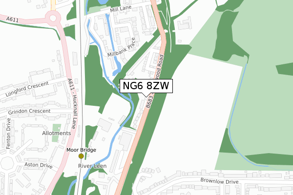
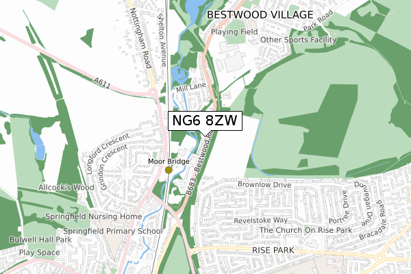
NG6 8ZW maps


Licence: Open Government Licence (requires attribution)
Attribution: Contains OS data © Crown copyright and database right 2025
Source: Open Postcode Geo
Licence: Open Government Licence (requires attribution)
Attribution: Contains OS data © Crown copyright and database right 2025; Contains Royal Mail data © Royal Mail copyright and database right 2025; Source: Office for National Statistics licensed under the Open Government Licence v.3.0
NG6 8ZW geodata
| Easting | 454866 |
| Northing | 346880 |
| Latitude | 53.016437 |
| Longitude | -1.183603 |
Where is NG6 8ZW?
| Country | England |
| Postcode District | NG6 |
Politics
| Ward | Bulwell |
|---|---|
| Constituency | Nottingham North |
House Prices
Sales of detached houses in NG6 8ZW
207, BESTWOOD ROAD, NOTTINGHAM, NG6 8ZW 2020 6 MAR £250,000 |
187, BESTWOOD ROAD, NOTTINGHAM, NG6 8ZW 2019 16 JUL £260,000 |
➜ Bestwood Village house prices
Licence: Contains HM Land Registry data © Crown copyright and database right 2025. This data is licensed under the Open Government Licence v3.0.
Transport
Nearest bus stops to NG6 8ZW
| Moorbridge Works (Bestwood Road) | Bulwell | 157m |
| Grindon Crescent (Hucknall Lane) | Bulwell Hall | 238m |
| Grindon Crescent Hr (Grindon Crescent) | Bulwell Hall | 258m |
| Grindon Crescent (Hucknall Lane) | Bulwell Hall | 260m |
| Moorbridge Cottage (Bestwood Road) | Bulwell | 260m |
Nearest underground/metro/tram to NG6 8ZW
| Moor Bridge Tram Stop (Hucknall Lane) | Moor Bridge | 315m |
| Bulwell Forest Tram Stop (Bestwood Road) | Bulwell Forest | 1,309m |
| Butler's Hill Tram Stop (Butlers Hill) | Butlers Hill | 1,414m |
Nearest railway stations to NG6 8ZW
| Bulwell Station | 2km |
| Hucknall Station | 2.6km |
Broadband
Broadband access in NG6 8ZW (2020 data)
| Percentage of properties with Next Generation Access | 100.0% |
| Percentage of properties with Superfast Broadband | 100.0% |
| Percentage of properties with Ultrafast Broadband | 100.0% |
| Percentage of properties with Full Fibre Broadband | 100.0% |
Superfast Broadband is between 30Mbps and 300Mbps
Ultrafast Broadband is > 300Mbps
Broadband limitations in NG6 8ZW (2020 data)
| Percentage of properties unable to receive 2Mbps | 0.0% |
| Percentage of properties unable to receive 5Mbps | 0.0% |
| Percentage of properties unable to receive 10Mbps | 0.0% |
| Percentage of properties unable to receive 30Mbps | 0.0% |
Deprivation
96.8% of English postcodes are less deprived than NG6 8ZW:Food Standards Agency
Three nearest food hygiene ratings to NG6 8ZW (metres)


➜ Get more ratings from the Food Standards Agency
Nearest post box to NG6 8ZW
| Last Collection | |||
|---|---|---|---|
| Location | Mon-Fri | Sat | Distance |
| Hucknall Lane Post Office | 17:00 | 11:30 | 262m |
| Haverhill Crescent | 17:00 | 12:30 | 405m |
| Moor Road | 17:00 | 11:30 | 429m |
NG6 8ZW ITL and NG6 8ZW LAU
The below table lists the International Territorial Level (ITL) codes (formerly Nomenclature of Territorial Units for Statistics (NUTS) codes) and Local Administrative Units (LAU) codes for NG6 8ZW:
| ITL 1 Code | Name |
|---|---|
| TLF | East Midlands (England) |
| ITL 2 Code | Name |
| TLF1 | Derbyshire and Nottinghamshire |
| ITL 3 Code | Name |
| TLF14 | Nottingham |
| LAU 1 Code | Name |
| E06000018 | Nottingham |
NG6 8ZW census areas
The below table lists the Census Output Area (OA), Lower Layer Super Output Area (LSOA), and Middle Layer Super Output Area (MSOA) for NG6 8ZW:
| Code | Name | |
|---|---|---|
| OA | E00070052 | |
| LSOA | E01013879 | Nottingham 002A |
| MSOA | E02002869 | Nottingham 002 |
Nearest postcodes to NG6 8ZW
| NG6 8SS | Bestwood Road | 145m |
| NG6 8EL | Millbank Place | 168m |
| NG6 8ES | Millbank Place | 206m |
| NG6 8EF | Millbank Place | 239m |
| NG6 8SR | Moorbridge Cottages | 247m |
| NG5 5AE | Little Oakwood Drive | 250m |
| NG6 8AB | Hucknall Lane | 253m |
| NG6 8TA | Old Mill Close | 259m |
| NG6 8AD | Hucknall Lane | 269m |
| NG6 8FD | Mill Lane | 307m |