NG6 8PA maps, stats, and open data
- Home
- Postcode
- NG
- NG6
- NG6 8
NG6 8PA is located in the Bulwell electoral ward, within the unitary authority of Nottingham and the English Parliamentary constituency of Nottingham North. The Sub Integrated Care Board (ICB) Location is NHS Nottingham and Nottinghamshire ICB - 52R and the police force is Nottinghamshire. This postcode has been in use since September 2017.
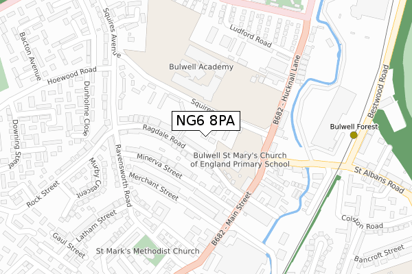
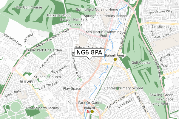
NG6 8PA maps


Source: OS Open Zoomstack (Ordnance Survey)
Licence: Open Government Licence (requires attribution)
Attribution: Contains OS data © Crown copyright and database right 2025
Source: Open Postcode GeoLicence: Open Government Licence (requires attribution)
Attribution: Contains OS data © Crown copyright and database right 2025; Contains Royal Mail data © Royal Mail copyright and database right 2025; Source: Office for National Statistics licensed under the Open Government Licence v.3.0
NG6 8PA geodata
| Easting | 454079 |
| Northing | 345695 |
| Latitude | 53.005866 |
| Longitude | -1.195532 |
Where is NG6 8PA?
| Country | England |
| Postcode District | NG6 |
Politics
| Ward | Bulwell |
|---|
| Constituency | Nottingham North |
|---|
Transport
Nearest bus stops to NG6 8PA
| Squires Avenue (Main Street) | Bulwell | 161m |
| Carey Road | Bulwell | 177m |
| Carey Road | Bulwell | 207m |
| Latham Street (Ravensworth Road) | Bulwell | 228m |
| Squires Avenue (Hucknall Lane) | Bulwell | 233m |
Nearest underground/metro/tram to NG6 8PA
| Bulwell Forest Tram Stop (Bestwood Road) | Bulwell Forest | 328m |
| Bulwell Tram Stop (Station Road) | Bulwell | 688m |
| Moor Bridge Tram Stop (Hucknall Lane) | Moor Bridge | 1,117m |
Nearest railway stations to NG6 8PA
| Bulwell Station | 0.7km |
| Hucknall Station | 3.6km |
Broadband
Broadband access in NG6 8PA (2020 data)
| Percentage of properties with Next Generation Access | 100.0% |
| Percentage of properties with Superfast Broadband | 100.0% |
| Percentage of properties with Ultrafast Broadband | 100.0% |
| Percentage of properties with Full Fibre Broadband | 0.0% |
Superfast Broadband is between 30Mbps and 300Mbps
Ultrafast Broadband is > 300Mbps
Broadband limitations in NG6 8PA (2020 data)
| Percentage of properties unable to receive 2Mbps | 0.0% |
| Percentage of properties unable to receive 5Mbps | 0.0% |
| Percentage of properties unable to receive 10Mbps | 0.0% |
| Percentage of properties unable to receive 30Mbps | 0.0% |
Deprivation
92.8% of English postcodes are less deprived than
NG6 8PA:
Food Standards Agency
Three nearest food hygiene ratings to NG6 8PA (metres)
Conextion Club
Seventh Day Adventist Church
83m
St Mary's C Of E School
Bulwell St Marys Ce Primary And Nursery School
83m
Aspens Services Ltd Bulwell Academy
➜ Get more ratings from the Food Standards Agency
Nearest post box to NG6 8PA
| | Last Collection | |
|---|
| Location | Mon-Fri | Sat | Distance |
|---|
| Ravensworth Road | 17:30 | 12:00 | 219m |
| Squires Avenue | 17:30 | 11:00 | 481m |
| Bulwell Post Office | 17:15 | 12:00 | 520m |
NG6 8PA ITL and NG6 8PA LAU
The below table lists the International Territorial Level (ITL) codes (formerly Nomenclature of Territorial Units for Statistics (NUTS) codes) and Local Administrative Units (LAU) codes for NG6 8PA:
| ITL 1 Code | Name |
|---|
| TLF | East Midlands (England) |
| ITL 2 Code | Name |
|---|
| TLF1 | Derbyshire and Nottinghamshire |
| ITL 3 Code | Name |
|---|
| TLF14 | Nottingham |
| LAU 1 Code | Name |
|---|
| E06000018 | Nottingham |
NG6 8PA census areas
The below table lists the Census Output Area (OA), Lower Layer Super Output Area (LSOA), and Middle Layer Super Output Area (MSOA) for NG6 8PA:
| Code | Name |
|---|
| OA | E00070020 | |
|---|
| LSOA | E01013882 | Nottingham 002D |
|---|
| MSOA | E02002869 | Nottingham 002 |
|---|
Nearest postcodes to NG6 8PA


