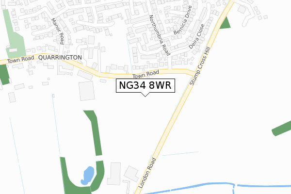
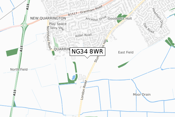
NG34 8WR is located in the Sleaford Quarrington & Mareham electoral ward, within the local authority district of North Kesteven and the English Parliamentary constituency of Sleaford and North Hykeham. The Sub Integrated Care Board (ICB) Location is NHS Lincolnshire ICB - 71E and the police force is Lincolnshire. This postcode has been in use since July 2019.


GetTheData
Source: OS Open Zoomstack (Ordnance Survey)
Licence: Open Government Licence (requires attribution)
Attribution: Contains OS data © Crown copyright and database right 2025
Source: Open Postcode Geo
Licence: Open Government Licence (requires attribution)
Attribution: Contains OS data © Crown copyright and database right 2025; Contains Royal Mail data © Royal Mail copyright and database right 2025; Source: Office for National Statistics licensed under the Open Government Licence v.3.0
| Easting | 505896 |
| Northing | 344329 |
| Latitude | 52.985868 |
| Longitude | -0.424012 |
GetTheData
Source: Open Postcode Geo
Licence: Open Government Licence
| Country | England |
| Postcode District | NG34 |
➜ See where NG34 is on a map ➜ Where is Sleaford? | |
GetTheData
Source: Land Registry Price Paid Data
Licence: Open Government Licence
| Ward | Sleaford Quarrington & Mareham |
| Constituency | Sleaford And North Hykeham |
GetTheData
Source: ONS Postcode Database
Licence: Open Government Licence
2025 31 MAR £310,000 |
2024 8 AUG £437,500 |
51, PARK HILL, QUARRINGTON, SLEAFORD, NG34 8WR 2024 23 FEB £315,000 |
53, PARK HILL, QUARRINGTON, SLEAFORD, NG34 8WR 2023 10 NOV £260,000 |
25, PARK HILL, QUARRINGTON, SLEAFORD, NG34 8WR 2023 5 MAY £339,950 |
64, PARK HILL, QUARRINGTON, SLEAFORD, NG34 8WR 2023 28 APR £289,950 |
55, PARK HILL, QUARRINGTON, SLEAFORD, NG34 8WR 2023 19 APR £337,950 |
27, PARK HILL, QUARRINGTON, SLEAFORD, NG34 8WR 2023 24 MAR £249,950 |
23, PARK HILL, QUARRINGTON, SLEAFORD, NG34 8WR 2023 17 MAR £259,950 |
24, PARK HILL, QUARRINGTON, SLEAFORD, NG34 8WR 2022 9 SEP £304,950 |
GetTheData
Source: HM Land Registry Price Paid Data
Licence: Contains HM Land Registry data © Crown copyright and database right 2025. This data is licensed under the Open Government Licence v3.0.
| Northunbria Road (Bernicia Drive) | Sleaford | 199m |
| Mercia Close (Northumbria Road) | Sleaford | 255m |
| Hengist Close (Aidan Road) | Sleaford | 324m |
| Manor Road (Town Road) | Sleaford | 423m |
| Alfred Close (Aidan Road) | Sleaford | 430m |
| Sleaford Station | 1.4km |
| Rauceby Station | 2.2km |
GetTheData
Source: NaPTAN
Licence: Open Government Licence
GetTheData
Source: ONS Postcode Database
Licence: Open Government Licence


➜ Get more ratings from the Food Standards Agency
GetTheData
Source: Food Standards Agency
Licence: FSA terms & conditions
| Last Collection | |||
|---|---|---|---|
| Location | Mon-Fri | Sat | Distance |
| Victoria Avenue | 16:45 | 11:00 | 645m |
| Rookery Avenue | 16:45 | 11:00 | 977m |
| Lord Street | 17:00 | 11:00 | 1,100m |
GetTheData
Source: Dracos
Licence: Creative Commons Attribution-ShareAlike
The below table lists the International Territorial Level (ITL) codes (formerly Nomenclature of Territorial Units for Statistics (NUTS) codes) and Local Administrative Units (LAU) codes for NG34 8WR:
| ITL 1 Code | Name |
|---|---|
| TLF | East Midlands (England) |
| ITL 2 Code | Name |
| TLF3 | Lincolnshire |
| ITL 3 Code | Name |
| TLF30 | Lincolnshire CC |
| LAU 1 Code | Name |
| E07000139 | North Kesteven |
GetTheData
Source: ONS Postcode Directory
Licence: Open Government Licence
The below table lists the Census Output Area (OA), Lower Layer Super Output Area (LSOA), and Middle Layer Super Output Area (MSOA) for NG34 8WR:
| Code | Name | |
|---|---|---|
| OA | E00169350 | |
| LSOA | E01026234 | North Kesteven 011D |
| MSOA | E02005463 | North Kesteven 011 |
GetTheData
Source: ONS Postcode Directory
Licence: Open Government Licence
| NG34 8WY | Wessex Close | 149m |
| NG34 8RS | Town Road | 227m |
| NG34 8UT | Northumbria Road | 229m |
| NG34 8WP | Mercia Close | 252m |
| NG34 8WX | Anglia Close | 265m |
| NG34 8UR | Deira Close | 274m |
| NG34 8WF | Bernicia Drive | 276m |
| NG34 8YG | The Garth | 279m |
| NG34 8WT | Edwin Close | 284m |
| NG34 8WE | Bede Close | 324m |
GetTheData
Source: Open Postcode Geo; Land Registry Price Paid Data
Licence: Open Government Licence