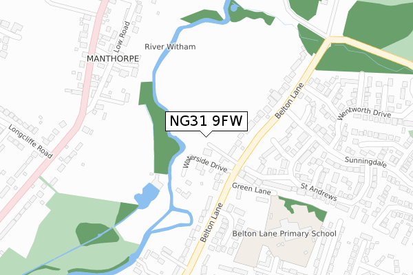
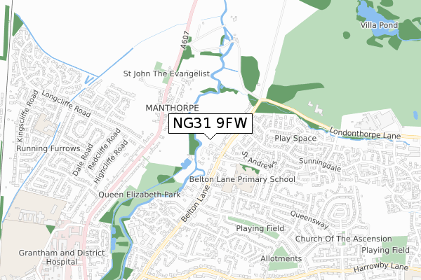
NG31 9FW is located in the Belmont electoral ward, within the local authority district of South Kesteven and the English Parliamentary constituency of Grantham and Stamford. The Sub Integrated Care Board (ICB) Location is NHS Lincolnshire ICB - 71E and the police force is Lincolnshire. This postcode has been in use since September 2017.


GetTheData
Source: OS Open Zoomstack (Ordnance Survey)
Licence: Open Government Licence (requires attribution)
Attribution: Contains OS data © Crown copyright and database right 2025
Source: Open Postcode Geo
Licence: Open Government Licence (requires attribution)
Attribution: Contains OS data © Crown copyright and database right 2025; Contains Royal Mail data © Royal Mail copyright and database right 2025; Source: Office for National Statistics licensed under the Open Government Licence v.3.0
| Easting | 492286 |
| Northing | 337459 |
| Latitude | 52.926642 |
| Longitude | -0.628634 |
GetTheData
Source: Open Postcode Geo
Licence: Open Government Licence
| Country | England |
| Postcode District | NG31 |
➜ See where NG31 is on a map ➜ Where is Grantham? | |
GetTheData
Source: Land Registry Price Paid Data
Licence: Open Government Licence
| Ward | Belmont |
| Constituency | Grantham And Stamford |
GetTheData
Source: ONS Postcode Database
Licence: Open Government Licence
| Green Lane (Belton Lane) | Grantham | 91m |
| Acorn Close (Belton Lane) | Grantham | 147m |
| St Andrews (Sunningdale) | Grantham | 236m |
| St Andrews (Sunningdale) | Grantham | 258m |
| The Well (High Road) | Manthorpe | 344m |
| Grantham Station | 2.4km |
GetTheData
Source: NaPTAN
Licence: Open Government Licence
GetTheData
Source: ONS Postcode Database
Licence: Open Government Licence


➜ Get more ratings from the Food Standards Agency
GetTheData
Source: Food Standards Agency
Licence: FSA terms & conditions
| Last Collection | |||
|---|---|---|---|
| Location | Mon-Fri | Sat | Distance |
| Princess Drive | 18:15 | 11:45 | 943m |
| Princess Drive Post Office | 18:30 | 11:45 | 947m |
| Sandon Close | 17:00 | 11:45 | 1,253m |
GetTheData
Source: Dracos
Licence: Creative Commons Attribution-ShareAlike
The below table lists the International Territorial Level (ITL) codes (formerly Nomenclature of Territorial Units for Statistics (NUTS) codes) and Local Administrative Units (LAU) codes for NG31 9FW:
| ITL 1 Code | Name |
|---|---|
| TLF | East Midlands (England) |
| ITL 2 Code | Name |
| TLF3 | Lincolnshire |
| ITL 3 Code | Name |
| TLF30 | Lincolnshire CC |
| LAU 1 Code | Name |
| E07000141 | South Kesteven |
GetTheData
Source: ONS Postcode Directory
Licence: Open Government Licence
The below table lists the Census Output Area (OA), Lower Layer Super Output Area (LSOA), and Middle Layer Super Output Area (MSOA) for NG31 9FW:
| Code | Name | |
|---|---|---|
| OA | E00133557 | |
| LSOA | E01026294 | South Kesteven 007C |
| MSOA | E02005482 | South Kesteven 007 |
GetTheData
Source: ONS Postcode Directory
Licence: Open Government Licence
| NG31 9PL | Belton Lane | 146m |
| NG31 9PB | Braemar Close | 158m |
| NG31 9PW | Belton Lane | 179m |
| NG31 9PD | Formby Close | 183m |
| NG31 9JN | Acorn Close | 193m |
| NG31 9PR | Belton Lane | 281m |
| NG31 9RP | Mill Close | 285m |
| NG31 9PQ | Turnberry Close | 288m |
| NG31 8NQ | Low Road | 305m |
| NG31 9PE | St Andrews | 306m |
GetTheData
Source: Open Postcode Geo; Land Registry Price Paid Data
Licence: Open Government Licence