NG31 8WR maps, stats, and open data
NG31 8WR is located in the Grantham Arnoldfield electoral ward, within the local authority district of South Kesteven and the English Parliamentary constituency of Grantham and Stamford. The Sub Integrated Care Board (ICB) Location is NHS Lincolnshire ICB - 71E and the police force is Lincolnshire. This postcode has been in use since December 2018.
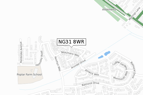
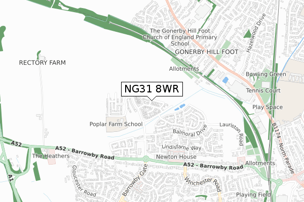
NG31 8WR maps


Licence: Open Government Licence (requires attribution)
Attribution: Contains OS data © Crown copyright and database right 2025
Source: Open Postcode Geo
Licence: Open Government Licence (requires attribution)
Attribution: Contains OS data © Crown copyright and database right 2025; Contains Royal Mail data © Royal Mail copyright and database right 2025; Source: Office for National Statistics licensed under the Open Government Licence v.3.0
NG31 8WR geodata
| Easting | 490020 |
| Northing | 336850 |
| Latitude | 52.921554 |
| Longitude | -0.662501 |
Where is NG31 8WR?
| Country | England |
| Postcode District | NG31 |
Politics
| Ward | Grantham Arnoldfield |
|---|---|
| Constituency | Grantham And Stamford |
House Prices
Sales of detached houses in NG31 8WR
2022 7 SEP £455,000 |
2022 26 JUL £400,000 |
2021 8 DEC £355,000 |
20, CALDICOT GARDENS, GRANTHAM, NG31 8WR 2020 25 SEP £257,995 |
22, CALDICOT GARDENS, GRANTHAM, NG31 8WR 2020 25 SEP £299,995 |
18, CALDICOT GARDENS, GRANTHAM, NG31 8WR 2020 31 JUL £242,995 |
24, CALDICOT GARDENS, GRANTHAM, NG31 8WR 2020 31 JUL £249,995 |
16, CALDICOT GARDENS, GRANTHAM, NG31 8WR 2020 27 MAR £353,995 |
14, CALDICOT GARDENS, GRANTHAM, NG31 8WR 2020 27 MAR £299,995 |
12, CALDICOT GARDENS, GRANTHAM, NG31 8WR 2020 27 MAR £391,995 |
Licence: Contains HM Land Registry data © Crown copyright and database right 2025. This data is licensed under the Open Government Licence v3.0.
Transport
Nearest bus stops to NG31 8WR
| Newton House Nursing Home (Barrowby Road) | Grantham | 536m |
| Muddle And Go Nowhere Ph (Barrowby Road) | Grantham | 537m |
| Newton House Nursing Home (Barrowby Road) | Grantham | 556m |
| Muddle And Go Nowhere Ph (Barrowby Road) | Grantham | 578m |
| Cliffe Avenue (Gonerby Road) | Gonerby Hill Foot | 594m |
Nearest railway stations to NG31 8WR
| Grantham Station | 2.2km |
Broadband
Broadband access in NG31 8WR (2020 data)
| Percentage of properties with Next Generation Access | 100.0% |
| Percentage of properties with Superfast Broadband | 100.0% |
| Percentage of properties with Ultrafast Broadband | 100.0% |
| Percentage of properties with Full Fibre Broadband | 94.7% |
Superfast Broadband is between 30Mbps and 300Mbps
Ultrafast Broadband is > 300Mbps
Broadband limitations in NG31 8WR (2020 data)
| Percentage of properties unable to receive 2Mbps | 0.0% |
| Percentage of properties unable to receive 5Mbps | 0.0% |
| Percentage of properties unable to receive 10Mbps | 0.0% |
| Percentage of properties unable to receive 30Mbps | 0.0% |
Deprivation
8.7% of English postcodes are less deprived than NG31 8WR:Food Standards Agency
Three nearest food hygiene ratings to NG31 8WR (metres)


➜ Get more ratings from the Food Standards Agency
Nearest post box to NG31 8WR
| Last Collection | |||
|---|---|---|---|
| Location | Mon-Fri | Sat | Distance |
| Barrowby Gate | 16:00 | 11:45 | 813m |
| Dysart Road Post Office | 17:00 | 12:00 | 1,306m |
| Asda | 16:30 | 11:30 | 1,347m |
NG31 8WR ITL and NG31 8WR LAU
The below table lists the International Territorial Level (ITL) codes (formerly Nomenclature of Territorial Units for Statistics (NUTS) codes) and Local Administrative Units (LAU) codes for NG31 8WR:
| ITL 1 Code | Name |
|---|---|
| TLF | East Midlands (England) |
| ITL 2 Code | Name |
| TLF3 | Lincolnshire |
| ITL 3 Code | Name |
| TLF30 | Lincolnshire CC |
| LAU 1 Code | Name |
| E07000141 | South Kesteven |
NG31 8WR census areas
The below table lists the Census Output Area (OA), Lower Layer Super Output Area (LSOA), and Middle Layer Super Output Area (MSOA) for NG31 8WR:
| Code | Name | |
|---|---|---|
| OA | E00169420 | |
| LSOA | E01026320 | South Kesteven 004A |
| MSOA | E02005479 | South Kesteven 004 |
Nearest postcodes to NG31 8WR
| NG31 8UL | Bamburgh Close | 228m |
| NG31 8UN | Scarborough Close | 246m |
| NG31 8UJ | Alnwick Way | 247m |
| NG31 8TF | Dover Close | 334m |
| NG31 8SY | Balmoral Drive | 342m |
| NG31 8SS | Grimsthorpe Close | 360m |
| NG31 8TG | Oakham Close | 387m |
| NG31 8JF | Malting Cottages | 400m |
| NG31 8ST | Lindisfarne Way | 412m |
| NG31 8UQ | Lewes Avenue | 414m |