Property/Postcode Data Search:
NG24 3XP maps, stats, and open data
NG24 3XP is located in the Farndon & Fernwood electoral ward, within the local authority district of Newark and Sherwood and the English Parliamentary constituency of Newark. The Sub Integrated Care Board (ICB) Location is NHS Nottingham and Nottinghamshire ICB - 52R and the police force is Nottinghamshire. This postcode has been in use since June 2019.
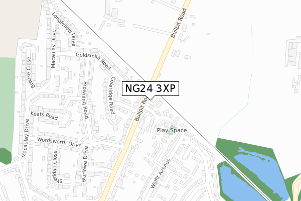
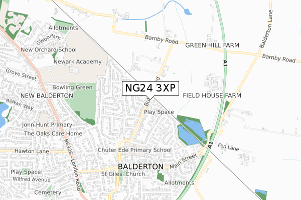
NG24 3XP maps


Source: OS Open Zoomstack (Ordnance Survey)
Licence: Open Government Licence (requires attribution)
Attribution: Contains OS data © Crown copyright and database right 2025
Source: Open Postcode Geo
Licence: Open Government Licence (requires attribution)
Attribution: Contains OS data © Crown copyright and database right 2025; Contains Royal Mail data © Royal Mail copyright and database right 2025; Source: Office for National Statistics licensed under the Open Government Licence v.3.0
Licence: Open Government Licence (requires attribution)
Attribution: Contains OS data © Crown copyright and database right 2025
Source: Open Postcode Geo
Licence: Open Government Licence (requires attribution)
Attribution: Contains OS data © Crown copyright and database right 2025; Contains Royal Mail data © Royal Mail copyright and database right 2025; Source: Office for National Statistics licensed under the Open Government Licence v.3.0
NG24 3XP geodata
| Easting | 480069 |
| Northing | 351360 |
| Latitude | 53.053531 |
| Longitude | -0.806887 |
Where is NG24 3XP?
| Country | England |
| Postcode District | NG24 |
Politics
| Ward | Farndon & Fernwood |
|---|---|
| Constituency | Newark |
Transport
Nearest bus stops to NG24 3XP
| Grange Road | Hawtonville | 426m |
| Gill House (Grange Road) | Hawtonville | 484m |
| Gill House (Grange Road) | Hawtonville | 491m |
| Smith House (Grange Road) | Hawtonville | 598m |
| Lilac Close (Cherry Holt) | Hawtonville | 602m |
Nearest railway stations to NG24 3XP
| Newark Castle Station | 3km |
| Newark North Gate Station | 3.2km |
Deprivation
29.7% of English postcodes are less deprived than NG24 3XP:Food Standards Agency
Three nearest food hygiene ratings to NG24 3XP (metres)
Christ Church C Of E Primary School

Flaxley Lane
285m
Kings Court

Flaxley Lane
285m
Grange Road Stores

10A Grange Road
461m
➜ Get more ratings from the Food Standards Agency
Nearest post box to NG24 3XP
| Last Collection | |||
|---|---|---|---|
| Location | Mon-Fri | Sat | Distance |
| Hawton Road Post Office | 17:30 | 11:30 | 1,185m |
| Hawton | 16:00 | 07:30 | 1,266m |
| Hawton Road | 17:30 | 11:30 | 1,428m |
NG24 3XP ITL and NG24 3XP LAU
The below table lists the International Territorial Level (ITL) codes (formerly Nomenclature of Territorial Units for Statistics (NUTS) codes) and Local Administrative Units (LAU) codes for NG24 3XP:
| ITL 1 Code | Name |
|---|---|
| TLF | East Midlands (England) |
| ITL 2 Code | Name |
| TLF1 | Derbyshire and Nottinghamshire |
| ITL 3 Code | Name |
| TLF15 | North Nottinghamshire |
| LAU 1 Code | Name |
| E07000175 | Newark and Sherwood |
NG24 3XP census areas
The below table lists the Census Output Area (OA), Lower Layer Super Output Area (LSOA), and Middle Layer Super Output Area (MSOA) for NG24 3XP:
| Code | Name | |
|---|---|---|
| OA | E00144333 | |
| LSOA | E01033394 | Newark and Sherwood 012G |
| MSOA | E02005904 | Newark and Sherwood 012 |
Nearest postcodes to NG24 3XP
| NG24 3BY | Lowfield Cottages | 395m |
| NG24 4EF | Bowbridge Road | 414m |
| NG24 4LE | Grange Road | 448m |
| NG24 4LH | Grange Road | 468m |
| NG24 4LQ | Ash Road | 521m |
| NG24 4LN | Grange Road | 545m |
| NG24 4JY | Cherry Holt | 588m |
| NG24 4LP | Grange Road | 591m |
| NG24 4LB | Lindsay Avenue | 592m |
| NG24 4LA | Cherry Holt | 603m |