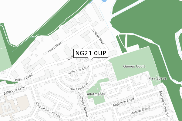
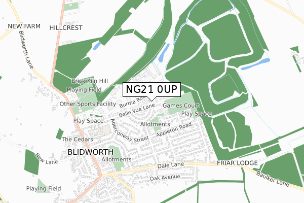
NG21 0UP is located in the Rainworth South & Blidworth electoral ward, within the local authority district of Newark and Sherwood and the English Parliamentary constituency of Sherwood. The Sub Integrated Care Board (ICB) Location is NHS Nottingham and Nottinghamshire ICB - 52R and the police force is Nottinghamshire. This postcode has been in use since September 2018.


GetTheData
Source: OS Open Zoomstack (Ordnance Survey)
Licence: Open Government Licence (requires attribution)
Attribution: Contains OS data © Crown copyright and database right 2025
Source: Open Postcode Geo
Licence: Open Government Licence (requires attribution)
Attribution: Contains OS data © Crown copyright and database right 2025; Contains Royal Mail data © Royal Mail copyright and database right 2025; Source: Office for National Statistics licensed under the Open Government Licence v.3.0
| Easting | 459657 |
| Northing | 356613 |
| Latitude | 53.103405 |
| Longitude | -1.110398 |
GetTheData
Source: Open Postcode Geo
Licence: Open Government Licence
| Country | England |
| Postcode District | NG21 |
➜ See where NG21 is on a map ➜ Where is Blidworth? | |
GetTheData
Source: Land Registry Price Paid Data
Licence: Open Government Licence
| Ward | Rainworth South & Blidworth |
| Constituency | Sherwood |
GetTheData
Source: ONS Postcode Database
Licence: Open Government Licence
| The Crescent (Belle Vue Lane) | Blidworth | 52m |
| Appleton Road | Blidworth | 272m |
| Aberconway Street (Belle Vue Lane) | Blidworth | 332m |
| Aberconway Street (Belle Vue Lane) | Blidworth | 333m |
| Central Avenue (Appleton Road) | Blidworth | 347m |
GetTheData
Source: NaPTAN
Licence: Open Government Licence
| Percentage of properties with Next Generation Access | 100.0% |
| Percentage of properties with Superfast Broadband | 100.0% |
| Percentage of properties with Ultrafast Broadband | 100.0% |
| Percentage of properties with Full Fibre Broadband | 0.0% |
Superfast Broadband is between 30Mbps and 300Mbps
Ultrafast Broadband is > 300Mbps
| Percentage of properties unable to receive 2Mbps | 0.0% |
| Percentage of properties unable to receive 5Mbps | 0.0% |
| Percentage of properties unable to receive 10Mbps | 0.0% |
| Percentage of properties unable to receive 30Mbps | 0.0% |
GetTheData
Source: Ofcom
Licence: Ofcom Terms of Use (requires attribution)
GetTheData
Source: ONS Postcode Database
Licence: Open Government Licence


➜ Get more ratings from the Food Standards Agency
GetTheData
Source: Food Standards Agency
Licence: FSA terms & conditions
| Last Collection | |||
|---|---|---|---|
| Location | Mon-Fri | Sat | Distance |
| Appleton Road | 17:00 | 11:00 | 329m |
| Belle Vue | 17:00 | 11:00 | 433m |
| Dale Lane | 17:00 | 11:00 | 538m |
GetTheData
Source: Dracos
Licence: Creative Commons Attribution-ShareAlike
The below table lists the International Territorial Level (ITL) codes (formerly Nomenclature of Territorial Units for Statistics (NUTS) codes) and Local Administrative Units (LAU) codes for NG21 0UP:
| ITL 1 Code | Name |
|---|---|
| TLF | East Midlands (England) |
| ITL 2 Code | Name |
| TLF1 | Derbyshire and Nottinghamshire |
| ITL 3 Code | Name |
| TLF15 | North Nottinghamshire |
| LAU 1 Code | Name |
| E07000175 | Newark and Sherwood |
GetTheData
Source: ONS Postcode Directory
Licence: Open Government Licence
The below table lists the Census Output Area (OA), Lower Layer Super Output Area (LSOA), and Middle Layer Super Output Area (MSOA) for NG21 0UP:
| Code | Name | |
|---|---|---|
| OA | E00144182 | |
| LSOA | E01028299 | Newark and Sherwood 006C |
| MSOA | E02005898 | Newark and Sherwood 006 |
GetTheData
Source: ONS Postcode Directory
Licence: Open Government Licence
| NG21 0SF | Belle Vue Lane | 45m |
| NG21 0RX | Gilbert Way | 87m |
| NG21 0SE | The Crescent | 143m |
| NG21 0SL | Boundary Crescent | 208m |
| NG21 0TZ | Mavis Wood Mews | 222m |
| NG21 0RH | The Crescent | 223m |
| NG21 0RT | Burma Road | 226m |
| NG21 0RY | Hazel Court | 248m |
| NG21 0SH | Central Avenue | 252m |
| NG21 0SG | Appleton Road | 277m |
GetTheData
Source: Open Postcode Geo; Land Registry Price Paid Data
Licence: Open Government Licence