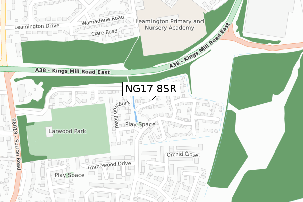
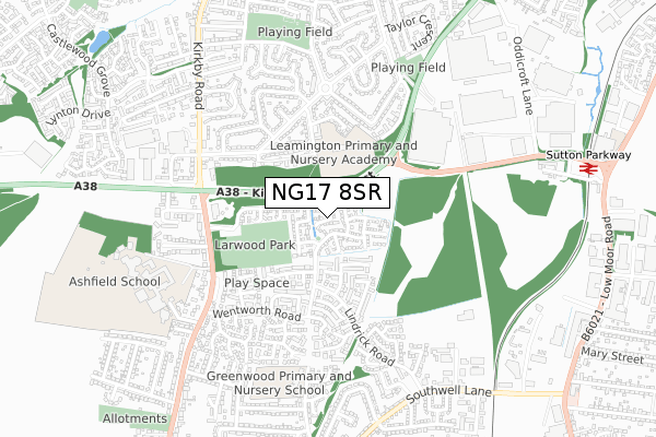
NG17 8SR is located in the Larwood electoral ward, within the local authority district of Ashfield and the English Parliamentary constituency of Ashfield. The Sub Integrated Care Board (ICB) Location is NHS Nottingham and Nottinghamshire ICB - 52R and the police force is Nottinghamshire. This postcode has been in use since November 2017.


GetTheData
Source: OS Open Zoomstack (Ordnance Survey)
Licence: Open Government Licence (requires attribution)
Attribution: Contains OS data © Crown copyright and database right 2025
Source: Open Postcode Geo
Licence: Open Government Licence (requires attribution)
Attribution: Contains OS data © Crown copyright and database right 2025; Contains Royal Mail data © Royal Mail copyright and database right 2025; Source: Office for National Statistics licensed under the Open Government Licence v.3.0
| Easting | 449601 |
| Northing | 357515 |
| Latitude | 53.112540 |
| Longitude | -1.260443 |
GetTheData
Source: Open Postcode Geo
Licence: Open Government Licence
| Country | England |
| Postcode District | NG17 |
➜ See where NG17 is on a map ➜ Where is Kirkby-in-Ashfield? | |
GetTheData
Source: Land Registry Price Paid Data
Licence: Open Government Licence
| Ward | Larwood |
| Constituency | Ashfield |
GetTheData
Source: ONS Postcode Database
Licence: Open Government Licence
| Barnes Crescent (Leamington Drive) | Sutton In Ashfield | 365m |
| Barnes Crescent (Leamington Drive) | Sutton In Ashfield | 375m |
| Raymond Close (Sutton Road) | Kirkby In Ashfield | 454m |
| Raymond Close (Sutton Road) | Kirkby In Ashfield | 464m |
| Tom Wass Road (Leamington Drive) | Sutton In Ashfield | 491m |
| Sutton Parkway Station | 1km |
| Kirkby in Ashfield Station | 1.5km |
| Mansfield Station | 5.3km |
GetTheData
Source: NaPTAN
Licence: Open Government Licence
| Percentage of properties with Next Generation Access | 0.0% |
| Percentage of properties with Superfast Broadband | 0.0% |
| Percentage of properties with Ultrafast Broadband | 0.0% |
| Percentage of properties with Full Fibre Broadband | 0.0% |
Superfast Broadband is between 30Mbps and 300Mbps
Ultrafast Broadband is > 300Mbps
| Median download speed | 6.5Mbps |
| Average download speed | 6.8Mbps |
| Maximum download speed | 14.03Mbps |
| Median upload speed | 0.8Mbps |
| Average upload speed | 0.8Mbps |
| Maximum upload speed | 1.18Mbps |
| Percentage of properties unable to receive 2Mbps | 0.0% |
| Percentage of properties unable to receive 5Mbps | 0.0% |
| Percentage of properties unable to receive 10Mbps | 0.0% |
| Percentage of properties unable to receive 30Mbps | 100.0% |
GetTheData
Source: Ofcom
Licence: Ofcom Terms of Use (requires attribution)
GetTheData
Source: ONS Postcode Database
Licence: Open Government Licence


➜ Get more ratings from the Food Standards Agency
GetTheData
Source: Food Standards Agency
Licence: FSA terms & conditions
| Last Collection | |||
|---|---|---|---|
| Location | Mon-Fri | Sat | Distance |
| Leamington Drive Post Office | 17:00 | 11:00 | 509m |
| Kirkby Road | 17:00 | 11:00 | 749m |
| Elm Tree Road | 16:45 | 11:30 | 814m |
GetTheData
Source: Dracos
Licence: Creative Commons Attribution-ShareAlike
The below table lists the International Territorial Level (ITL) codes (formerly Nomenclature of Territorial Units for Statistics (NUTS) codes) and Local Administrative Units (LAU) codes for NG17 8SR:
| ITL 1 Code | Name |
|---|---|
| TLF | East Midlands (England) |
| ITL 2 Code | Name |
| TLF1 | Derbyshire and Nottinghamshire |
| ITL 3 Code | Name |
| TLF15 | North Nottinghamshire |
| LAU 1 Code | Name |
| E07000170 | Ashfield |
GetTheData
Source: ONS Postcode Directory
Licence: Open Government Licence
The below table lists the Census Output Area (OA), Lower Layer Super Output Area (LSOA), and Middle Layer Super Output Area (MSOA) for NG17 8SR:
| Code | Name | |
|---|---|---|
| OA | E00142449 | |
| LSOA | E01027959 | Ashfield 009E |
| MSOA | E02005827 | Ashfield 009 |
GetTheData
Source: ONS Postcode Directory
Licence: Open Government Licence
| NG17 8PD | Bluebell Grove | 220m |
| NG17 8PH | Orchid Close | 221m |
| NG17 8PG | Grangewood Road | 232m |
| NG17 8QB | Homewood Drive | 244m |
| NG17 5BB | Clare Road | 248m |
| NG17 8PF | Charters Close | 248m |
| NG17 8QA | Gratton Court | 271m |
| NG17 5BD | Warnadene Road | 291m |
| NG17 8QD | Reville Court | 300m |
| NG17 8PJ | Primrose Close | 302m |
GetTheData
Source: Open Postcode Geo; Land Registry Price Paid Data
Licence: Open Government Licence