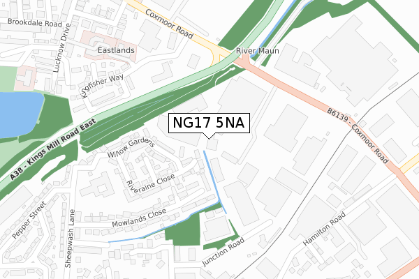
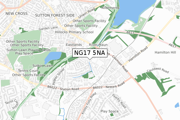
NG17 5NA is located in the Sutton Junction & Harlow Wood electoral ward, within the local authority district of Ashfield and the English Parliamentary constituency of Ashfield. The Sub Integrated Care Board (ICB) Location is NHS Nottingham and Nottinghamshire ICB - 52R and the police force is Nottinghamshire. This postcode has been in use since December 2019.


GetTheData
Source: OS Open Zoomstack (Ordnance Survey)
Licence: Open Government Licence (requires attribution)
Attribution: Contains OS data © Crown copyright and database right 2025
Source: Open Postcode Geo
Licence: Open Government Licence (requires attribution)
Attribution: Contains OS data © Crown copyright and database right 2025; Contains Royal Mail data © Royal Mail copyright and database right 2025; Source: Office for National Statistics licensed under the Open Government Licence v.3.0
| Easting | 451015 |
| Northing | 358777 |
| Latitude | 53.123750 |
| Longitude | -1.239121 |
GetTheData
Source: Open Postcode Geo
Licence: Open Government Licence
| Country | England |
| Postcode District | NG17 |
➜ See where NG17 is on a map ➜ Where is Sutton in Ashfield? | |
GetTheData
Source: Land Registry Price Paid Data
Licence: Open Government Licence
| Ward | Sutton Junction & Harlow Wood |
| Constituency | Ashfield |
GetTheData
Source: ONS Postcode Database
Licence: Open Government Licence
| Bus Depot (Junction Road) | Sutton Junction | 263m |
| Midland Road (Station Road) | Sutton Junction | 344m |
| Kirkby Folly Road | Sutton Junction | 357m |
| Midland Road (Station Road) | Sutton Junction | 362m |
| Kirkby Folly Road | Sutton Junction | 386m |
| Sutton Parkway Station | 1.2km |
| Kirkby in Ashfield Station | 2.8km |
| Mansfield Station | 3.4km |
GetTheData
Source: NaPTAN
Licence: Open Government Licence
GetTheData
Source: ONS Postcode Database
Licence: Open Government Licence


➜ Get more ratings from the Food Standards Agency
GetTheData
Source: Food Standards Agency
Licence: FSA terms & conditions
| Last Collection | |||
|---|---|---|---|
| Location | Mon-Fri | Sat | Distance |
| Kirkby Folly Road | 16:45 | 11:00 | 567m |
| The Hillocks | 17:00 | 11:00 | 627m |
| Station Road | 17:00 | 11:00 | 935m |
GetTheData
Source: Dracos
Licence: Creative Commons Attribution-ShareAlike
The below table lists the International Territorial Level (ITL) codes (formerly Nomenclature of Territorial Units for Statistics (NUTS) codes) and Local Administrative Units (LAU) codes for NG17 5NA:
| ITL 1 Code | Name |
|---|---|
| TLF | East Midlands (England) |
| ITL 2 Code | Name |
| TLF1 | Derbyshire and Nottinghamshire |
| ITL 3 Code | Name |
| TLF15 | North Nottinghamshire |
| LAU 1 Code | Name |
| E07000170 | Ashfield |
GetTheData
Source: ONS Postcode Directory
Licence: Open Government Licence
The below table lists the Census Output Area (OA), Lower Layer Super Output Area (LSOA), and Middle Layer Super Output Area (MSOA) for NG17 5NA:
| Code | Name | |
|---|---|---|
| OA | E00173368 | |
| LSOA | E01027972 | Ashfield 004B |
| MSOA | E02005822 | Ashfield 004 |
GetTheData
Source: ONS Postcode Directory
Licence: Open Government Licence
| NG17 5GJ | Shepherds Way | 97m |
| NG17 5JH | Riveraine Close | 159m |
| NG17 5JG | Maun Close | 172m |
| NG17 5GH | Mowlands Close | 174m |
| NG17 5JF | Willow Gardens | 185m |
| NG17 5BF | Leander Close | 276m |
| NG17 5LQ | Dukes Close | 323m |
| NG17 5GN | Vellus Court | 354m |
| NG17 5HG | Station Road | 354m |
| NG17 5JP | Newark Road | 360m |
GetTheData
Source: Open Postcode Geo; Land Registry Price Paid Data
Licence: Open Government Licence