NG16 2WU maps, stats, and open data
NG16 2WU is located in the Greasley electoral ward, within the local authority district of Broxtowe and the English Parliamentary constituency of Broxtowe. The Sub Integrated Care Board (ICB) Location is NHS Nottingham and Nottinghamshire ICB - 52R and the police force is Nottinghamshire. This postcode has been in use since July 2018.
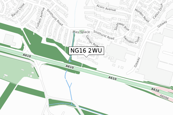
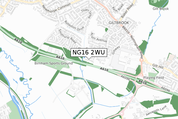
NG16 2WU maps


Licence: Open Government Licence (requires attribution)
Attribution: Contains OS data © Crown copyright and database right 2025
Source: Open Postcode Geo
Licence: Open Government Licence (requires attribution)
Attribution: Contains OS data © Crown copyright and database right 2025; Contains Royal Mail data © Royal Mail copyright and database right 2025; Source: Office for National Statistics licensed under the Open Government Licence v.3.0
NG16 2WU geodata
| Easting | 447757 |
| Northing | 345279 |
| Latitude | 53.002726 |
| Longitude | -1.289799 |
Where is NG16 2WU?
| Country | England |
| Postcode District | NG16 |
Politics
| Ward | Greasley |
|---|---|
| Constituency | Broxtowe |
House Prices
Sales of detached houses in NG16 2WU
2023 24 AUG £370,000 |
2019 25 JAN £295,000 |
12, DAVENPORT DRIVE, GILTBROOK, NOTTINGHAM, NG16 2WU 2018 23 NOV £267,500 |
25, DAVENPORT DRIVE, GILTBROOK, NOTTINGHAM, NG16 2WU 2018 23 NOV £220,000 |
16, DAVENPORT DRIVE, GILTBROOK, NOTTINGHAM, NG16 2WU 2018 12 OCT £295,000 |
23, DAVENPORT DRIVE, GILTBROOK, NOTTINGHAM, NG16 2WU 2018 29 AUG £212,000 |
14, DAVENPORT DRIVE, GILTBROOK, NOTTINGHAM, NG16 2WU 2018 29 AUG £290,000 |
31, DAVENPORT DRIVE, GILTBROOK, NOTTINGHAM, NG16 2WU 2018 20 AUG £210,000 |
Licence: Contains HM Land Registry data © Crown copyright and database right 2025. This data is licensed under the Open Government Licence v3.0.
Transport
Nearest bus stops to NG16 2WU
| Brackenfield Drive (Smithurst Road) | Newthorpe Common | 154m |
| Brackenfield Drive (Smithurst Road) | Newthorpe Common | 165m |
| Brassington Close (Smithurst Road) | Newthorpe Common | 254m |
| Brassington Close (Smithurst Road) | Newthorpe Common | 271m |
| Grantham Close (Smithurst Road) | Newthorpe Common | 329m |
Nearest railway stations to NG16 2WU
| Ilkeston Station | 2.6km |
| Langley Mill Station | 3.3km |
Broadband
Broadband access in NG16 2WU (2020 data)
| Percentage of properties with Next Generation Access | 100.0% |
| Percentage of properties with Superfast Broadband | 100.0% |
| Percentage of properties with Ultrafast Broadband | 0.0% |
| Percentage of properties with Full Fibre Broadband | 0.0% |
Superfast Broadband is between 30Mbps and 300Mbps
Ultrafast Broadband is > 300Mbps
Broadband speed in NG16 2WU (2019 data)
Download
| Median download speed | 39.3Mbps |
| Average download speed | 27.7Mbps |
| Maximum download speed | 55.00Mbps |
Upload
| Median upload speed | 9.2Mbps |
| Average upload speed | 6.5Mbps |
| Maximum upload speed | 18.32Mbps |
Broadband limitations in NG16 2WU (2020 data)
| Percentage of properties unable to receive 2Mbps | 0.0% |
| Percentage of properties unable to receive 5Mbps | 0.0% |
| Percentage of properties unable to receive 10Mbps | 0.0% |
| Percentage of properties unable to receive 30Mbps | 0.0% |
Deprivation
23.3% of English postcodes are less deprived than NG16 2WU:Food Standards Agency
Three nearest food hygiene ratings to NG16 2WU (metres)


➜ Get more ratings from the Food Standards Agency
Nearest post box to NG16 2WU
| Last Collection | |||
|---|---|---|---|
| Location | Mon-Fri | Sat | Distance |
| Smithurst Road | 16:30 | 12:15 | 155m |
| Giltbrook Ind Est | 19:00 | 635m | |
| Giltbrook Post Office | 17:15 | 12:15 | 673m |
NG16 2WU ITL and NG16 2WU LAU
The below table lists the International Territorial Level (ITL) codes (formerly Nomenclature of Territorial Units for Statistics (NUTS) codes) and Local Administrative Units (LAU) codes for NG16 2WU:
| ITL 1 Code | Name |
|---|---|
| TLF | East Midlands (England) |
| ITL 2 Code | Name |
| TLF1 | Derbyshire and Nottinghamshire |
| ITL 3 Code | Name |
| TLF16 | South Nottinghamshire |
| LAU 1 Code | Name |
| E07000172 | Broxtowe |
NG16 2WU census areas
The below table lists the Census Output Area (OA), Lower Layer Super Output Area (LSOA), and Middle Layer Super Output Area (MSOA) for NG16 2WU:
| Code | Name | |
|---|---|---|
| OA | E00143276 | |
| LSOA | E01028116 | Broxtowe 003C |
| MSOA | E02005852 | Broxtowe 003 |
Nearest postcodes to NG16 2WU
| NG16 2UQ | Weightman Drive | 139m |
| NG16 2UH | Brassington Close | 205m |
| NG16 2WE | Leech Court | 215m |
| NG16 2US | Brackenfield Drive | 220m |
| NG16 2WQ | Southwell Rise | 263m |
| NG16 2UJ | Turner Drive | 273m |
| NG16 2WD | Swindon Close | 296m |
| NG16 2WJ | Acorn Avenue | 321m |
| NG16 2UD | Smithurst Road | 339m |
| NG16 2WB | Grantham Close | 341m |