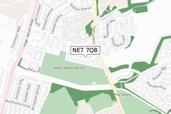
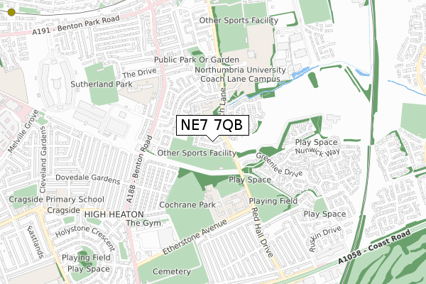
NE7 7QB is located in the Manor Park electoral ward, within the metropolitan district of Newcastle upon Tyne and the English Parliamentary constituency of Newcastle upon Tyne East. The Sub Integrated Care Board (ICB) Location is NHS North East and North Cumbria ICB - 13T and the police force is Northumbria. This postcode has been in use since December 2018.


GetTheData
Source: OS Open Zoomstack (Ordnance Survey)
Licence: Open Government Licence (requires attribution)
Attribution: Contains OS data © Crown copyright and database right 2025
Source: Open Postcode Geo
Licence: Open Government Licence (requires attribution)
Attribution: Contains OS data © Crown copyright and database right 2025; Contains Royal Mail data © Royal Mail copyright and database right 2025; Source: Office for National Statistics licensed under the Open Government Licence v.3.0
| Easting | 427416 |
| Northing | 567574 |
| Latitude | 55.001994 |
| Longitude | -1.572952 |
GetTheData
Source: Open Postcode Geo
Licence: Open Government Licence
| Country | England |
| Postcode District | NE7 |
➜ See where NE7 is on a map ➜ Where is Newcastle upon Tyne? | |
GetTheData
Source: Land Registry Price Paid Data
Licence: Open Government Licence
| Ward | Manor Park |
| Constituency | Newcastle Upon Tyne East |
GetTheData
Source: ONS Postcode Database
Licence: Open Government Licence
| Coach Lane Campus (Coach Lane) | Cochrane Park | 71m |
| Coach Lane Campus (Coach Lane) | Cochrane Park | 103m |
| Benton Road-manor Park (Benton Road) | High Heaton | 358m |
| Red Hall Drive - Felixstowe Drive (Red Hall Drive) | Cochrane Park | 386m |
| Benton Road-corchester Walk (Benton Road) | High Heaton | 422m |
| Four Lane Ends (Tyne And Wear Metro Station) (A188 Benton Road) | Four Lane Ends | 975m |
| Benton (Tyne And Wear Metro Station) (Station Approach) | Benton | 1,345m |
| Longbenton (Tyne And Wear Metro Station) (Leaholm Road) | Longbenton | 1,412m |
| Manors Station | 3.8km |
| Newcastle Station | 4.7km |
GetTheData
Source: NaPTAN
Licence: Open Government Licence
| Percentage of properties with Next Generation Access | 100.0% |
| Percentage of properties with Superfast Broadband | 100.0% |
| Percentage of properties with Ultrafast Broadband | 100.0% |
| Percentage of properties with Full Fibre Broadband | 100.0% |
Superfast Broadband is between 30Mbps and 300Mbps
Ultrafast Broadband is > 300Mbps
| Percentage of properties unable to receive 2Mbps | 0.0% |
| Percentage of properties unable to receive 5Mbps | 0.0% |
| Percentage of properties unable to receive 10Mbps | 0.0% |
| Percentage of properties unable to receive 30Mbps | 0.0% |
GetTheData
Source: Ofcom
Licence: Ofcom Terms of Use (requires attribution)
GetTheData
Source: ONS Postcode Database
Licence: Open Government Licence


➜ Get more ratings from the Food Standards Agency
GetTheData
Source: Food Standards Agency
Licence: FSA terms & conditions
| Last Collection | |||
|---|---|---|---|
| Location | Mon-Fri | Sat | Distance |
| Church Green | 17:30 | 12:15 | 90m |
| Fairways Avenue | 17:30 | 12:00 | 352m |
| Greenlee Drive | 17:30 | 12:00 | 535m |
GetTheData
Source: Dracos
Licence: Creative Commons Attribution-ShareAlike
The below table lists the International Territorial Level (ITL) codes (formerly Nomenclature of Territorial Units for Statistics (NUTS) codes) and Local Administrative Units (LAU) codes for NE7 7QB:
| ITL 1 Code | Name |
|---|---|
| TLC | North East (England) |
| ITL 2 Code | Name |
| TLC2 | Northumberland, and Tyne and Wear |
| ITL 3 Code | Name |
| TLC22 | Tyneside |
| LAU 1 Code | Name |
| E08000021 | Newcastle upon Tyne |
GetTheData
Source: ONS Postcode Directory
Licence: Open Government Licence
The below table lists the Census Output Area (OA), Lower Layer Super Output Area (LSOA), and Middle Layer Super Output Area (MSOA) for NE7 7QB:
| Code | Name | |
|---|---|---|
| OA | E00175589 | |
| LSOA | E01008323 | Newcastle upon Tyne 007F |
| MSOA | E02001714 | Newcastle upon Tyne 007 |
GetTheData
Source: ONS Postcode Directory
Licence: Open Government Licence
| NE7 7YR | St Asaph Close | 138m |
| NE7 7TP | Birkdale Close | 153m |
| NE7 7YT | Wells Close | 191m |
| NE7 7TY | Fairview Green | 195m |
| NE7 7YS | Shrewsbury Close | 232m |
| NE7 7YU | Westminster Way | 242m |
| NE7 7GG | Halleypike Close | 255m |
| NE7 7YP | Ely Close | 260m |
| NE7 7TU | Fairdale Avenue | 263m |
| NE7 7UB | Fairways Avenue | 287m |
GetTheData
Source: Open Postcode Geo; Land Registry Price Paid Data
Licence: Open Government Licence