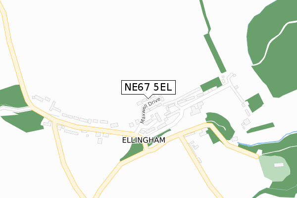
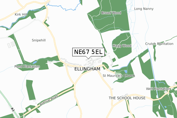
NE67 5EL is located in the Longhoughton electoral ward, within the unitary authority of Northumberland and the English Parliamentary constituency of Berwick-upon-Tweed. The Sub Integrated Care Board (ICB) Location is NHS North East and North Cumbria ICB - 00L and the police force is Northumbria. This postcode has been in use since May 2019.


GetTheData
Source: OS Open Zoomstack (Ordnance Survey)
Licence: Open Government Licence (requires attribution)
Attribution: Contains OS data © Crown copyright and database right 2025
Source: Open Postcode Geo
Licence: Open Government Licence (requires attribution)
Attribution: Contains OS data © Crown copyright and database right 2025; Contains Royal Mail data © Royal Mail copyright and database right 2025; Source: Office for National Statistics licensed under the Open Government Licence v.3.0
| Easting | 417114 |
| Northing | 625874 |
| Latitude | 55.526310 |
| Longitude | -1.730482 |
GetTheData
Source: Open Postcode Geo
Licence: Open Government Licence
| Country | England |
| Postcode District | NE67 |
➜ See where NE67 is on a map ➜ Where is Ellingham? | |
GetTheData
Source: Land Registry Price Paid Data
Licence: Open Government Licence
| Ward | Longhoughton |
| Constituency | Berwick-upon-tweed |
GetTheData
Source: ONS Postcode Database
Licence: Open Government Licence
| Packhorse (Street) | Ellingham | 311m |
| Ellingham Lodge (A1) | Ellingham | 1,296m |
| Ellingham Lodge (A1) | Ellingham | 1,297m |
| Garden Cottage (Road To Ellingham) | Preston | 1,307m |
| Preston Tower (C70) | Preston | 1,388m |
| Chathill Station | 1.9km |
GetTheData
Source: NaPTAN
Licence: Open Government Licence
| Percentage of properties with Next Generation Access | 100.0% |
| Percentage of properties with Superfast Broadband | 100.0% |
| Percentage of properties with Ultrafast Broadband | 83.3% |
| Percentage of properties with Full Fibre Broadband | 83.3% |
Superfast Broadband is between 30Mbps and 300Mbps
Ultrafast Broadband is > 300Mbps
| Percentage of properties unable to receive 2Mbps | 0.0% |
| Percentage of properties unable to receive 5Mbps | 0.0% |
| Percentage of properties unable to receive 10Mbps | 0.0% |
| Percentage of properties unable to receive 30Mbps | 0.0% |
GetTheData
Source: Ofcom
Licence: Ofcom Terms of Use (requires attribution)
GetTheData
Source: ONS Postcode Database
Licence: Open Government Licence


➜ Get more ratings from the Food Standards Agency
GetTheData
Source: Food Standards Agency
Licence: FSA terms & conditions
| Last Collection | |||
|---|---|---|---|
| Location | Mon-Fri | Sat | Distance |
| Ellingham | 17:45 | 08:00 | 183m |
| Preston | 17:15 | 08:30 | 1,383m |
| Chathill Post Office | 17:15 | 12:00 | 1,875m |
GetTheData
Source: Dracos
Licence: Creative Commons Attribution-ShareAlike
The below table lists the International Territorial Level (ITL) codes (formerly Nomenclature of Territorial Units for Statistics (NUTS) codes) and Local Administrative Units (LAU) codes for NE67 5EL:
| ITL 1 Code | Name |
|---|---|
| TLC | North East (England) |
| ITL 2 Code | Name |
| TLC2 | Northumberland, and Tyne and Wear |
| ITL 3 Code | Name |
| TLC21 | Northumberland |
| LAU 1 Code | Name |
| E06000057 | Northumberland |
GetTheData
Source: ONS Postcode Directory
Licence: Open Government Licence
The below table lists the Census Output Area (OA), Lower Layer Super Output Area (LSOA), and Middle Layer Super Output Area (MSOA) for NE67 5EL:
| Code | Name | |
|---|---|---|
| OA | E00139299 | |
| LSOA | E01027384 | Northumberland 003E |
| MSOA | E02005708 | Northumberland 003 |
GetTheData
Source: ONS Postcode Directory
Licence: Open Government Licence
| NE67 5EY | 138m | |
| NE67 5HA | 212m | |
| NE67 5EX | 220m | |
| NE67 5EU | 248m | |
| NE67 5HB | Golden Close | 258m |
| NE67 5HD | Farm Cottages | 286m |
| NE67 5ET | 774m | |
| NE67 5LJ | 978m | |
| NE67 5HF | 1103m | |
| NE67 5DX | Tynely New Houses | 1718m |
GetTheData
Source: Open Postcode Geo; Land Registry Price Paid Data
Licence: Open Government Licence