Property/Postcode Data Search:
NE66 1EY maps, stats, and open data
NE66 1EY is located in the Alnwick electoral ward, within the unitary authority of Northumberland and the English Parliamentary constituency of Berwick-upon-Tweed. The Sub Integrated Care Board (ICB) Location is NHS North East and North Cumbria ICB - 00L and the police force is Northumbria. This postcode has been in use since September 2019.
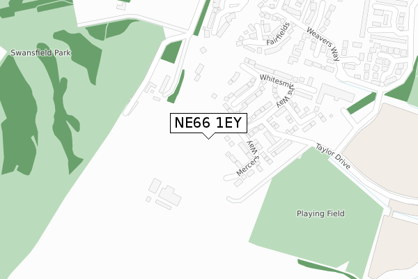
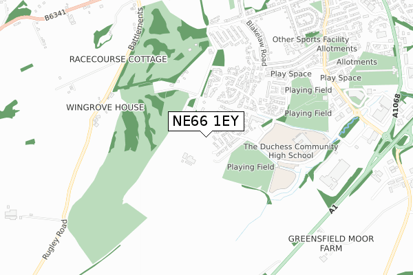
NE66 1EY maps


Source: OS Open Zoomstack (Ordnance Survey)
Licence: Open Government Licence (requires attribution)
Attribution: Contains OS data © Crown copyright and database right 2025
Source: Open Postcode Geo
Licence: Open Government Licence (requires attribution)
Attribution: Contains OS data © Crown copyright and database right 2025; Contains Royal Mail data © Royal Mail copyright and database right 2025; Source: Office for National Statistics licensed under the Open Government Licence v.3.0
Licence: Open Government Licence (requires attribution)
Attribution: Contains OS data © Crown copyright and database right 2025
Source: Open Postcode Geo
Licence: Open Government Licence (requires attribution)
Attribution: Contains OS data © Crown copyright and database right 2025; Contains Royal Mail data © Royal Mail copyright and database right 2025; Source: Office for National Statistics licensed under the Open Government Licence v.3.0
NE66 1EY geodata
| Easting | 418441 |
| Northing | 611800 |
| Latitude | 55.399804 |
| Longitude | -1.710389 |
Where is NE66 1EY?
| Country | England |
| Postcode District | NE66 |
Politics
| Ward | Alnwick |
|---|---|
| Constituency | Berwick-upon-tweed |
House Prices
Sales of detached houses in NE66 1EY
2025 23 MAY £370,000 |
7, BUTCHERS CLOSE, SWORDY PARK, ALNWICK, NE66 1EY 2022 1 JUL £284,995 |
6, BUTCHERS CLOSE, SWORDY PARK, ALNWICK, NE66 1EY 2022 1 JUL £256,995 |
5, BUTCHERS CLOSE, SWORDY PARK, ALNWICK, NE66 1EY 2022 22 JUN £284,995 |
11, BUTCHERS CLOSE, SWORDY PARK, ALNWICK, NE66 1EY 2022 17 JUN £274,995 |
9, BUTCHERS CLOSE, SWORDY PARK, ALNWICK, NE66 1EY 2022 27 MAY £274,995 |
8, BUTCHERS CLOSE, SWORDY PARK, ALNWICK, NE66 1EY 2022 13 MAY £284,995 |
3, BUTCHERS CLOSE, SWORDY PARK, ALNWICK, NE66 1EY 2022 31 MAR £254,995 |
2, BUTCHERS CLOSE, SWORDY PARK, ALNWICK, NE66 1EY 2022 25 MAR £289,995 |
2022 10 MAR £309,995 |
Source: HM Land Registry Price Paid Data
Licence: Contains HM Land Registry data © Crown copyright and database right 2025. This data is licensed under the Open Government Licence v3.0.
Licence: Contains HM Land Registry data © Crown copyright and database right 2025. This data is licensed under the Open Government Licence v3.0.
Transport
Nearest bus stops to NE66 1EY
| Weavers Way | St James Estate | 362m |
| Arkle Court (Weavers Way) | St James Estate | 601m |
| Blakelaw Road South End (Blakelaw Road) | St James Estate | 619m |
| Greensfield Avenue West End (Greensfield Avenue) | St James Estate | 644m |
| Blakelaw Road Centre (Blakelaw Road) | St James Estate | 696m |
Nearest railway stations to NE66 1EY
| Alnmouth Station | 4.7km |
Deprivation
22.2% of English postcodes are less deprived than NE66 1EY:Food Standards Agency
Three nearest food hygiene ratings to NE66 1EY (metres)
Weavers Cafe

Swordy Drive
366m
Alnwick Cricket Club (1837) Ltd

Weavers Way
705m
Rooftops Bed & Breakfast

14 Blakelaw Road
708m
➜ Get more ratings from the Food Standards Agency
Nearest post box to NE66 1EY
| Last Collection | |||
|---|---|---|---|
| Location | Mon-Fri | Sat | Distance |
| Weavers Way | 17:45 | 11:30 | 557m |
| Alnwick Delivery Office | 18:00 | 12:45 | 786m |
| Dunterns | 17:45 | 11:30 | 794m |
NE66 1EY ITL and NE66 1EY LAU
The below table lists the International Territorial Level (ITL) codes (formerly Nomenclature of Territorial Units for Statistics (NUTS) codes) and Local Administrative Units (LAU) codes for NE66 1EY:
| ITL 1 Code | Name |
|---|---|
| TLC | North East (England) |
| ITL 2 Code | Name |
| TLC2 | Northumberland, and Tyne and Wear |
| ITL 3 Code | Name |
| TLC21 | Northumberland |
| LAU 1 Code | Name |
| E06000057 | Northumberland |
NE66 1EY census areas
The below table lists the Census Output Area (OA), Lower Layer Super Output Area (LSOA), and Middle Layer Super Output Area (MSOA) for NE66 1EY:
| Code | Name | |
|---|---|---|
| OA | E00139177 | |
| LSOA | E01027356 | Northumberland 004A |
| MSOA | E02005702 | Northumberland 004 |
Nearest postcodes to NE66 1EY
| NE66 1BT | Fairfields | 356m |
| NE66 1SE | Highfield Park | 358m |
| NE66 1BF | Aydon View | 379m |
| NE66 1SW | Farriers Court | 430m |
| NE66 1BU | Coopers Close | 434m |
| NE66 2AB | 444m | |
| NE66 1BW | Fullers Walk | 479m |
| NE66 1BZ | Merchants Gardens | 483m |
| NE66 1BB | Blakelaw Road | 500m |
| NE66 1BY | Blakelaw Court | 509m |