NE63 9WT maps, stats, and open data
NE63 9WT is located in the Seaton with Newbiggin West electoral ward, within the unitary authority of Northumberland and the English Parliamentary constituency of Wansbeck. The Sub Integrated Care Board (ICB) Location is NHS North East and North Cumbria ICB - 00L and the police force is Northumbria. This postcode has been in use since October 2018.
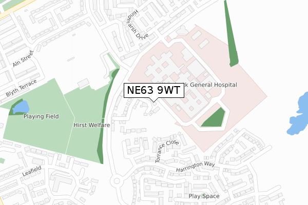
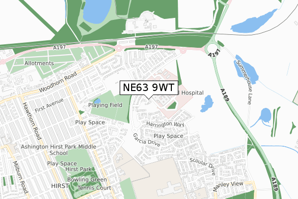
NE63 9WT maps


Licence: Open Government Licence (requires attribution)
Attribution: Contains OS data © Crown copyright and database right 2025
Source: Open Postcode Geo
Licence: Open Government Licence (requires attribution)
Attribution: Contains OS data © Crown copyright and database right 2025; Contains Royal Mail data © Royal Mail copyright and database right 2025; Source: Office for National Statistics licensed under the Open Government Licence v.3.0
NE63 9WT geodata
| Easting | 428899 |
| Northing | 587792 |
| Latitude | 55.183582 |
| Longitude | -1.547724 |
Where is NE63 9WT?
| Country | England |
| Postcode District | NE63 |
Politics
| Ward | Seaton With Newbiggin West |
|---|---|
| Constituency | Wansbeck |
House Prices
Sales of detached houses in NE63 9WT
2023 26 JUL £220,000 |
10, EAGLE CLOSE, WINDMILL PARK, ASHINGTON, NE63 9WT 2021 28 JUN £156,995 |
6, EAGLE CLOSE, WINDMILL PARK, ASHINGTON, NE63 9WT 2019 28 FEB £175,995 |
2018 21 DEC £169,995 |
9, EAGLE CLOSE, WINDMILL PARK, ASHINGTON, NE63 9WT 2018 18 OCT £190,995 |
1, EAGLE CLOSE, ASHINGTON, NE63 9WT 2018 12 OCT £152,995 |
Licence: Contains HM Land Registry data © Crown copyright and database right 2025. This data is licensed under the Open Government Licence v3.0.
Transport
Nearest bus stops to NE63 9WT
| Main Entrance (Link Road) | Wansbeck Hospital | 132m |
| Main Entrance (Link Road) | Wansbeck Hospital | 170m |
| Woodhorn Villas (Woodhorn Lane) | Wansbeck Hospital | 415m |
| Woodhorn Villas (Woodhorn Road) | Wansbeck Hospital | 477m |
| Aged Miners' Homes (A197) | Wansbeck Hospital | 482m |
Broadband
Broadband access in NE63 9WT (2020 data)
| Percentage of properties with Next Generation Access | 100.0% |
| Percentage of properties with Superfast Broadband | 100.0% |
| Percentage of properties with Ultrafast Broadband | 0.0% |
| Percentage of properties with Full Fibre Broadband | 0.0% |
Superfast Broadband is between 30Mbps and 300Mbps
Ultrafast Broadband is > 300Mbps
Broadband speed in NE63 9WT (2019 data)
Download
| Median download speed | 39.5Mbps |
| Average download speed | 45.5Mbps |
| Maximum download speed | 79.97Mbps |
Upload
| Median upload speed | 9.9Mbps |
| Average upload speed | 10.9Mbps |
| Maximum upload speed | 20.00Mbps |
Broadband limitations in NE63 9WT (2020 data)
| Percentage of properties unable to receive 2Mbps | 0.0% |
| Percentage of properties unable to receive 5Mbps | 0.0% |
| Percentage of properties unable to receive 10Mbps | 0.0% |
| Percentage of properties unable to receive 30Mbps | 0.0% |
Deprivation
20.1% of English postcodes are less deprived than NE63 9WT:Food Standards Agency
Three nearest food hygiene ratings to NE63 9WT (metres)


➜ Get more ratings from the Food Standards Agency
Nearest post box to NE63 9WT
| Last Collection | |||
|---|---|---|---|
| Location | Mon-Fri | Sat | Distance |
| Moorhouse Estate | 17:00 | 11:45 | 379m |
| Woodhorn Villas | 17:00 | 10:45 | 534m |
| Alexandra Road | 17:00 | 11:45 | 845m |
NE63 9WT ITL and NE63 9WT LAU
The below table lists the International Territorial Level (ITL) codes (formerly Nomenclature of Territorial Units for Statistics (NUTS) codes) and Local Administrative Units (LAU) codes for NE63 9WT:
| ITL 1 Code | Name |
|---|---|
| TLC | North East (England) |
| ITL 2 Code | Name |
| TLC2 | Northumberland, and Tyne and Wear |
| ITL 3 Code | Name |
| TLC21 | Northumberland |
| LAU 1 Code | Name |
| E06000057 | Northumberland |
NE63 9WT census areas
The below table lists the Census Output Area (OA), Lower Layer Super Output Area (LSOA), and Middle Layer Super Output Area (MSOA) for NE63 9WT:
| Code | Name | |
|---|---|---|
| OA | E00176343 | |
| LSOA | E01027549 | Northumberland 013E |
| MSOA | E02005736 | Northumberland 013 |
Nearest postcodes to NE63 9WT
| NE63 9JL | Faldo Drive | 129m |
| NE63 9JS | Torrance Close | 154m |
| NE63 9NN | Casey Court | 200m |
| NE63 9DG | St Christophers Close | 203m |
| NE63 9JN | Harrington Way | 235m |
| NE63 9FA | Hindmarsh Drive | 253m |
| NE63 9JP | Harrington Way | 268m |
| NE63 9FS | Ryder Walk | 280m |
| NE63 9FH | Patterson Way | 283m |
| NE63 9JU | Montgomerie Court | 290m |