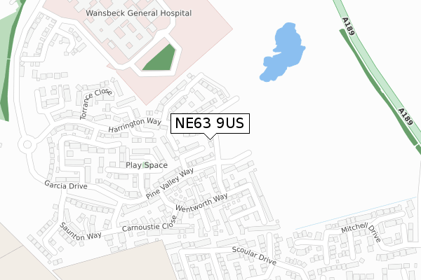
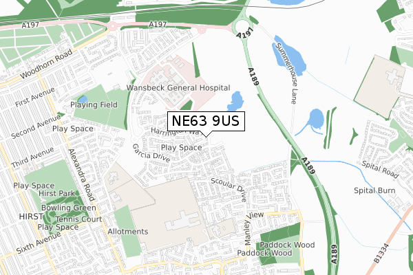
NE63 9US is located in the Seaton with Newbiggin West electoral ward, within the unitary authority of Northumberland and the English Parliamentary constituency of Wansbeck. The Sub Integrated Care Board (ICB) Location is NHS North East and North Cumbria ICB - 00L and the police force is Northumbria. This postcode has been in use since July 2018.


GetTheData
Source: OS Open Zoomstack (Ordnance Survey)
Licence: Open Government Licence (requires attribution)
Attribution: Contains OS data © Crown copyright and database right 2025
Source: Open Postcode Geo
Licence: Open Government Licence (requires attribution)
Attribution: Contains OS data © Crown copyright and database right 2025; Contains Royal Mail data © Royal Mail copyright and database right 2025; Source: Office for National Statistics licensed under the Open Government Licence v.3.0
| Easting | 429236 |
| Northing | 587554 |
| Latitude | 55.181424 |
| Longitude | -1.542456 |
GetTheData
Source: Open Postcode Geo
Licence: Open Government Licence
| Country | England |
| Postcode District | NE63 |
➜ See where NE63 is on a map ➜ Where is Ashington? | |
GetTheData
Source: Land Registry Price Paid Data
Licence: Open Government Licence
| Ward | Seaton With Newbiggin West |
| Constituency | Wansbeck |
GetTheData
Source: ONS Postcode Database
Licence: Open Government Licence
2, CATALUNYA WAY, ASHINGTON, NE63 9US 2018 29 JUN £222,950 |
GetTheData
Source: HM Land Registry Price Paid Data
Licence: Contains HM Land Registry data © Crown copyright and database right 2025. This data is licensed under the Open Government Licence v3.0.
| Main Entrance (Link Road) | Wansbeck Hospital | 522m |
| Barnston (Manley View) | North Seaton | 572m |
| Main Entrance (Link Road) | Wansbeck Hospital | 574m |
| Barnston (Manley View) | North Seaton | 624m |
| Community Centre (Manley View) | North Seaton | 624m |
GetTheData
Source: NaPTAN
Licence: Open Government Licence
| Percentage of properties with Next Generation Access | 100.0% |
| Percentage of properties with Superfast Broadband | 100.0% |
| Percentage of properties with Ultrafast Broadband | 0.0% |
| Percentage of properties with Full Fibre Broadband | 0.0% |
Superfast Broadband is between 30Mbps and 300Mbps
Ultrafast Broadband is > 300Mbps
| Median download speed | 14.0Mbps |
| Average download speed | 28.8Mbps |
| Maximum download speed | 70.01Mbps |
| Median upload speed | 1.2Mbps |
| Average upload speed | 5.2Mbps |
| Maximum upload speed | 17.08Mbps |
| Percentage of properties unable to receive 2Mbps | 0.0% |
| Percentage of properties unable to receive 5Mbps | 0.0% |
| Percentage of properties unable to receive 10Mbps | 0.0% |
| Percentage of properties unable to receive 30Mbps | 0.0% |
GetTheData
Source: Ofcom
Licence: Ofcom Terms of Use (requires attribution)
GetTheData
Source: ONS Postcode Database
Licence: Open Government Licence


➜ Get more ratings from the Food Standards Agency
GetTheData
Source: Food Standards Agency
Licence: FSA terms & conditions
| Last Collection | |||
|---|---|---|---|
| Location | Mon-Fri | Sat | Distance |
| Manley View | 17:30 | 12:00 | 586m |
| Moorhouse Estate | 17:00 | 11:45 | 657m |
| Alexandra Road | 17:00 | 11:45 | 825m |
GetTheData
Source: Dracos
Licence: Creative Commons Attribution-ShareAlike
The below table lists the International Territorial Level (ITL) codes (formerly Nomenclature of Territorial Units for Statistics (NUTS) codes) and Local Administrative Units (LAU) codes for NE63 9US:
| ITL 1 Code | Name |
|---|---|
| TLC | North East (England) |
| ITL 2 Code | Name |
| TLC2 | Northumberland, and Tyne and Wear |
| ITL 3 Code | Name |
| TLC21 | Northumberland |
| LAU 1 Code | Name |
| E06000057 | Northumberland |
GetTheData
Source: ONS Postcode Directory
Licence: Open Government Licence
The below table lists the Census Output Area (OA), Lower Layer Super Output Area (LSOA), and Middle Layer Super Output Area (MSOA) for NE63 9US:
| Code | Name | |
|---|---|---|
| OA | E00176343 | |
| LSOA | E01027549 | Northumberland 013E |
| MSOA | E02005736 | Northumberland 013 |
GetTheData
Source: ONS Postcode Directory
Licence: Open Government Licence
| NE63 9GE | Birkdale Way | 118m |
| NE63 9GL | Pine Valley Way | 119m |
| NE63 9GD | Wentworth Way | 134m |
| NE63 9WG | Maidstone Gardens | 150m |
| NE63 9GN | Oakmont Rise | 168m |
| NE63 9GT | Sunningdale Road | 180m |
| NE63 9GX | Slaley Drive | 183m |
| NE63 9GY | Bandon Court | 188m |
| NE63 9JP | Harrington Way | 197m |
| NE63 9JN | Harrington Way | 201m |
GetTheData
Source: Open Postcode Geo; Land Registry Price Paid Data
Licence: Open Government Licence