NE63 0FF maps, stats, and open data
NE63 0FF is located in the College electoral ward, within the unitary authority of Northumberland and the English Parliamentary constituency of Wansbeck. The Sub Integrated Care Board (ICB) Location is NHS North East and North Cumbria ICB - 00L and the police force is Northumbria. This postcode has been in use since January 2019.
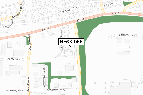
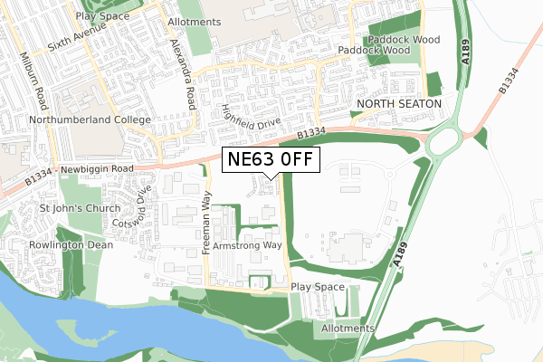
NE63 0FF maps


Licence: Open Government Licence (requires attribution)
Attribution: Contains OS data © Crown copyright and database right 2025
Source: Open Postcode Geo
Licence: Open Government Licence (requires attribution)
Attribution: Contains OS data © Crown copyright and database right 2025; Contains Royal Mail data © Royal Mail copyright and database right 2025; Source: Office for National Statistics licensed under the Open Government Licence v.3.0
NE63 0FF geodata
| Easting | 429115 |
| Northing | 586251 |
| Latitude | 55.169723 |
| Longitude | -1.544490 |
Where is NE63 0FF?
| Country | England |
| Postcode District | NE63 |
Politics
| Ward | College |
|---|---|
| Constituency | Wansbeck |
House Prices
Sales of detached houses in NE63 0FF
19, KILBOURN STREET, ESSENDENE RISE, ASHINGTON, NE63 0FF 2020 3 DEC £247,995 |
16, KILBOURN STREET, ESSENDENE RISE, ASHINGTON, NE63 0FF 2020 28 AUG £230,845 |
13, KILBOURN STREET, ESSENDENE RISE, ASHINGTON, NE63 0FF 2020 28 FEB £237,495 |
23, KILBOURN STREET, ESSENDENE RISE, ASHINGTON, NE63 0FF 2020 24 JAN £194,995 |
9, KILBOURN STREET, ESSENDENE RISE, ASHINGTON, NE63 0FF 2019 6 NOV £245,995 |
22, KILBOURN STREET, ESSENDENE RISE, ASHINGTON, NE63 0FF 2019 31 OCT £254,995 |
31, KILBOURN STREET, ESSENDENE RISE, ASHINGTON, NE63 0FF 2019 25 OCT £219,995 |
37, KILBOURN STREET, ESSENDENE RISE, ASHINGTON, NE63 0FF 2019 21 OCT £178,995 |
10, KILBOURN STREET, ESSENDENE RISE, ASHINGTON, NE63 0FF 2019 26 JUL £236,000 |
38, KILBOURN STREET, ESSENDENE RISE, ASHINGTON, NE63 0FF 2019 28 JUN £239,995 |
Licence: Contains HM Land Registry data © Crown copyright and database right 2025. This data is licensed under the Open Government Licence v3.0.
Transport
Nearest bus stops to NE63 0FF
| Boiler Row | North Seaton | 159m |
| Industrial Estate (Freeman Way) | North Seaton Colliery | 324m |
| Highfield Drive | North Seaton | 326m |
| Industrial Estate (Freeman Way) | North Seaton Colliery | 358m |
| Links View (Road To North) | North Seaton Colliery | 474m |
Broadband
Broadband access in NE63 0FF (2020 data)
| Percentage of properties with Next Generation Access | 100.0% |
| Percentage of properties with Superfast Broadband | 100.0% |
| Percentage of properties with Ultrafast Broadband | 100.0% |
| Percentage of properties with Full Fibre Broadband | 100.0% |
Superfast Broadband is between 30Mbps and 300Mbps
Ultrafast Broadband is > 300Mbps
Broadband limitations in NE63 0FF (2020 data)
| Percentage of properties unable to receive 2Mbps | 0.0% |
| Percentage of properties unable to receive 5Mbps | 0.0% |
| Percentage of properties unable to receive 10Mbps | 0.0% |
| Percentage of properties unable to receive 30Mbps | 0.0% |
Deprivation
47.8% of English postcodes are less deprived than NE63 0FF:Food Standards Agency
Three nearest food hygiene ratings to NE63 0FF (metres)


➜ Get more ratings from the Food Standards Agency
Nearest post box to NE63 0FF
| Last Collection | |||
|---|---|---|---|
| Location | Mon-Fri | Sat | Distance |
| Alwinton Square | 17:00 | 11:45 | 460m |
| North Seaton Colliery | 16:00 | 11:00 | 537m |
| Manley View | 17:30 | 12:00 | 853m |
NE63 0FF ITL and NE63 0FF LAU
The below table lists the International Territorial Level (ITL) codes (formerly Nomenclature of Territorial Units for Statistics (NUTS) codes) and Local Administrative Units (LAU) codes for NE63 0FF:
| ITL 1 Code | Name |
|---|---|
| TLC | North East (England) |
| ITL 2 Code | Name |
| TLC2 | Northumberland, and Tyne and Wear |
| ITL 3 Code | Name |
| TLC21 | Northumberland |
| LAU 1 Code | Name |
| E06000057 | Northumberland |
NE63 0FF census areas
The below table lists the Census Output Area (OA), Lower Layer Super Output Area (LSOA), and Middle Layer Super Output Area (MSOA) for NE63 0FF:
| Code | Name | |
|---|---|---|
| OA | E00140124 | |
| LSOA | E01027532 | Northumberland 014A |
| MSOA | E02005738 | Northumberland 014 |
Nearest postcodes to NE63 0FF
| NE63 9SU | Pembroke Gardens | 211m |
| NE63 9ST | Carlton Grove | 253m |
| NE63 9SX | Avondale Gardens | 262m |
| NE63 9SR | Highfield Drive | 283m |
| NE63 9SP | Highfield Drive | 310m |
| NE63 9SW | Belgrave Gardens | 314m |
| NE63 9SJ | Fairfield Drive | 329m |
| NE63 9SS | Lyndhurst Road | 331m |
| NE63 9QN | Salisbury Close | 378m |
| NE63 0TR | Fox Cover | 381m |