Property/Postcode Data Search:
NE6 3PL maps, stats, and open data
NE6 3PL is located in the Walker electoral ward, within the metropolitan district of Newcastle upon Tyne and the English Parliamentary constituency of Newcastle upon Tyne East. The Sub Integrated Care Board (ICB) Location is NHS North East and North Cumbria ICB - 13T and the police force is Northumbria. This postcode has been in use since September 2017.
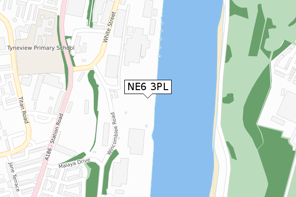
NE6 3PL maps


Source: OS Open Zoomstack (Ordnance Survey)
Licence: Open Government Licence (requires attribution)
Attribution: Contains OS data © Crown copyright and database right 2025
Source: Open Postcode Geo
Licence: Open Government Licence (requires attribution)
Attribution: Contains OS data © Crown copyright and database right 2025; Contains Royal Mail data © Royal Mail copyright and database right 2025; Source: Office for National Statistics licensed under the Open Government Licence v.3.0
Licence: Open Government Licence (requires attribution)
Attribution: Contains OS data © Crown copyright and database right 2025
Source: Open Postcode Geo
Licence: Open Government Licence (requires attribution)
Attribution: Contains OS data © Crown copyright and database right 2025; Contains Royal Mail data © Royal Mail copyright and database right 2025; Source: Office for National Statistics licensed under the Open Government Licence v.3.0
NE6 3PL geodata
| Easting | 429777 |
| Northing | 564250 |
| Latitude | 54.971990 |
| Longitude | -1.536386 |
Where is NE6 3PL?
| Country | England |
| Postcode District | NE6 |
Politics
| Ward | Walker |
|---|---|
| Constituency | Newcastle Upon Tyne East |
Transport
Nearest bus stops to NE6 3PL
| White Street | Low Walker | 216m |
| White Street | Low Walker | 246m |
| Station Road - Rhodes Street (Station Road) | Walker | 311m |
| Station Road - Rhodes Street (Station Road) | Walker | 332m |
| Rhodes Street | Walker | 348m |
Nearest underground/metro/tram to NE6 3PL
| Hebburn (Tyne And Wear Metro Station) (Prince Consort Road) | Hebburn | 1,096m |
| Walkergate (Tyne And Wear Metro Station) (Benfield Road) | Walkergate | 2,090m |
Nearest railway stations to NE6 3PL
| Heworth Station | 2.6km |
| Manors Station | 4.4km |
| Brockley Whins Station | 5km |
Deprivation
98.2% of English postcodes are less deprived than NE6 3PL:Food Standards Agency
Three nearest food hygiene ratings to NE6 3PL (metres)
Building Futures East
Building Futures North East White Street
305m
M & P Davies

62 Proctor Street
382m
Jubilee Club

4 Proctor Street
479m
➜ Get more ratings from the Food Standards Agency
Nearest post box to NE6 3PL
| Last Collection | |||
|---|---|---|---|
| Location | Mon-Fri | Sat | Distance |
| Walker Post Office | 17:00 | 12:15 | 592m |
| Regent Road | 17:30 | 11:45 | 745m |
| Tharsis Road | 17:30 | 10:30 | 961m |
NE6 3PL ITL and NE6 3PL LAU
The below table lists the International Territorial Level (ITL) codes (formerly Nomenclature of Territorial Units for Statistics (NUTS) codes) and Local Administrative Units (LAU) codes for NE6 3PL:
| ITL 1 Code | Name |
|---|---|
| TLC | North East (England) |
| ITL 2 Code | Name |
| TLC2 | Northumberland, and Tyne and Wear |
| ITL 3 Code | Name |
| TLC22 | Tyneside |
| LAU 1 Code | Name |
| E08000021 | Newcastle upon Tyne |
NE6 3PL census areas
The below table lists the Census Output Area (OA), Lower Layer Super Output Area (LSOA), and Middle Layer Super Output Area (MSOA) for NE6 3PL:
| Code | Name | |
|---|---|---|
| OA | E00042767 | |
| LSOA | E01008425 | Newcastle upon Tyne 030B |
| MSOA | E02001737 | Newcastle upon Tyne 030 |
Nearest postcodes to NE6 3PL
| NE6 3UB | Anson Walk | 383m |
| NE6 3UP | Station Road | 406m |
| NE6 3UD | Andromeda Court | 417m |
| NE6 3DX | Proctor Street | 420m |
| NE6 3UF | Lysander Drive | 444m |
| NE6 3QG | Winslow Close | 460m |
| NE6 3UT | Beverley Terrace | 467m |
| NE6 3QA | Winslow Place | 481m |
| NE31 1TL | St Annes Close | 483m |
| NE6 3UQ | Station Road | 486m |