NE5 3QW maps, stats, and open data
- Home
- Postcode
- NE
- NE5
- NE5 3
NE5 3QW is located in the Blakelaw electoral ward, within the metropolitan district of Newcastle upon Tyne and the English Parliamentary constituency of Newcastle upon Tyne Central. The Sub Integrated Care Board (ICB) Location is NHS North East and North Cumbria ICB - 13T and the police force is Northumbria. This postcode has been in use since January 2019.
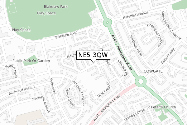
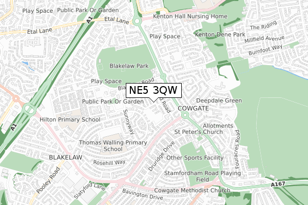
NE5 3QW maps


Source: OS Open Zoomstack (Ordnance Survey)
Licence: Open Government Licence (requires attribution)
Attribution: Contains OS data © Crown copyright and database right 2025
Source: Open Postcode GeoLicence: Open Government Licence (requires attribution)
Attribution: Contains OS data © Crown copyright and database right 2025; Contains Royal Mail data © Royal Mail copyright and database right 2025; Source: Office for National Statistics licensed under the Open Government Licence v.3.0
NE5 3QW geodata
| Easting | 421513 |
| Northing | 566804 |
| Latitude | 54.995364 |
| Longitude | -1.665290 |
Where is NE5 3QW?
| Country | England |
| Postcode District | NE5 |
Politics
| Ward | Blakelaw |
|---|
| Constituency | Newcastle Upon Tyne Central |
|---|
Transport
Nearest bus stops to NE5 3QW
| Ponteland Road-fuchsia Place (Ponteland Road) | Blakelaw | 202m |
| Springfield Road-firfield Road (Springfield Road) | Cowgate | 202m |
| Springfield Road-firfield Road (Springfield Road) | Cowgate | 211m |
| Blakelaw Road-wilbury Place (Blakelaw Road) | Blakelaw | 218m |
| Blakelaw Road-wilbury Place (Blakelaw Road) | Blakelaw | 231m |
Nearest railway stations to NE5 3QW
| Metrocentre Station | 4.1km |
| Newcastle Station | 4.3km |
| Blaydon Station | 4.5km |
Broadband
Broadband access in NE5 3QW (2020 data)
| Percentage of properties with Next Generation Access | 75.0% |
| Percentage of properties with Superfast Broadband | 75.0% |
| Percentage of properties with Ultrafast Broadband | 75.0% |
| Percentage of properties with Full Fibre Broadband | 0.0% |
Superfast Broadband is between 30Mbps and 300Mbps
Ultrafast Broadband is > 300Mbps
Broadband limitations in NE5 3QW (2020 data)
| Percentage of properties unable to receive 2Mbps | 0.0% |
| Percentage of properties unable to receive 5Mbps | 0.0% |
| Percentage of properties unable to receive 10Mbps | 0.0% |
| Percentage of properties unable to receive 30Mbps | 25.0% |
Deprivation
90.8% of English postcodes are less deprived than
NE5 3QW:
Food Standards Agency
Three nearest food hygiene ratings to NE5 3QW (metres)
Imperia Pizza Restaurant
Blakelaw And Cowgate Legion Club
Chai Shai
➜ Get more ratings from the Food Standards Agency
Nearest post box to NE5 3QW
| | Last Collection | |
|---|
| Location | Mon-Fri | Sat | Distance |
|---|
| Hillheads Post Office | 17:45 | 11:15 | 504m |
| Dewley Road | 17:30 | 10:30 | 859m |
| Etal Way | 17:30 | 11:30 | 870m |
NE5 3QW ITL and NE5 3QW LAU
The below table lists the International Territorial Level (ITL) codes (formerly Nomenclature of Territorial Units for Statistics (NUTS) codes) and Local Administrative Units (LAU) codes for NE5 3QW:
| ITL 1 Code | Name |
|---|
| TLC | North East (England) |
| ITL 2 Code | Name |
|---|
| TLC2 | Northumberland, and Tyne and Wear |
| ITL 3 Code | Name |
|---|
| TLC22 | Tyneside |
| LAU 1 Code | Name |
|---|
| E08000021 | Newcastle upon Tyne |
NE5 3QW census areas
The below table lists the Census Output Area (OA), Lower Layer Super Output Area (LSOA), and Middle Layer Super Output Area (MSOA) for NE5 3QW:
| Code | Name |
|---|
| OA | E00042104 | |
|---|
| LSOA | E01008300 | Newcastle upon Tyne 016A |
|---|
| MSOA | E02001723 | Newcastle upon Tyne 016 |
|---|
Nearest postcodes to NE5 3QW


