NE38 7TL maps, stats, and open data
NE38 7TL is located in the Washington Central electoral ward, within the metropolitan district of Sunderland and the English Parliamentary constituency of Washington and Sunderland West. The Sub Integrated Care Board (ICB) Location is NHS North East and North Cumbria ICB - 00P and the police force is Northumbria. This postcode has been in use since September 2019.
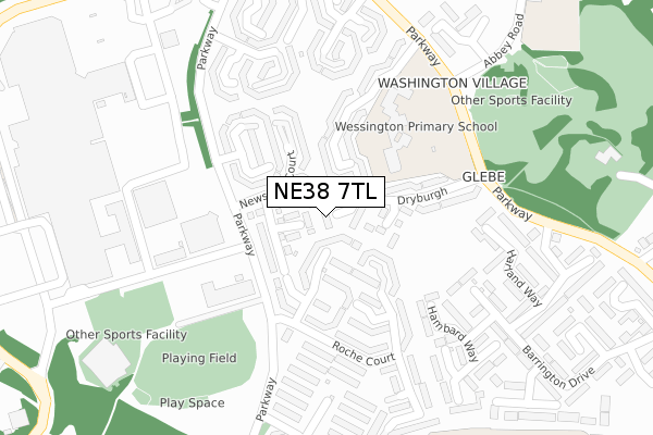
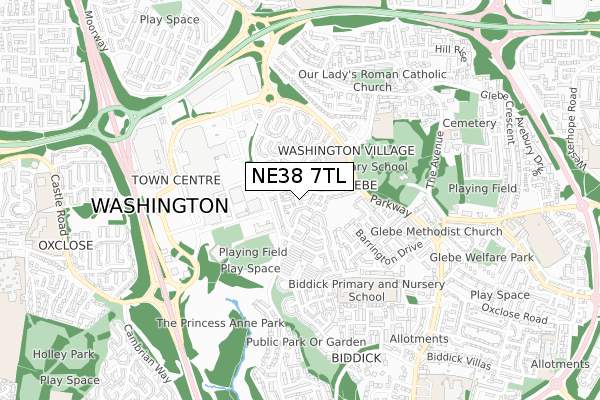
NE38 7TL maps


Licence: Open Government Licence (requires attribution)
Attribution: Contains OS data © Crown copyright and database right 2025
Source: Open Postcode Geo
Licence: Open Government Licence (requires attribution)
Attribution: Contains OS data © Crown copyright and database right 2025; Contains Royal Mail data © Royal Mail copyright and database right 2025; Source: Office for National Statistics licensed under the Open Government Licence v.3.0
NE38 7TL geodata
| Easting | 430494 |
| Northing | 556162 |
| Latitude | 54.899270 |
| Longitude | -1.526041 |
Where is NE38 7TL?
| Country | England |
| Postcode District | NE38 |
Politics
| Ward | Washington Central |
|---|---|
| Constituency | Washington And Sunderland West |
House Prices
Sales of detached houses in NE38 7TL
9, GERTRUDE COURT, WASHINGTON, NE38 7TL 2019 27 SEP £187,950 |
Licence: Contains HM Land Registry data © Crown copyright and database right 2025. This data is licensed under the Open Government Licence v3.0.
Transport
Nearest bus stops to NE38 7TL
| Glebe (Newstead Court) | Washington | 17m |
| Glebe (Newstead Court) | Washington | 23m |
| Police Link Road - Leisure Centre (Police Link Road) | Washington | 264m |
| Police Link Road - Leisure Centre (Police Link Road) | Washington | 265m |
| Abbey Road | Washington Village | 395m |
Nearest railway stations to NE38 7TL
| Chester-le-Street Station | 6km |
Deprivation
91.8% of English postcodes are less deprived than NE38 7TL:Food Standards Agency
Three nearest food hygiene ratings to NE38 7TL (metres)


➜ Get more ratings from the Food Standards Agency
Nearest post box to NE38 7TL
| Last Collection | |||
|---|---|---|---|
| Location | Mon-Fri | Sat | Distance |
| Newstead Court | 17:00 | 10:30 | 28m |
| The Galleries | 18:30 | 410m | |
| Asda, The Galleries | 18:30 | 13:00 | 429m |
NE38 7TL ITL and NE38 7TL LAU
The below table lists the International Territorial Level (ITL) codes (formerly Nomenclature of Territorial Units for Statistics (NUTS) codes) and Local Administrative Units (LAU) codes for NE38 7TL:
| ITL 1 Code | Name |
|---|---|
| TLC | North East (England) |
| ITL 2 Code | Name |
| TLC2 | Northumberland, and Tyne and Wear |
| ITL 3 Code | Name |
| TLC23 | Sunderland |
| LAU 1 Code | Name |
| E08000024 | Sunderland |
NE38 7TL census areas
The below table lists the Census Output Area (OA), Lower Layer Super Output Area (LSOA), and Middle Layer Super Output Area (MSOA) for NE38 7TL:
| Code | Name | |
|---|---|---|
| OA | E00044942 | |
| LSOA | E01008849 | Sunderland 019D |
| MSOA | E02001809 | Sunderland 019 |
Nearest postcodes to NE38 7TL
| NE38 7PF | Newstead Court | 59m |
| NE38 7PU | Dryburgh | 88m |
| NE38 7PZ | Lanercost | 105m |
| NE38 7PN | Roche Court | 109m |
| NE38 7PY | Lanercost | 110m |
| NE38 7PE | Newstead Court | 124m |
| NE38 7PD | Talley Court | 141m |
| NE38 7PB | Talley Court | 151m |
| NE38 7PW | Roche Court | 160m |
| NE38 7PJ | Roche Court | 164m |