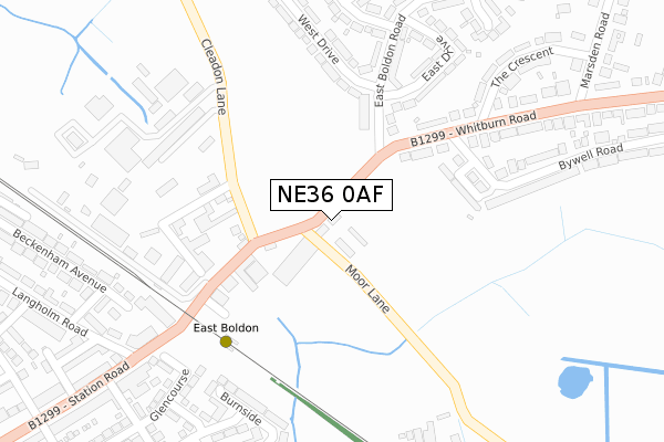
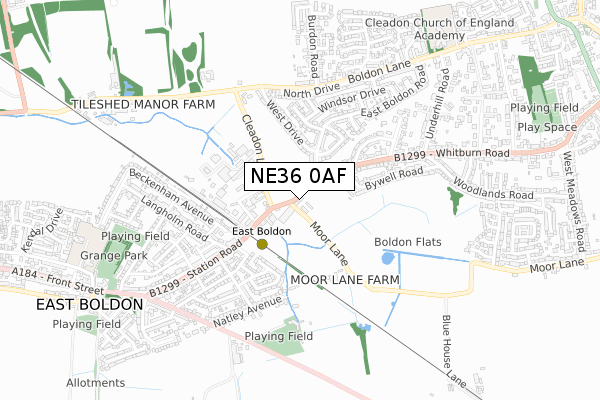
NE36 0AF is located in the Cleadon and East Boldon electoral ward, within the metropolitan district of South Tyneside and the English Parliamentary constituency of Jarrow. The Sub Integrated Care Board (ICB) Location is NHS North East and North Cumbria ICB - 00N and the police force is Northumbria. This postcode has been in use since February 2020.


GetTheData
Source: OS Open Zoomstack (Ordnance Survey)
Licence: Open Government Licence (requires attribution)
Attribution: Contains OS data © Crown copyright and database right 2025
Source: Open Postcode Geo
Licence: Open Government Licence (requires attribution)
Attribution: Contains OS data © Crown copyright and database right 2025; Contains Royal Mail data © Royal Mail copyright and database right 2025; Source: Office for National Statistics licensed under the Open Government Licence v.3.0
| Easting | 437376 |
| Northing | 561633 |
| Latitude | 54.947965 |
| Longitude | -1.418026 |
GetTheData
Source: Open Postcode Geo
Licence: Open Government Licence
| Country | England |
| Postcode District | NE36 |
➜ See where NE36 is on a map | |
GetTheData
Source: Land Registry Price Paid Data
Licence: Open Government Licence
| Ward | Cleadon And East Boldon |
| Constituency | Jarrow |
GetTheData
Source: ONS Postcode Database
Licence: Open Government Licence
| Cleadon Lane-industrial Estate (Cleadon Lane) | East Boldon | 126m |
| Cleadon Lane-industrial Estate (Cleadon Lane) | East Boldon | 138m |
| Whitburn Road-bywell Road (Whitburn Road) | Cleadon | 207m |
| Whitburn Road-the Crescent (Whitburn Road) | Cleadon | 265m |
| East Boldon Metro (Station Road) | East Boldon | 287m |
| East Boldon (Tyne And Wear Metro Station) (Station Approach) | East Boldon | 233m |
| East Boldon Station | 0.2km |
| Seaburn Station | 2.9km |
| Brockley Whins Station | 3.1km |
GetTheData
Source: NaPTAN
Licence: Open Government Licence
GetTheData
Source: ONS Postcode Database
Licence: Open Government Licence


➜ Get more ratings from the Food Standards Agency
GetTheData
Source: Food Standards Agency
Licence: FSA terms & conditions
| Last Collection | |||
|---|---|---|---|
| Location | Mon-Fri | Sat | Distance |
| Station Road Post Office | 16:15 | 10:30 | 369m |
| Station Road | 16:45 | 12:30 | 719m |
| Cleadon Post Office | 17:15 | 11:00 | 1,274m |
GetTheData
Source: Dracos
Licence: Creative Commons Attribution-ShareAlike
The below table lists the International Territorial Level (ITL) codes (formerly Nomenclature of Territorial Units for Statistics (NUTS) codes) and Local Administrative Units (LAU) codes for NE36 0AF:
| ITL 1 Code | Name |
|---|---|
| TLC | North East (England) |
| ITL 2 Code | Name |
| TLC2 | Northumberland, and Tyne and Wear |
| ITL 3 Code | Name |
| TLC22 | Tyneside |
| LAU 1 Code | Name |
| E08000023 | South Tyneside |
GetTheData
Source: ONS Postcode Directory
Licence: Open Government Licence
The below table lists the Census Output Area (OA), Lower Layer Super Output Area (LSOA), and Middle Layer Super Output Area (MSOA) for NE36 0AF:
| Code | Name | |
|---|---|---|
| OA | E00043752 | |
| LSOA | E01008618 | South Tyneside 022B |
| MSOA | E02001789 | South Tyneside 022 |
GetTheData
Source: ONS Postcode Directory
Licence: Open Government Licence
| NE36 0AJ | Cleadon Lane | 143m |
| SR6 7SH | East Boldon Road | 189m |
| SR6 7TF | Southend | 192m |
| SR6 7QU | Garden Lane | 211m |
| NE36 0AH | Cleadon Lane Industrial Estate | 224m |
| SR6 7QX | Whitburn Road | 231m |
| SR6 7SJ | West Drive | 243m |
| SR6 7TA | East Boldon Road | 274m |
| NE36 0ER | Willow Bank Court | 284m |
| SR6 7TE | East Drive | 311m |
GetTheData
Source: Open Postcode Geo; Land Registry Price Paid Data
Licence: Open Government Licence