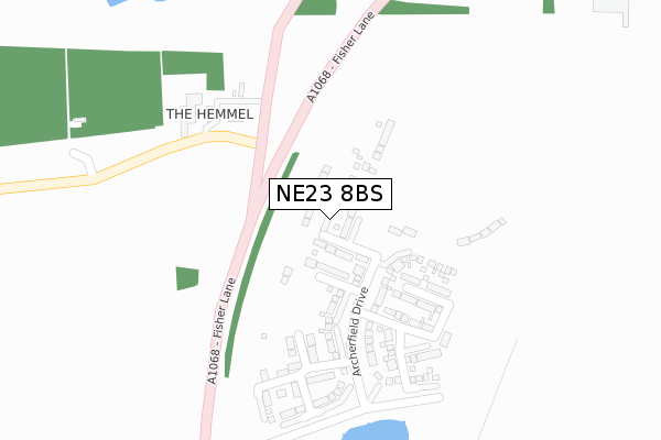
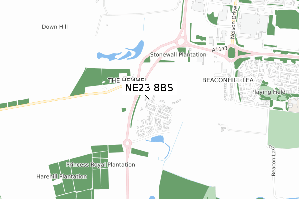
NE23 8BS is located in the Cramlington West electoral ward, within the unitary authority of Northumberland and the English Parliamentary constituency of Blyth Valley. The Sub Integrated Care Board (ICB) Location is NHS North East and North Cumbria ICB - 00L and the police force is Northumbria. This postcode has been in use since January 2020.


GetTheData
Source: OS Open Zoomstack (Ordnance Survey)
Licence: Open Government Licence (requires attribution)
Attribution: Contains OS data © Crown copyright and database right 2025
Source: Open Postcode Geo
Licence: Open Government Licence (requires attribution)
Attribution: Contains OS data © Crown copyright and database right 2025; Contains Royal Mail data © Royal Mail copyright and database right 2025; Source: Office for National Statistics licensed under the Open Government Licence v.3.0
| Easting | 424072 |
| Northing | 576749 |
| Latitude | 55.084611 |
| Longitude | -1.624457 |
GetTheData
Source: Open Postcode Geo
Licence: Open Government Licence
| Country | England |
| Postcode District | NE23 |
➜ See where NE23 is on a map ➜ Where is Cramlington? | |
GetTheData
Source: Land Registry Price Paid Data
Licence: Open Government Licence
| Ward | Cramlington West |
| Constituency | Blyth Valley |
GetTheData
Source: ONS Postcode Database
Licence: Open Government Licence
2024 20 DEC £332,500 |
2024 11 JUN £222,000 |
2024 26 JAN £286,000 |
59, FAIRHAVEN WAY, THE FAIRWAYS, CRAMLINGTON, NE23 8BS 2021 3 JUN £321,995 |
23, FAIRHAVEN WAY, THE FAIRWAYS, CRAMLINGTON, NE23 8BS 2021 28 MAY £239,950 |
25, FAIRHAVEN WAY, THE FAIRWAYS, CRAMLINGTON, NE23 8BS 2021 31 MAR £249,950 |
34, FAIRHAVEN WAY, THE FAIRWAYS, CRAMLINGTON, NE23 8BS 2021 25 FEB £376,995 |
36, FAIRHAVEN WAY, THE FAIRWAYS, CRAMLINGTON, NE23 8BS 2021 29 JAN £249,995 |
13, FAIRHAVEN WAY, THE FAIRWAYS, CRAMLINGTON, NE23 8BS 2021 6 JAN £269,950 |
3, FAIRHAVEN WAY, THE FAIRWAYS, CRAMLINGTON, NE23 8BS 2020 18 DEC £274,950 |
GetTheData
Source: HM Land Registry Price Paid Data
Licence: Contains HM Land Registry data © Crown copyright and database right 2025. This data is licensed under the Open Government Licence v3.0.
| Garden Centre (A1172) | Beacon Hill | 583m |
| Garden Centre (A1172) | Beacon Hill | 607m |
| Fisher Lane Roundabout (Fisher Lane) | Beacon Hill | 613m |
| Fisher Lane Roundabout (A1068) | Beacon Hill | 685m |
| Eastbourne Gardens | Beacon Hill | 784m |
| Cramlington Station | 1.7km |
GetTheData
Source: NaPTAN
Licence: Open Government Licence
GetTheData
Source: ONS Postcode Database
Licence: Open Government Licence


➜ Get more ratings from the Food Standards Agency
GetTheData
Source: Food Standards Agency
Licence: FSA terms & conditions
| Last Collection | |||
|---|---|---|---|
| Location | Mon-Fri | Sat | Distance |
| The Magpie Filling Station | 17:15 | 12:30 | 709m |
| Beacon Lea | 17:15 | 12:30 | 775m |
| Ladykirk Way | 17:15 | 12:30 | 1,394m |
GetTheData
Source: Dracos
Licence: Creative Commons Attribution-ShareAlike
The below table lists the International Territorial Level (ITL) codes (formerly Nomenclature of Territorial Units for Statistics (NUTS) codes) and Local Administrative Units (LAU) codes for NE23 8BS:
| ITL 1 Code | Name |
|---|---|
| TLC | North East (England) |
| ITL 2 Code | Name |
| TLC2 | Northumberland, and Tyne and Wear |
| ITL 3 Code | Name |
| TLC21 | Northumberland |
| LAU 1 Code | Name |
| E06000057 | Northumberland |
GetTheData
Source: ONS Postcode Directory
Licence: Open Government Licence
The below table lists the Census Output Area (OA), Lower Layer Super Output Area (LSOA), and Middle Layer Super Output Area (MSOA) for NE23 8BS:
| Code | Name | |
|---|---|---|
| OA | E00139503 | |
| LSOA | E01027412 | Northumberland 029D |
| MSOA | E02005715 | Northumberland 029 |
GetTheData
Source: ONS Postcode Directory
Licence: Open Government Licence
| NE23 8AY | Station Road | 544m |
| NE23 8JT | Kielder Avenue | 648m |
| NE23 8BH | Station Road | 726m |
| NE23 8JB | Ealing Square | 776m |
| NE23 8JA | Elgin Close | 807m |
| NE23 8AP | Beacon Mews | 998m |
| NE23 8HL | Selborne Close | 1026m |
| NE23 8HH | Sudbury Way | 1070m |
| NE23 8HJ | Shiel Gardens | 1090m |
| NE23 8HQ | Sudbury Way | 1111m |
GetTheData
Source: Open Postcode Geo; Land Registry Price Paid Data
Licence: Open Government Licence