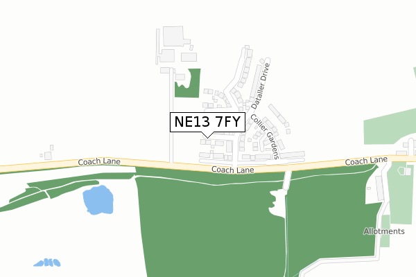
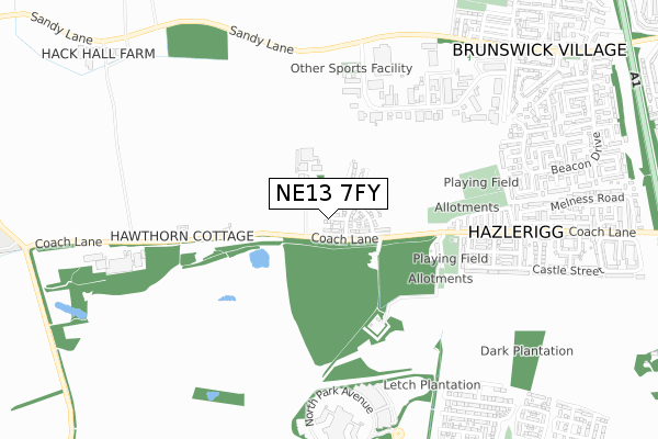
NE13 7FY maps, stats, and open data
NE13 7FY is located in the Castle electoral ward, within the metropolitan district of Newcastle upon Tyne and the English Parliamentary constituency of Newcastle upon Tyne North. The Sub Integrated Care Board (ICB) Location is NHS North East and North Cumbria ICB - 13T and the police force is Northumbria. This postcode has been in use since September 2019.
NE13 7FY maps


Licence: Open Government Licence (requires attribution)
Attribution: Contains OS data © Crown copyright and database right 2025
Source: Open Postcode Geo
Licence: Open Government Licence (requires attribution)
Attribution: Contains OS data © Crown copyright and database right 2025; Contains Royal Mail data © Royal Mail copyright and database right 2025; Source: Office for National Statistics licensed under the Open Government Licence v.3.0
NE13 7FY geodata
| Easting | 422605 |
| Northing | 572173 |
| Latitude | 55.043561 |
| Longitude | -1.647798 |
Where is NE13 7FY?
| Country | England |
| Postcode District | NE13 |
Politics
| Ward | Castle |
|---|---|
| Constituency | Newcastle Upon Tyne North |
House Prices
Sales of detached houses in NE13 7FY
77, DATALLER DRIVE, HAZLERIGG, NEWCASTLE UPON TYNE, NE13 7FY 2024 30 SEP £353,352 |
73, DATALLER DRIVE, HAZLERIGG, NEWCASTLE UPON TYNE, NE13 7FY 2024 30 SEP £434,102 |
75, DATALLER DRIVE, HAZLERIGG, NEWCASTLE UPON TYNE, NE13 7FY 2024 27 SEP £371,950 |
71, DATALLER DRIVE, HAZLERIGG, NEWCASTLE UPON TYNE, NE13 7FY 2024 27 SEP £275,453 |
79, DATALLER DRIVE, HAZLERIGG, NEWCASTLE UPON TYNE, NE13 7FY 2024 30 AUG £315,950 |
81, DATALLER DRIVE, HAZLERIGG, NEWCASTLE UPON TYNE, NE13 7FY 2024 22 AUG £275,453 |
85, DATALLER DRIVE, HAZLERIGG, NEWCASTLE UPON TYNE, NE13 7FY 2024 31 JUL £275,453 |
83, DATALLER DRIVE, HAZLERIGG, NEWCASTLE UPON TYNE, NE13 7FY 2024 31 JUL £424,602 |
93, DATALLER DRIVE, HAZLERIGG, NEWCASTLE UPON TYNE, NE13 7FY 2024 28 JUN £373,302 |
91, DATALLER DRIVE, HAZLERIGG, NEWCASTLE UPON TYNE, NE13 7FY 2024 28 JUN £373,302 |
Licence: Contains HM Land Registry data © Crown copyright and database right 2025. This data is licensed under the Open Government Licence v3.0.
Transport
Nearest bus stops to NE13 7FY
| Coach Lane-morley Hill Farm (Coach Lane) | Hazlerigg | 310m |
| Coach Lane-morley Hill Farm (Coach Lane) | Hazlerigg | 345m |
| Brunswick Industrial Estate (Unclassified Estate Road) | Brunswick Village | 350m |
| Coach Lane - Lola Street (Coach Lane) | Hazlerigg | 404m |
| Coach Lane - Lola Street (Coach Lane) | Hazlerigg | 412m |
Nearest railway stations to NE13 7FY
| Newcastle Airport Metro | 4.1km |
| Cramlington Station | 5.8km |
Deprivation
85.8% of English postcodes are less deprived than NE13 7FY:Food Standards Agency
Three nearest food hygiene ratings to NE13 7FY (metres)


➜ Get more ratings from the Food Standards Agency
Nearest post box to NE13 7FY
| Last Collection | |||
|---|---|---|---|
| Location | Mon-Fri | Sat | Distance |
| Hazelrigg Post Office | 17:45 | 12:00 | 633m |
| Beacon Drive | 17:30 | 11:30 | 823m |
| Brunswick Village Post Office | 17:30 | 11:45 | 876m |
NE13 7FY ITL and NE13 7FY LAU
The below table lists the International Territorial Level (ITL) codes (formerly Nomenclature of Territorial Units for Statistics (NUTS) codes) and Local Administrative Units (LAU) codes for NE13 7FY:
| ITL 1 Code | Name |
|---|---|
| TLC | North East (England) |
| ITL 2 Code | Name |
| TLC2 | Northumberland, and Tyne and Wear |
| ITL 3 Code | Name |
| TLC22 | Tyneside |
| LAU 1 Code | Name |
| E08000021 | Newcastle upon Tyne |
NE13 7FY census areas
The below table lists the Census Output Area (OA), Lower Layer Super Output Area (LSOA), and Middle Layer Super Output Area (MSOA) for NE13 7FY:
| Code | Name | |
|---|---|---|
| OA | E00042155 | |
| LSOA | E01008307 | Newcastle upon Tyne 001C |
| MSOA | E02001708 | Newcastle upon Tyne 001 |
Nearest postcodes to NE13 7FY
| NE13 7AR | Strawberry Terrace | 408m |
| NE13 7AT | Lola Street | 418m |
| NE13 7BA | Brunswick Industrial Estate | 450m |
| NE13 7AU | Lieven Street | 461m |
| NE13 7DA | Heddon Avenue | 484m |
| NE13 7AS | Coach Lane | 497m |
| NE13 7AX | Enid Street | 506m |
| NE13 7BX | Ryall Avenue | 531m |
| NE13 7AY | Charles Street | 535m |
| NE13 7DB | Belsay Avenue | 544m |