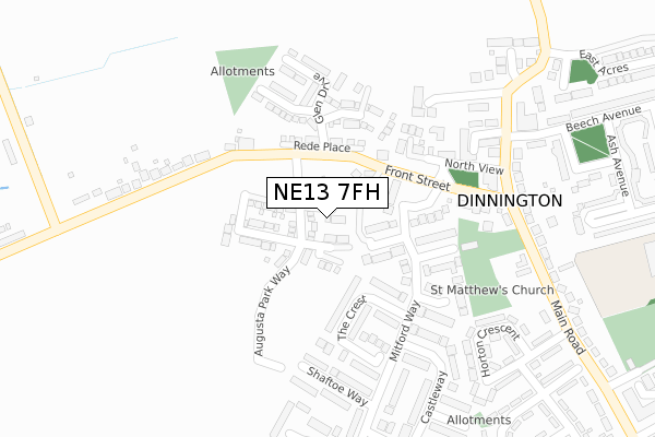
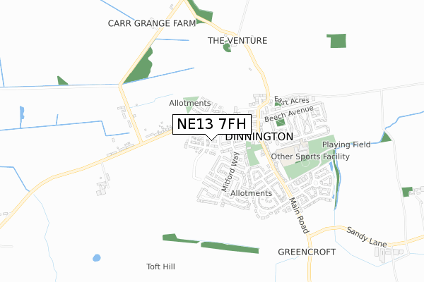
NE13 7FH maps, stats, and open data
NE13 7FH is located in the Castle electoral ward, within the metropolitan district of Newcastle upon Tyne and the English Parliamentary constituency of Newcastle upon Tyne North. The Sub Integrated Care Board (ICB) Location is NHS North East and North Cumbria ICB - 13T and the police force is Northumbria. This postcode has been in use since October 2018.
NE13 7FH maps


Licence: Open Government Licence (requires attribution)
Attribution: Contains OS data © Crown copyright and database right 2025
Source: Open Postcode Geo
Licence: Open Government Licence (requires attribution)
Attribution: Contains OS data © Crown copyright and database right 2025; Contains Royal Mail data © Royal Mail copyright and database right 2025; Source: Office for National Statistics licensed under the Open Government Licence v.3.0
NE13 7FH geodata
| Easting | 420532 |
| Northing | 573229 |
| Latitude | 55.053139 |
| Longitude | -1.680162 |
Where is NE13 7FH?
| Country | England |
| Postcode District | NE13 |
Politics
| Ward | Castle |
|---|---|
| Constituency | Newcastle Upon Tyne North |
House Prices
Sales of detached houses in NE13 7FH
127, AUGUSTA PARK WAY, DINNINGTON, NEWCASTLE UPON TYNE, NE13 7FH 2025 12 SEP £310,500 |
2025 17 APR £300,000 |
2024 22 OCT £325,000 |
2024 13 SEP £250,000 |
2024 6 SEP £237,500 |
2024 6 SEP £307,000 |
2024 31 MAY £300,000 |
119, AUGUSTA PARK WAY, DINNINGTON, NEWCASTLE UPON TYNE, NE13 7FH 2024 19 APR £310,000 |
133, AUGUSTA PARK WAY, DINNINGTON, NEWCASTLE UPON TYNE, NE13 7FH 2023 5 OCT £368,950 |
121, AUGUSTA PARK WAY, DINNINGTON, NEWCASTLE UPON TYNE, NE13 7FH 2023 29 SEP £330,950 |
Licence: Contains HM Land Registry data © Crown copyright and database right 2025. This data is licensed under the Open Government Licence v3.0.
Transport
Nearest bus stops to NE13 7FH
| Prestwick Road-church (Prestwick Rd) | Dinnington | 226m |
| Prestwick Road-church (Prestwick Rd) | Dinnington | 252m |
| Front Street (Front St) | Dinnington | 256m |
| Front Street | Dinnington | 277m |
| Prestwick Road-kenmar Villa (Prestwick Rd) | Dinnington | 359m |
Nearest railway stations to NE13 7FH
| Newcastle Airport Metro | 2.7km |
Broadband
Broadband access in NE13 7FH (2020 data)
| Percentage of properties with Next Generation Access | 100.0% |
| Percentage of properties with Superfast Broadband | 100.0% |
| Percentage of properties with Ultrafast Broadband | 85.2% |
| Percentage of properties with Full Fibre Broadband | 85.2% |
Superfast Broadband is between 30Mbps and 300Mbps
Ultrafast Broadband is > 300Mbps
Broadband limitations in NE13 7FH (2020 data)
| Percentage of properties unable to receive 2Mbps | 0.0% |
| Percentage of properties unable to receive 5Mbps | 0.0% |
| Percentage of properties unable to receive 10Mbps | 0.0% |
| Percentage of properties unable to receive 30Mbps | 0.0% |
Deprivation
65.2% of English postcodes are less deprived than NE13 7FH:Food Standards Agency
Three nearest food hygiene ratings to NE13 7FH (metres)


➜ Get more ratings from the Food Standards Agency
Nearest post box to NE13 7FH
| Last Collection | |||
|---|---|---|---|
| Location | Mon-Fri | Sat | Distance |
| North View Dinnington | 17:30 | 11:45 | 298m |
| Brunswick Village Post Office | 17:30 | 11:45 | 2,831m |
| Hazelrigg Post Office | 17:45 | 12:00 | 2,955m |
NE13 7FH ITL and NE13 7FH LAU
The below table lists the International Territorial Level (ITL) codes (formerly Nomenclature of Territorial Units for Statistics (NUTS) codes) and Local Administrative Units (LAU) codes for NE13 7FH:
| ITL 1 Code | Name |
|---|---|
| TLC | North East (England) |
| ITL 2 Code | Name |
| TLC2 | Northumberland, and Tyne and Wear |
| ITL 3 Code | Name |
| TLC22 | Tyneside |
| LAU 1 Code | Name |
| E08000021 | Newcastle upon Tyne |
NE13 7FH census areas
The below table lists the Census Output Area (OA), Lower Layer Super Output Area (LSOA), and Middle Layer Super Output Area (MSOA) for NE13 7FH:
| Code | Name | |
|---|---|---|
| OA | E00042162 | |
| LSOA | E01008306 | Newcastle upon Tyne 001B |
| MSOA | E02001708 | Newcastle upon Tyne 001 |
Nearest postcodes to NE13 7FH
| NE13 7LU | The Crest | 122m |
| NE13 7LL | Dunsley Gardens | 122m |
| NE13 7LP | Prestwick Road | 168m |
| NE13 7LX | Shaftoe Way | 201m |
| NE13 7LN | Farndale Close | 202m |
| NE13 7LJ | Church Close | 209m |
| NE13 7LR | The Winding | 221m |
| NE13 7AH | South View | 223m |
| NE13 7LW | Mitford Way | 226m |
| NE13 7LY | Bracken Close | 246m |