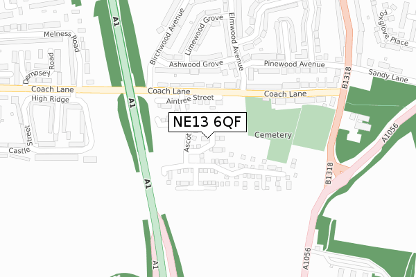
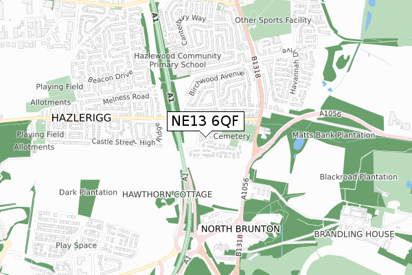
NE13 6QF maps, stats, and open data
NE13 6QF is located in the Parklands electoral ward, within the metropolitan district of Newcastle upon Tyne and the English Parliamentary constituency of Newcastle upon Tyne North. The Sub Integrated Care Board (ICB) Location is NHS North East and North Cumbria ICB - 13T and the police force is Northumbria. This postcode has been in use since June 2018.
NE13 6QF maps


Licence: Open Government Licence (requires attribution)
Attribution: Contains OS data © Crown copyright and database right 2025
Source: Open Postcode Geo
Licence: Open Government Licence (requires attribution)
Attribution: Contains OS data © Crown copyright and database right 2025; Contains Royal Mail data © Royal Mail copyright and database right 2025; Source: Office for National Statistics licensed under the Open Government Licence v.3.0
NE13 6QF geodata
| Easting | 423950 |
| Northing | 571837 |
| Latitude | 55.040479 |
| Longitude | -1.626778 |
Where is NE13 6QF?
| Country | England |
| Postcode District | NE13 |
Politics
| Ward | Parklands |
|---|---|
| Constituency | Newcastle Upon Tyne North |
House Prices
Sales of detached houses in NE13 6QF
2025 8 MAY £278,000 |
2022 30 SEP £275,000 |
2022 18 FEB £255,000 |
2019 28 MAR £229,995 |
49, CHELTENHAM CLOSE, NORTH GOSFORTH, NEWCASTLE UPON TYNE, NE13 6QF 2019 22 MAR £214,995 |
37, CHELTENHAM CLOSE, NORTH GOSFORTH, NEWCASTLE UPON TYNE, NE13 6QF 2018 19 DEC £229,995 |
2, CHELTENHAM CLOSE, NORTH GOSFORTH, NEWCASTLE UPON TYNE, NE13 6QF 2018 21 SEP £229,995 |
2018 21 SEP £232,995 |
2018 3 AUG £238,995 |
3, CHELTENHAM CLOSE, NORTH GOSFORTH, NEWCASTLE UPON TYNE, NE13 6QF 2018 19 JUN £306,995 |
Licence: Contains HM Land Registry data © Crown copyright and database right 2025. This data is licensed under the Open Government Licence v3.0.
Transport
Nearest bus stops to NE13 6QF
| Coach Lane-rydal Terrace (Coach Lane) | Hazlerigg | 118m |
| Coach Lane-rydal Terrace (Coach Lane) | Hazlerigg | 128m |
| Coach Lane-birchwood Avenue (Coach Lane) | Hazlerigg | 163m |
| Great North Road-cemetery (Great North Road) | Wideopen | 298m |
| Coach Lane | Hazlerigg | 315m |
Broadband
Broadband access in NE13 6QF (2020 data)
| Percentage of properties with Next Generation Access | 100.0% |
| Percentage of properties with Superfast Broadband | 100.0% |
| Percentage of properties with Ultrafast Broadband | 100.0% |
| Percentage of properties with Full Fibre Broadband | 100.0% |
Superfast Broadband is between 30Mbps and 300Mbps
Ultrafast Broadband is > 300Mbps
Broadband limitations in NE13 6QF (2020 data)
| Percentage of properties unable to receive 2Mbps | 0.0% |
| Percentage of properties unable to receive 5Mbps | 0.0% |
| Percentage of properties unable to receive 10Mbps | 0.0% |
| Percentage of properties unable to receive 30Mbps | 0.0% |
Deprivation
49.7% of English postcodes are less deprived than NE13 6QF:Food Standards Agency
Three nearest food hygiene ratings to NE13 6QF (metres)


➜ Get more ratings from the Food Standards Agency
Nearest post box to NE13 6QF
| Last Collection | |||
|---|---|---|---|
| Location | Mon-Fri | Sat | Distance |
| Elmwood Avenue | 17:30 | 12:00 | 232m |
| High Ridge | 17:30 | 12:00 | 363m |
| Pinewood Avenue | 17:30 | 12:00 | 375m |
NE13 6QF ITL and NE13 6QF LAU
The below table lists the International Territorial Level (ITL) codes (formerly Nomenclature of Territorial Units for Statistics (NUTS) codes) and Local Administrative Units (LAU) codes for NE13 6QF:
| ITL 1 Code | Name |
|---|---|
| TLC | North East (England) |
| ITL 2 Code | Name |
| TLC2 | Northumberland, and Tyne and Wear |
| ITL 3 Code | Name |
| TLC22 | Tyneside |
| LAU 1 Code | Name |
| E08000021 | Newcastle upon Tyne |
NE13 6QF census areas
The below table lists the Census Output Area (OA), Lower Layer Super Output Area (LSOA), and Middle Layer Super Output Area (MSOA) for NE13 6QF:
| Code | Name | |
|---|---|---|
| OA | E00175605 | |
| LSOA | E01008308 | Newcastle upon Tyne 001D |
| MSOA | E02001708 | Newcastle upon Tyne 001 |
Nearest postcodes to NE13 6QF
| NE13 6PS | Rydal Terrace | 138m |
| NE13 6PT | Ashwood Grove | 171m |
| NE13 6PW | Elmwood Mews | 185m |
| NE13 6PR | Woodlands Park Villas | 212m |
| NE13 6QD | Pinewood Avenue | 246m |
| NE13 6PP | Gosforth Park Villas | 246m |
| NE13 6PU | Limewood Grove | 255m |
| NE13 6PX | Elmwood Avenue | 261m |
| NE13 7NE | Ridge Court | 286m |
| NE13 6QB | Birchwood Avenue | 317m |