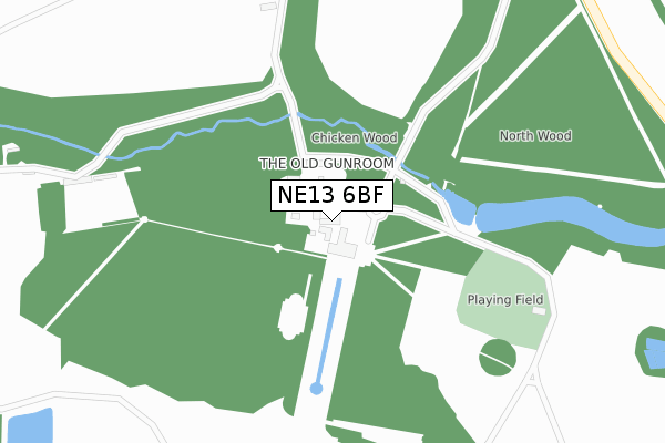
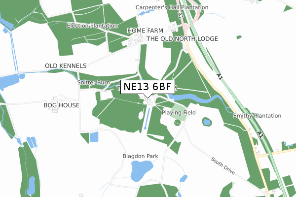
NE13 6BF is located in the Ponteland East and Stannington electoral ward, within the unitary authority of Northumberland and the English Parliamentary constituency of Hexham. The Sub Integrated Care Board (ICB) Location is NHS North East and North Cumbria ICB - 00L and the police force is Northumbria. This postcode has been in use since October 2017.


GetTheData
Source: OS Open Zoomstack (Ordnance Survey)
Licence: Open Government Licence (requires attribution)
Attribution: Contains OS data © Crown copyright and database right 2025
Source: Open Postcode Geo
Licence: Open Government Licence (requires attribution)
Attribution: Contains OS data © Crown copyright and database right 2025; Contains Royal Mail data © Royal Mail copyright and database right 2025; Source: Office for National Statistics licensed under the Open Government Licence v.3.0
| Easting | 421537 |
| Northing | 577085 |
| Latitude | 55.087746 |
| Longitude | -1.664142 |
GetTheData
Source: Open Postcode Geo
Licence: Open Government Licence
| Country | England |
| Postcode District | NE13 |
➜ See where NE13 is on a map | |
GetTheData
Source: Land Registry Price Paid Data
Licence: Open Government Licence
| Ward | Ponteland East And Stannington |
| Constituency | Hexham |
GetTheData
Source: ONS Postcode Database
Licence: Open Government Licence
| Blagdon Hall Cottages (Old Great North Road) | Shotton | 563m |
| Blagdon Hall Cottages (Old Great North Road) | Shotton | 610m |
| New Kennels (Old Great North Road) | Shotton | 959m |
| New Kennels (A1 Sliproad) | Shotton | 970m |
| Shotton Edge (Old Great North Road) | Blagdon | 982m |
| Cramlington Station | 4.2km |
GetTheData
Source: NaPTAN
Licence: Open Government Licence
GetTheData
Source: ONS Postcode Database
Licence: Open Government Licence


➜ Get more ratings from the Food Standards Agency
GetTheData
Source: Food Standards Agency
Licence: FSA terms & conditions
| Last Collection | |||
|---|---|---|---|
| Location | Mon-Fri | Sat | Distance |
| Shotton Edge | 17:30 | 11:00 | 1,015m |
| Shotton Lane Ends | 17:30 | 11:00 | 1,033m |
| Stannington Post Office | 16:15 | 09:00 | 2,340m |
GetTheData
Source: Dracos
Licence: Creative Commons Attribution-ShareAlike
The below table lists the International Territorial Level (ITL) codes (formerly Nomenclature of Territorial Units for Statistics (NUTS) codes) and Local Administrative Units (LAU) codes for NE13 6BF:
| ITL 1 Code | Name |
|---|---|
| TLC | North East (England) |
| ITL 2 Code | Name |
| TLC2 | Northumberland, and Tyne and Wear |
| ITL 3 Code | Name |
| TLC21 | Northumberland |
| LAU 1 Code | Name |
| E06000057 | Northumberland |
GetTheData
Source: ONS Postcode Directory
Licence: Open Government Licence
The below table lists the Census Output Area (OA), Lower Layer Super Output Area (LSOA), and Middle Layer Super Output Area (MSOA) for NE13 6BF:
| Code | Name | |
|---|---|---|
| OA | E00139821 | |
| LSOA | E01027473 | Northumberland 015D |
| MSOA | E02005722 | Northumberland 015 |
GetTheData
Source: ONS Postcode Directory
Licence: Open Government Licence
| NE13 6DB | Blagdon Estate | 335m |
| NE61 6EX | 1278m | |
| NE61 6ET | 1415m | |
| NE61 6HA | The Limes | 2200m |
| NE61 6PP | Briery Hill Lane | 2212m |
| NE61 6HD | Vale View | 2220m |
| NE61 6EP | 2259m | |
| NE61 6HH | Elizabeth Square | 2268m |
| NE61 6HP | 2270m | |
| NE13 6BU | Berwick Hill Road | 2303m |
GetTheData
Source: Open Postcode Geo; Land Registry Price Paid Data
Licence: Open Government Licence