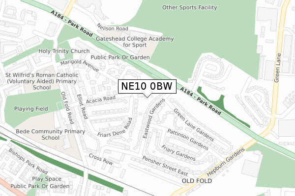
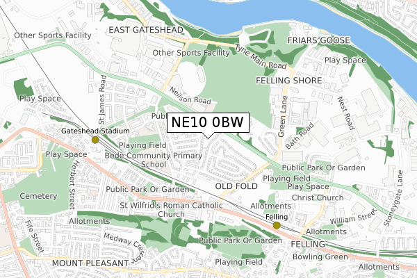
NE10 0BW is located in the Felling electoral ward, within the metropolitan district of Gateshead and the English Parliamentary constituency of Gateshead. The Sub Integrated Care Board (ICB) Location is NHS North East and North Cumbria ICB - 13T and the police force is Northumbria. This postcode has been in use since September 2019.


GetTheData
Source: OS Open Zoomstack (Ordnance Survey)
Licence: Open Government Licence (requires attribution)
Attribution: Contains OS data © Crown copyright and database right 2025
Source: Open Postcode Geo
Licence: Open Government Licence (requires attribution)
Attribution: Contains OS data © Crown copyright and database right 2025; Contains Royal Mail data © Royal Mail copyright and database right 2025; Source: Office for National Statistics licensed under the Open Government Licence v.3.0
| Easting | 427110 |
| Northing | 562654 |
| Latitude | 54.957800 |
| Longitude | -1.578197 |
GetTheData
Source: Open Postcode Geo
Licence: Open Government Licence
| Country | England |
| Postcode District | NE10 |
➜ See where NE10 is on a map ➜ Where is Gateshead? | |
GetTheData
Source: Land Registry Price Paid Data
Licence: Open Government Licence
| Ward | Felling |
| Constituency | Gateshead |
GetTheData
Source: ONS Postcode Database
Licence: Open Government Licence
| Eastwood Gardens | Felling | 175m |
| Eastwood Gardens | Felling | 179m |
| Pattinson Gardens | Felling | 201m |
| Pattinson Gardens | Felling | 213m |
| Elliot Road | Felling | 237m |
| Gateshead Stadium (Tyne And Wear Metro Station) (St James Road) | Gateshead Stadium | 633m |
| Felling (Tyne And Wear Metro Station) (Mulberry Street) | Felling | 695m |
| Heworth (Tyne And Wear Metro Station) (Abbotsford Road (Felling By-pass)) | Heworth | 1,628m |
| Heworth Station | 1.6km |
| Manors Station | 2.4km |
| Newcastle Station | 2.8km |
GetTheData
Source: NaPTAN
Licence: Open Government Licence
| Percentage of properties with Next Generation Access | 100.0% |
| Percentage of properties with Superfast Broadband | 100.0% |
| Percentage of properties with Ultrafast Broadband | 100.0% |
| Percentage of properties with Full Fibre Broadband | 100.0% |
Superfast Broadband is between 30Mbps and 300Mbps
Ultrafast Broadband is > 300Mbps
| Percentage of properties unable to receive 2Mbps | 0.0% |
| Percentage of properties unable to receive 5Mbps | 0.0% |
| Percentage of properties unable to receive 10Mbps | 0.0% |
| Percentage of properties unable to receive 30Mbps | 0.0% |
GetTheData
Source: Ofcom
Licence: Ofcom Terms of Use (requires attribution)
GetTheData
Source: ONS Postcode Database
Licence: Open Government Licence


➜ Get more ratings from the Food Standards Agency
GetTheData
Source: Food Standards Agency
Licence: FSA terms & conditions
| Last Collection | |||
|---|---|---|---|
| Location | Mon-Fri | Sat | Distance |
| St Wilfreds Rectory | 17:30 | 12:00 | 437m |
| Green Lane | 17:30 | 12:00 | 462m |
| Sunderland Road Post Office | 18:00 | 12:00 | 610m |
GetTheData
Source: Dracos
Licence: Creative Commons Attribution-ShareAlike
The below table lists the International Territorial Level (ITL) codes (formerly Nomenclature of Territorial Units for Statistics (NUTS) codes) and Local Administrative Units (LAU) codes for NE10 0BW:
| ITL 1 Code | Name |
|---|---|
| TLC | North East (England) |
| ITL 2 Code | Name |
| TLC2 | Northumberland, and Tyne and Wear |
| ITL 3 Code | Name |
| TLC22 | Tyneside |
| LAU 1 Code | Name |
| E08000037 | Gateshead |
GetTheData
Source: ONS Postcode Directory
Licence: Open Government Licence
The below table lists the Census Output Area (OA), Lower Layer Super Output Area (LSOA), and Middle Layer Super Output Area (MSOA) for NE10 0BW:
| Code | Name | |
|---|---|---|
| OA | E00041645 | |
| LSOA | E01008214 | Gateshead 003A |
| MSOA | E02001684 | Gateshead 003 |
GetTheData
Source: ONS Postcode Directory
Licence: Open Government Licence
| NE10 0AH | Eastwood Gardens | 89m |
| NE10 0AN | Curren Gardens | 115m |
| NE10 0DR | Friars Dene Road | 116m |
| NE10 0DP | Marigold Avenue | 135m |
| NE10 0DU | Acacia Road | 139m |
| NE10 0AJ | Friary Gardens | 218m |
| NE10 0AE | Green Lane Gardens | 226m |
| NE10 0AL | Pattinson Gardens | 228m |
| NE10 0EH | Coach Road Green | 233m |
| NE10 0AP | Pensher Street East | 241m |
GetTheData
Source: Open Postcode Geo; Land Registry Price Paid Data
Licence: Open Government Licence