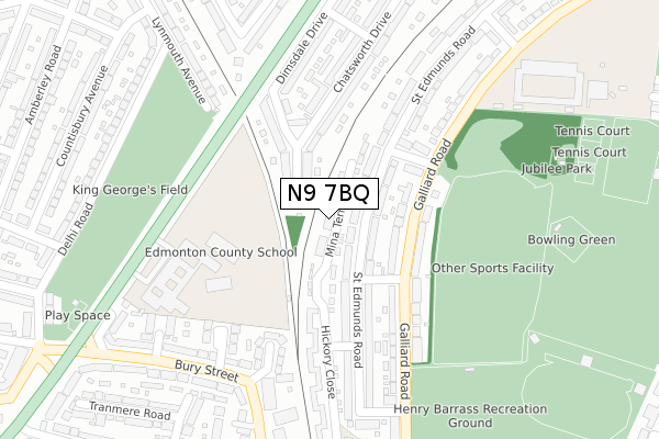
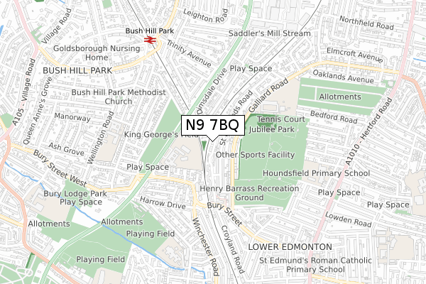
N9 7BQ is located in the Jubilee electoral ward, within the London borough of Enfield and the English Parliamentary constituency of Edmonton. The Sub Integrated Care Board (ICB) Location is NHS North Central London ICB - 93C and the police force is Metropolitan Police. This postcode has been in use since November 2017.


GetTheData
Source: OS Open Zoomstack (Ordnance Survey)
Licence: Open Government Licence (requires attribution)
Attribution: Contains OS data © Crown copyright and database right 2025
Source: Open Postcode Geo
Licence: Open Government Licence (requires attribution)
Attribution: Contains OS data © Crown copyright and database right 2025; Contains Royal Mail data © Royal Mail copyright and database right 2025; Source: Office for National Statistics licensed under the Open Government Licence v.3.0
| Easting | 534067 |
| Northing | 194799 |
| Latitude | 51.636031 |
| Longitude | -0.064125 |
GetTheData
Source: Open Postcode Geo
Licence: Open Government Licence
| Country | England |
| Postcode District | N9 |
➜ See where N9 is on a map ➜ Where is Edmonton? | |
GetTheData
Source: Land Registry Price Paid Data
Licence: Open Government Licence
| Ward | Jubilee |
| Constituency | Edmonton |
GetTheData
Source: ONS Postcode Database
Licence: Open Government Licence
| Bury Street Lower Edmonton | Lower Edmonton | 270m |
| Bury Street Great Cambridge Road (Great Cambridge Road) | Bush Hill Park | 388m |
| Bury Street Great Cambridge Road | Bush Hill Park | 396m |
| Trinity Avenuebush Hill Park | Bush Hill Park | 433m |
| Galliards Road | Lower Edmonton | 445m |
| Bush Hill Park Station | 0.7km |
| Edmonton Green Station | 1.3km |
| Southbury Station | 1.6km |
GetTheData
Source: NaPTAN
Licence: Open Government Licence
| Percentage of properties with Next Generation Access | 100.0% |
| Percentage of properties with Superfast Broadband | 100.0% |
| Percentage of properties with Ultrafast Broadband | 0.0% |
| Percentage of properties with Full Fibre Broadband | 0.0% |
Superfast Broadband is between 30Mbps and 300Mbps
Ultrafast Broadband is > 300Mbps
| Median download speed | 16.3Mbps |
| Average download speed | 23.7Mbps |
| Maximum download speed | 78.12Mbps |
| Median upload speed | 5.6Mbps |
| Average upload speed | 5.3Mbps |
| Maximum upload speed | 19.53Mbps |
| Percentage of properties unable to receive 2Mbps | 0.0% |
| Percentage of properties unable to receive 5Mbps | 0.0% |
| Percentage of properties unable to receive 10Mbps | 0.0% |
| Percentage of properties unable to receive 30Mbps | 0.0% |
GetTheData
Source: Ofcom
Licence: Ofcom Terms of Use (requires attribution)
GetTheData
Source: ONS Postcode Database
Licence: Open Government Licence


➜ Get more ratings from the Food Standards Agency
GetTheData
Source: Food Standards Agency
Licence: FSA terms & conditions
| Last Collection | |||
|---|---|---|---|
| Location | Mon-Fri | Sat | Distance |
| Galliard Road/St Edmunds Road | 17:30 | 12:00 | 299m |
| Chatsworth Drive | 17:30 | 12:00 | 306m |
| Lynmouth Avenue | 17:30 | 12:00 | 363m |
GetTheData
Source: Dracos
Licence: Creative Commons Attribution-ShareAlike
The below table lists the International Territorial Level (ITL) codes (formerly Nomenclature of Territorial Units for Statistics (NUTS) codes) and Local Administrative Units (LAU) codes for N9 7BQ:
| ITL 1 Code | Name |
|---|---|
| TLI | London |
| ITL 2 Code | Name |
| TLI5 | Outer London - East and North East |
| ITL 3 Code | Name |
| TLI54 | Enfield |
| LAU 1 Code | Name |
| E09000010 | Enfield |
GetTheData
Source: ONS Postcode Directory
Licence: Open Government Licence
The below table lists the Census Output Area (OA), Lower Layer Super Output Area (LSOA), and Middle Layer Super Output Area (MSOA) for N9 7BQ:
| Code | Name | |
|---|---|---|
| OA | E00007362 | |
| LSOA | E01001478 | Enfield 016B |
| MSOA | E02000292 | Enfield 016 |
GetTheData
Source: ONS Postcode Directory
Licence: Open Government Licence
| N9 7PS | St Edmunds Road | 43m |
| N9 7PR | St Edmunds Road | 72m |
| EN1 1HA | Lathkill Close | 93m |
| N9 7PB | Galliard Road | 161m |
| N9 7PA | Galliard Road | 163m |
| N9 7PP | Hamilton Avenue | 164m |
| EN1 1HB | Dimsdale Drive | 169m |
| EN1 1EU | Chatsworth Drive | 193m |
| N9 7PT | St Edmunds Road | 208m |
| N9 9JF | Warren Crescent | 217m |
GetTheData
Source: Open Postcode Geo; Land Registry Price Paid Data
Licence: Open Government Licence