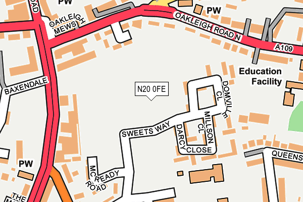
N20 0FE is located in the Whetstone electoral ward, within the London borough of Barnet and the English Parliamentary constituency of Chipping Barnet. The Sub Integrated Care Board (ICB) Location is NHS North Central London ICB - 93C and the police force is Metropolitan Police. This postcode has been in use since October 2018.


GetTheData
Source: OS OpenMap – Local (Ordnance Survey)
Source: OS VectorMap District (Ordnance Survey)
Licence: Open Government Licence (requires attribution)
| Easting | 526632 |
| Northing | 193802 |
| Latitude | 51.628793 |
| Longitude | -0.171859 |
GetTheData
Source: Open Postcode Geo
Licence: Open Government Licence
| Country | England |
| Postcode District | N20 |
➜ See where N20 is on a map ➜ Where is London? | |
GetTheData
Source: Land Registry Price Paid Data
Licence: Open Government Licence
| Ward | Whetstone |
| Constituency | Chipping Barnet |
GetTheData
Source: ONS Postcode Database
Licence: Open Government Licence
| Oakleigh Road North (Whetstone High Road) | Whetstone | 178m |
| Oakleigh Park North (Oakleigh Road North) | Oakleigh Park | 180m |
| Whetstonethe Griffin (Oakleigh Road North) | Oakleigh Park | 184m |
| Whetstonethe Griffin (Oakleigh Road North) | Oakleigh Park | 190m |
| Oakleigh Road North (Whetstone High Road) | Whetstone | 205m |
| Totteridge & Whetstone Underground Station | Whetstone | 545m |
| Woodside Park Underground Station | Woodside Park | 1,522m |
| Oakleigh Park Station | 1.1km |
| New Barnet Station | 2.2km |
| New Southgate Station | 2.6km |
GetTheData
Source: NaPTAN
Licence: Open Government Licence
| Percentage of properties with Next Generation Access | 100.0% |
| Percentage of properties with Superfast Broadband | 100.0% |
| Percentage of properties with Ultrafast Broadband | 100.0% |
| Percentage of properties with Full Fibre Broadband | 100.0% |
Superfast Broadband is between 30Mbps and 300Mbps
Ultrafast Broadband is > 300Mbps
| Percentage of properties unable to receive 2Mbps | 0.0% |
| Percentage of properties unable to receive 5Mbps | 0.0% |
| Percentage of properties unable to receive 10Mbps | 0.0% |
| Percentage of properties unable to receive 30Mbps | 0.0% |
GetTheData
Source: Ofcom
Licence: Ofcom Terms of Use (requires attribution)
GetTheData
Source: ONS Postcode Database
Licence: Open Government Licence


➜ Get more ratings from the Food Standards Agency
GetTheData
Source: Food Standards Agency
Licence: FSA terms & conditions
| Last Collection | |||
|---|---|---|---|
| Location | Mon-Fri | Sat | Distance |
| Whetstone Delivery Office | 18:00 | 12:00 | 163m |
| 63 Friern Barnet Lane | 17:30 | 12:00 | 266m |
| High Road | 17:30 | 12:00 | 312m |
GetTheData
Source: Dracos
Licence: Creative Commons Attribution-ShareAlike
The below table lists the International Territorial Level (ITL) codes (formerly Nomenclature of Territorial Units for Statistics (NUTS) codes) and Local Administrative Units (LAU) codes for N20 0FE:
| ITL 1 Code | Name |
|---|---|
| TLI | London |
| ITL 2 Code | Name |
| TLI7 | Outer London - West and North West |
| ITL 3 Code | Name |
| TLI71 | Barnet |
| LAU 1 Code | Name |
| E09000003 | Barnet |
GetTheData
Source: ONS Postcode Directory
Licence: Open Government Licence
The below table lists the Census Output Area (OA), Lower Layer Super Output Area (LSOA), and Middle Layer Super Output Area (MSOA) for N20 0FE:
| Code | Name | |
|---|---|---|
| OA | E00001379 | |
| LSOA | E01000281 | Barnet 008D |
| MSOA | E02000031 | Barnet 008 |
GetTheData
Source: ONS Postcode Directory
Licence: Open Government Licence
| N20 0LF | Darcy Close | 112m |
| N20 9EU | Whetstone Close | 121m |
| N20 0LR | High Road | 153m |
| N20 0LE | Domville Close | 153m |
| N20 9EX | Oakleigh Road North | 154m |
| N20 9ET | Oakleigh Road North | 155m |
| N20 0LQ | Millson Close | 155m |
| N20 0LH | High Road | 199m |
| N20 9HE | Oakleigh Road North | 206m |
| N20 9HG | Oakleigh Road North | 208m |
GetTheData
Source: Open Postcode Geo; Land Registry Price Paid Data
Licence: Open Government Licence