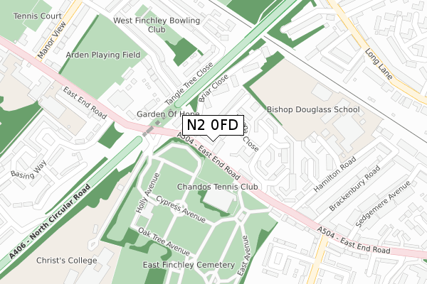
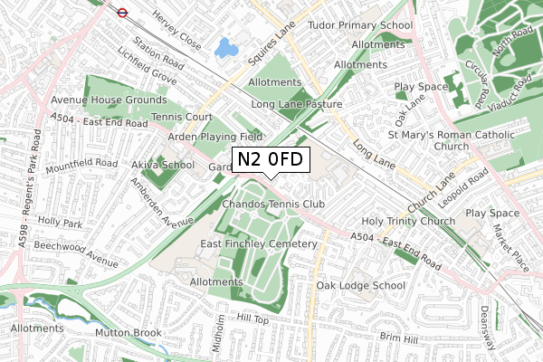
N2 0FD maps, stats, and open data
N2 0FD is located in the East Finchley electoral ward, within the London borough of Barnet and the English Parliamentary constituency of Finchley and Golders Green. The Sub Integrated Care Board (ICB) Location is NHS North Central London ICB - 93C and the police force is Metropolitan Police. This postcode has been in use since August 2017.
N2 0FD maps


Licence: Open Government Licence (requires attribution)
Attribution: Contains OS data © Crown copyright and database right 2025
Source: Open Postcode Geo
Licence: Open Government Licence (requires attribution)
Attribution: Contains OS data © Crown copyright and database right 2025; Contains Royal Mail data © Royal Mail copyright and database right 2025; Source: Office for National Statistics licensed under the Open Government Licence v.3.0
N2 0FD geodata
| Easting | 525964 |
| Northing | 189897 |
| Latitude | 51.593850 |
| Longitude | -0.182907 |
Where is N2 0FD?
| Country | England |
| Postcode District | N2 |
Politics
| Ward | East Finchley |
|---|---|
| Constituency | Finchley And Golders Green |
House Prices
Sales of detached houses in N2 0FD
2024 2 OCT £1,375,000 |
4, ETHAN DRIVE, LONDON, N2 0FD 2019 15 NOV £1,050,000 |
3, ETHAN DRIVE, LONDON, N2 0FD 2019 30 JUL £1,310,000 |
8, ETHAN DRIVE, LONDON, N2 0FD 2019 29 MAR £1,060,000 |
2, ETHAN DRIVE, LONDON, N2 0FD 2019 8 MAR £1,350,000 |
2019 29 JAN £1,400,000 |
7, ETHAN DRIVE, LONDON, N2 0FD 2018 30 APR £1,050,000 |
5, ETHAN DRIVE, LONDON, N2 0FD 2017 3 NOV £1,500,000 |
6, ETHAN DRIVE, LONDON, N2 0FD 2017 3 NOV £1,100,000 |
Licence: Contains HM Land Registry data © Crown copyright and database right 2025. This data is licensed under the Open Government Licence v3.0.
Transport
Nearest bus stops to N2 0FD
| East Finchley Cemetery | Hampstead Garden Suburb | 95m |
| Christ's College (East End Road) | Finchley | 114m |
| East Finchley Cemetery | Hampstead Garden Suburb | 134m |
| East End Road | Finchley | 212m |
| East End Road | Finchley | 216m |
Nearest underground/metro/tram to N2 0FD
| Finchley Central Underground Station | Finchley Central | 1,030m |
| East Finchley Underground Station | East Finchley | 1,449m |
Nearest railway stations to N2 0FD
| New Southgate Station | 3.6km |
| Hendon Station | 4.2km |
| Alexandra Palace Station | 4.4km |
Broadband
Broadband access in N2 0FD (2020 data)
| Percentage of properties with Next Generation Access | 100.0% |
| Percentage of properties with Superfast Broadband | 100.0% |
| Percentage of properties with Ultrafast Broadband | 0.0% |
| Percentage of properties with Full Fibre Broadband | 0.0% |
Superfast Broadband is between 30Mbps and 300Mbps
Ultrafast Broadband is > 300Mbps
Broadband speed in N2 0FD (2019 data)
Download
| Median download speed | 38.5Mbps |
| Average download speed | 39.0Mbps |
| Maximum download speed | 45.70Mbps |
Upload
| Median upload speed | 8.1Mbps |
| Average upload speed | 7.7Mbps |
| Maximum upload speed | 8.79Mbps |
Broadband limitations in N2 0FD (2020 data)
| Percentage of properties unable to receive 2Mbps | 0.0% |
| Percentage of properties unable to receive 5Mbps | 0.0% |
| Percentage of properties unable to receive 10Mbps | 0.0% |
| Percentage of properties unable to receive 30Mbps | 0.0% |
Deprivation
77.2% of English postcodes are less deprived than N2 0FD:Food Standards Agency
Three nearest food hygiene ratings to N2 0FD (metres)


➜ Get more ratings from the Food Standards Agency
Nearest post box to N2 0FD
| Last Collection | |||
|---|---|---|---|
| Location | Mon-Fri | Sat | Distance |
| 61 East End Road | 17:30 | 12:00 | 100m |
| Font Hills | 17:30 | 12:00 | 475m |
| 18 Manor View | 17:30 | 12:00 | 476m |
N2 0FD ITL and N2 0FD LAU
The below table lists the International Territorial Level (ITL) codes (formerly Nomenclature of Territorial Units for Statistics (NUTS) codes) and Local Administrative Units (LAU) codes for N2 0FD:
| ITL 1 Code | Name |
|---|---|
| TLI | London |
| ITL 2 Code | Name |
| TLI7 | Outer London - West and North West |
| ITL 3 Code | Name |
| TLI71 | Barnet |
| LAU 1 Code | Name |
| E09000003 | Barnet |
N2 0FD census areas
The below table lists the Census Output Area (OA), Lower Layer Super Output Area (LSOA), and Middle Layer Super Output Area (MSOA) for N2 0FD:
| Code | Name | |
|---|---|---|
| OA | E00000894 | |
| LSOA | E01000176 | Barnet 027A |
| MSOA | E02000050 | Barnet 027 |
Nearest postcodes to N2 0FD
| N2 0XH | East End Road | 53m |
| N2 0TJ | Juliana Close | 67m |
| N2 0SD | Briar Close | 96m |
| N3 2TR | Tangle Tree Close | 173m |
| N3 2LH | Briarfield Avenue | 202m |
| N2 0SG | Hamilton Road | 241m |
| N2 0RZ | East End Road | 245m |
| N3 2TA | East End Road | 246m |
| N2 0SB | Ossulton Place | 268m |
| N3 2LG | Briarfield Avenue | 274m |