MK9 3FJ maps, stats, and open data
MK9 3FJ is located in the Central Milton Keynes electoral ward, within the unitary authority of Milton Keynes and the English Parliamentary constituency of Milton Keynes North. The Sub Integrated Care Board (ICB) Location is NHS Bedfordshire, Luton and Milton Keynes ICB - M1J4Y and the police force is Thames Valley. This postcode has been in use since March 2018.
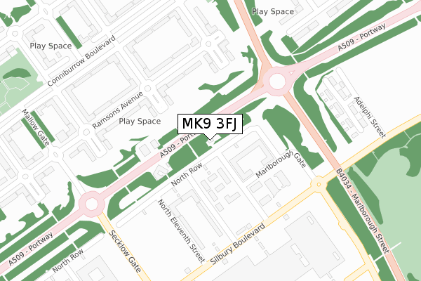
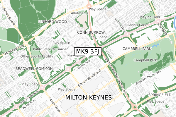
MK9 3FJ maps


Licence: Open Government Licence (requires attribution)
Attribution: Contains OS data © Crown copyright and database right 2025
Source: Open Postcode Geo
Licence: Open Government Licence (requires attribution)
Attribution: Contains OS data © Crown copyright and database right 2025; Contains Royal Mail data © Royal Mail copyright and database right 2025; Source: Office for National Statistics licensed under the Open Government Licence v.3.0
MK9 3FJ geodata
| Easting | 485542 |
| Northing | 239578 |
| Latitude | 52.048014 |
| Longitude | -0.754020 |
Where is MK9 3FJ?
| Country | England |
| Postcode District | MK9 |
Politics
| Ward | Central Milton Keynes |
|---|---|
| Constituency | Milton Keynes North |
Transport
Nearest bus stops to MK9 3FJ
| Downs Barn Boulevard (Marlborough Street V8) | Downs Barn | 266m |
| Downs Barn Boulevard (Marlborough Street V8) | Downs Barn | 284m |
| Conniburrow Boulevard | Conniburrow | 329m |
| Conniburrow Boulevard | Conniburrow | 342m |
| Marjoram Place (Conniburrow Boulevard) | Conniburrow | 355m |
Nearest railway stations to MK9 3FJ
| Milton Keynes Central Station | 2.1km |
| Wolverton Station | 4km |
| Bow Brickhill Station | 6.3km |
Deprivation
85.6% of English postcodes are less deprived than MK9 3FJ:Food Standards Agency
Three nearest food hygiene ratings to MK9 3FJ (metres)


➜ Get more ratings from the Food Standards Agency
Nearest post box to MK9 3FJ
| Last Collection | |||
|---|---|---|---|
| Location | Mon-Fri | Sat | Distance |
| P O Conniburrow Boulevard | 17:30 | 12:00 | 317m |
| Downs Barn Boulevard | 17:30 | 12:00 | 434m |
| Lloyds Court | 18:30 | 12:00 | 453m |
MK9 3FJ ITL and MK9 3FJ LAU
The below table lists the International Territorial Level (ITL) codes (formerly Nomenclature of Territorial Units for Statistics (NUTS) codes) and Local Administrative Units (LAU) codes for MK9 3FJ:
| ITL 1 Code | Name |
|---|---|
| TLJ | South East (England) |
| ITL 2 Code | Name |
| TLJ1 | Berkshire, Buckinghamshire and Oxfordshire |
| ITL 3 Code | Name |
| TLJ12 | Milton Keynes |
| LAU 1 Code | Name |
| E06000042 | Milton Keynes |
MK9 3FJ census areas
The below table lists the Census Output Area (OA), Lower Layer Super Output Area (LSOA), and Middle Layer Super Output Area (MSOA) for MK9 3FJ:
| Code | Name | |
|---|---|---|
| OA | E00084443 | |
| LSOA | E01033499 | Milton Keynes 014E |
| MSOA | E02003472 | Milton Keynes 014 |
Nearest postcodes to MK9 3FJ
| MK9 3BL | North Row | 88m |
| MK9 3BP | North Thirteenth Street | 93m |
| MK9 3NS | North Row | 96m |
| MK9 3NR | North Thirteenth Street | 106m |
| MK9 3BS | North Twelfth Street | 126m |
| MK9 3NP | North Fourteenth Street | 137m |
| MK9 3BH | North Row | 154m |
| MK14 7AU | Speedwell Place | 166m |
| MK14 7BH | Ramsons Avenue | 169m |
| MK9 3BT | North Twelfth Street | 172m |