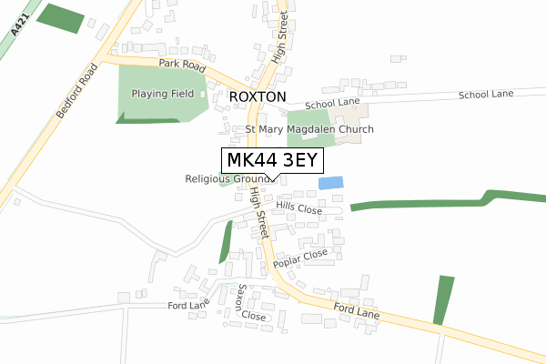
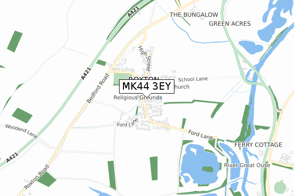
MK44 3EY maps, stats, and open data
MK44 3EY is located in the Wyboston electoral ward, within the unitary authority of Bedford and the English Parliamentary constituency of North East Bedfordshire. The Sub Integrated Care Board (ICB) Location is NHS Bedfordshire, Luton and Milton Keynes ICB - M1J4Y and the police force is Bedfordshire. This postcode has been in use since October 2018.
MK44 3EY maps


Licence: Open Government Licence (requires attribution)
Attribution: Contains OS data © Crown copyright and database right 2025
Source: Open Postcode Geo
Licence: Open Government Licence (requires attribution)
Attribution: Contains OS data © Crown copyright and database right 2025; Contains Royal Mail data © Royal Mail copyright and database right 2025; Source: Office for National Statistics licensed under the Open Government Licence v.3.0
MK44 3EY geodata
| Easting | 515278 |
| Northing | 254437 |
| Latitude | 52.176168 |
| Longitude | -0.315560 |
Where is MK44 3EY?
| Country | England |
| Postcode District | MK44 |
Politics
| Ward | Wyboston |
|---|---|
| Constituency | North East Bedfordshire |
House Prices
Sales of detached houses in MK44 3EY
2021 3 JUN £900,000 |
4, CHURCH FARM COURT, ROXTON, BEDFORD, MK44 3EY 2021 2 MAR £892,000 |
3, CHURCH FARM COURT, ROXTON, BEDFORD, MK44 3EY 2019 1 NOV £965,000 |
1, CHURCH FARM COURT, ROXTON, BEDFORD, MK44 3EY 2019 11 OCT £965,000 |
Licence: Contains HM Land Registry data © Crown copyright and database right 2025. This data is licensed under the Open Government Licence v3.0.
Transport
Nearest bus stops to MK44 3EY
| High Street (Park Road) | Roxton | 177m |
| High Street (Park Road) | Roxton | 180m |
| Park Road (Bedford Road) | Roxton | 378m |
| Park Road (Bedford Road) | Roxton | 403m |
| Garden Centre (Bedford Road) | Roxton | 814m |
Broadband
Broadband access in MK44 3EY (2020 data)
| Percentage of properties with Next Generation Access | 100.0% |
| Percentage of properties with Superfast Broadband | 100.0% |
| Percentage of properties with Ultrafast Broadband | 0.0% |
| Percentage of properties with Full Fibre Broadband | 0.0% |
Superfast Broadband is between 30Mbps and 300Mbps
Ultrafast Broadband is > 300Mbps
Broadband limitations in MK44 3EY (2020 data)
| Percentage of properties unable to receive 2Mbps | 0.0% |
| Percentage of properties unable to receive 5Mbps | 0.0% |
| Percentage of properties unable to receive 10Mbps | 0.0% |
| Percentage of properties unable to receive 30Mbps | 0.0% |
Deprivation
56% of English postcodes are less deprived than MK44 3EY:Food Standards Agency
Three nearest food hygiene ratings to MK44 3EY (metres)


➜ Get more ratings from the Food Standards Agency
Nearest post box to MK44 3EY
| Last Collection | |||
|---|---|---|---|
| Location | Mon-Fri | Sat | Distance |
| Post Office High Street | 16:20 | 09:30 | 168m |
| Station Road | 16:00 | 09:15 | 1,646m |
| Cross Road | 15:30 | 09:15 | 1,683m |
MK44 3EY ITL and MK44 3EY LAU
The below table lists the International Territorial Level (ITL) codes (formerly Nomenclature of Territorial Units for Statistics (NUTS) codes) and Local Administrative Units (LAU) codes for MK44 3EY:
| ITL 1 Code | Name |
|---|---|
| TLH | East |
| ITL 2 Code | Name |
| TLH2 | Bedfordshire and Hertfordshire |
| ITL 3 Code | Name |
| TLH24 | Bedford |
| LAU 1 Code | Name |
| E06000055 | Bedford |
MK44 3EY census areas
The below table lists the Census Output Area (OA), Lower Layer Super Output Area (LSOA), and Middle Layer Super Output Area (MSOA) for MK44 3EY:
| Code | Name | |
|---|---|---|
| OA | E00088557 | |
| LSOA | E01017542 | Bedford 004D |
| MSOA | E02003619 | Bedford 004 |
Nearest postcodes to MK44 3EY
| MK44 3EE | Hills Close | 72m |
| MK44 3EB | High Street | 102m |
| MK44 3ED | High Street | 102m |
| MK44 3EG | Poplar Close | 141m |
| MK44 3EX | Southfields | 159m |
| MK44 3EL | Ford Lane | 219m |
| MK44 3EP | Saxon Close | 232m |
| MK44 3EJ | Ford Lane | 234m |
| MK44 3DR | School Lane | 238m |
| MK44 3EA | High Street | 273m |