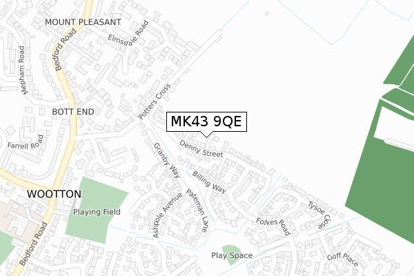
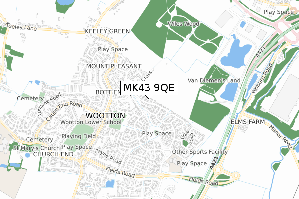
MK43 9QE is located in the Wootton & Kempston Rural electoral ward, within the unitary authority of Bedford and the English Parliamentary constituency of Mid Bedfordshire. The Sub Integrated Care Board (ICB) Location is NHS Bedfordshire, Luton and Milton Keynes ICB - M1J4Y and the police force is Bedfordshire. This postcode has been in use since October 2018.


GetTheData
Source: OS Open Zoomstack (Ordnance Survey)
Licence: Open Government Licence (requires attribution)
Attribution: Contains OS data © Crown copyright and database right 2025
Source: Open Postcode Geo
Licence: Open Government Licence (requires attribution)
Attribution: Contains OS data © Crown copyright and database right 2025; Contains Royal Mail data © Royal Mail copyright and database right 2025; Source: Office for National Statistics licensed under the Open Government Licence v.3.0
| Easting | 501333 |
| Northing | 245489 |
| Latitude | 52.098482 |
| Longitude | -0.522078 |
GetTheData
Source: Open Postcode Geo
Licence: Open Government Licence
| Country | England |
| Postcode District | MK43 |
➜ See where MK43 is on a map ➜ Where is Wootton? | |
GetTheData
Source: Land Registry Price Paid Data
Licence: Open Government Licence
| Ward | Wootton & Kempston Rural |
| Constituency | Mid Bedfordshire |
GetTheData
Source: ONS Postcode Database
Licence: Open Government Licence
| Potters Cross (Bedford Road) | Wootton | 341m |
| Potters Cross (Bedford Road) | Wootton | 349m |
| Elmsdale Road (Bedford Road) | Wootton | 418m |
| Elmsdale Road (Bedford Road) | Wootton | 420m |
| Folkes Road (Aspole Avenue) | Wootton | 439m |
| Kempston Hardwick Station | 1.4km |
| Stewartby Station | 3.3km |
| Millbrook (Beds) Station | 5km |
GetTheData
Source: NaPTAN
Licence: Open Government Licence
| Percentage of properties with Next Generation Access | 100.0% |
| Percentage of properties with Superfast Broadband | 100.0% |
| Percentage of properties with Ultrafast Broadband | 100.0% |
| Percentage of properties with Full Fibre Broadband | 100.0% |
Superfast Broadband is between 30Mbps and 300Mbps
Ultrafast Broadband is > 300Mbps
| Percentage of properties unable to receive 2Mbps | 0.0% |
| Percentage of properties unable to receive 5Mbps | 0.0% |
| Percentage of properties unable to receive 10Mbps | 0.0% |
| Percentage of properties unable to receive 30Mbps | 0.0% |
GetTheData
Source: Ofcom
Licence: Ofcom Terms of Use (requires attribution)
GetTheData
Source: ONS Postcode Database
Licence: Open Government Licence


➜ Get more ratings from the Food Standards Agency
GetTheData
Source: Food Standards Agency
Licence: FSA terms & conditions
| Last Collection | |||
|---|---|---|---|
| Location | Mon-Fri | Sat | Distance |
| Post Office Bedford Road | 16:55 | 11:00 | 403m |
| Keeley Lane | 17:00 | 11:00 | 764m |
| Church Road | 16:50 | 10:30 | 924m |
GetTheData
Source: Dracos
Licence: Creative Commons Attribution-ShareAlike
The below table lists the International Territorial Level (ITL) codes (formerly Nomenclature of Territorial Units for Statistics (NUTS) codes) and Local Administrative Units (LAU) codes for MK43 9QE:
| ITL 1 Code | Name |
|---|---|
| TLH | East |
| ITL 2 Code | Name |
| TLH2 | Bedfordshire and Hertfordshire |
| ITL 3 Code | Name |
| TLH24 | Bedford |
| LAU 1 Code | Name |
| E06000055 | Bedford |
GetTheData
Source: ONS Postcode Directory
Licence: Open Government Licence
The below table lists the Census Output Area (OA), Lower Layer Super Output Area (LSOA), and Middle Layer Super Output Area (MSOA) for MK43 9QE:
| Code | Name | |
|---|---|---|
| OA | E00088606 | |
| LSOA | E01017553 | Bedford 020C |
| MSOA | E02003635 | Bedford 020 |
GetTheData
Source: ONS Postcode Directory
Licence: Open Government Licence
| MK43 9JG | Potters Cross | 180m |
| MK43 9FL | Lunniss Way | 183m |
| MK43 9FN | Pateman Lane | 183m |
| MK43 9LA | Stables Court | 218m |
| MK43 9JQ | Potters Cross | 245m |
| MK43 9JX | Manor Road | 252m |
| MK43 9FX | Simms Close | 255m |
| MK43 9JY | Oak Close | 260m |
| MK43 9JA | The Willows | 263m |
| MK43 9JW | Elmsdale Road | 263m |
GetTheData
Source: Open Postcode Geo; Land Registry Price Paid Data
Licence: Open Government Licence