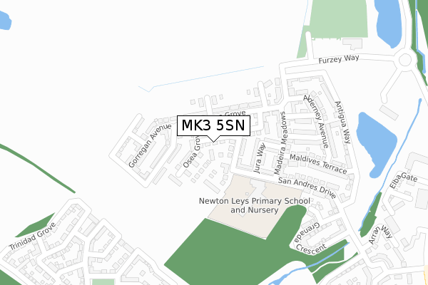
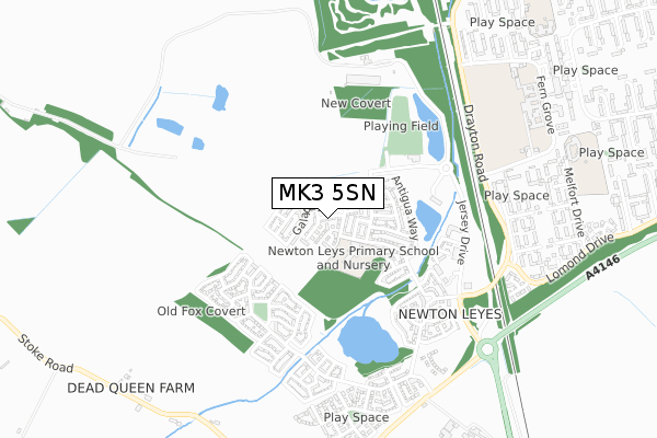
MK3 5SN is located in the Bletchley East electoral ward, within the unitary authority of Milton Keynes and the English Parliamentary constituency of Milton Keynes South. The Sub Integrated Care Board (ICB) Location is NHS Bedfordshire, Luton and Milton Keynes ICB - M1J4Y and the police force is Thames Valley. This postcode has been in use since June 2019.


GetTheData
Source: OS Open Zoomstack (Ordnance Survey)
Licence: Open Government Licence (requires attribution)
Attribution: Contains OS data © Crown copyright and database right 2025
Source: Open Postcode Geo
Licence: Open Government Licence (requires attribution)
Attribution: Contains OS data © Crown copyright and database right 2025; Contains Royal Mail data © Royal Mail copyright and database right 2025; Source: Office for National Statistics licensed under the Open Government Licence v.3.0
| Easting | 486722 |
| Northing | 231618 |
| Latitude | 51.976281 |
| Longitude | -0.738829 |
GetTheData
Source: Open Postcode Geo
Licence: Open Government Licence
| Country | England |
| Postcode District | MK3 |
➜ See where MK3 is on a map ➜ Where is Bletchley? | |
GetTheData
Source: Land Registry Price Paid Data
Licence: Open Government Licence
| Ward | Bletchley East |
| Constituency | Milton Keynes South |
GetTheData
Source: ONS Postcode Database
Licence: Open Government Licence
1, WALLASEA AVENUE, NEWTON LEYS, MILTON KEYNES, MK3 5SN 2019 27 SEP £325,000 |
GetTheData
Source: HM Land Registry Price Paid Data
Licence: Contains HM Land Registry data © Crown copyright and database right 2025. This data is licensed under the Open Government Licence v3.0.
| St Helena Avenue | Newton Leys | 485m |
| Tulla Court (Fern Grove) | Bletchley | 683m |
| Fern Grove | Bletchley | 873m |
| Lomond Drive | Bletchley | 875m |
| Sir Herbert Leon School (Fern Grove) | Bletchley | 980m |
| Bletchley Station | 2.1km |
| Fenny Stratford Station | 3.1km |
| Bow Brickhill Station | 4.3km |
GetTheData
Source: NaPTAN
Licence: Open Government Licence
| Percentage of properties with Next Generation Access | 100.0% |
| Percentage of properties with Superfast Broadband | 100.0% |
| Percentage of properties with Ultrafast Broadband | 100.0% |
| Percentage of properties with Full Fibre Broadband | 100.0% |
Superfast Broadband is between 30Mbps and 300Mbps
Ultrafast Broadband is > 300Mbps
| Percentage of properties unable to receive 2Mbps | 0.0% |
| Percentage of properties unable to receive 5Mbps | 0.0% |
| Percentage of properties unable to receive 10Mbps | 0.0% |
| Percentage of properties unable to receive 30Mbps | 0.0% |
GetTheData
Source: Ofcom
Licence: Ofcom Terms of Use (requires attribution)
GetTheData
Source: ONS Postcode Database
Licence: Open Government Licence


➜ Get more ratings from the Food Standards Agency
GetTheData
Source: Food Standards Agency
Licence: FSA terms & conditions
| Last Collection | |||
|---|---|---|---|
| Location | Mon-Fri | Sat | Distance |
| St. Lucia Crescent | 17:30 | 12:00 | 696m |
| Serpentine Court | 17:30 | 12:00 | 1,014m |
| Barton Road | 17:30 | 12:00 | 1,151m |
GetTheData
Source: Dracos
Licence: Creative Commons Attribution-ShareAlike
The below table lists the International Territorial Level (ITL) codes (formerly Nomenclature of Territorial Units for Statistics (NUTS) codes) and Local Administrative Units (LAU) codes for MK3 5SN:
| ITL 1 Code | Name |
|---|---|
| TLJ | South East (England) |
| ITL 2 Code | Name |
| TLJ1 | Berkshire, Buckinghamshire and Oxfordshire |
| ITL 3 Code | Name |
| TLJ12 | Milton Keynes |
| LAU 1 Code | Name |
| E06000042 | Milton Keynes |
GetTheData
Source: ONS Postcode Directory
Licence: Open Government Licence
The below table lists the Census Output Area (OA), Lower Layer Super Output Area (LSOA), and Middle Layer Super Output Area (MSOA) for MK3 5SN:
| Code | Name | |
|---|---|---|
| OA | E00175381 | |
| LSOA | E01016743 | Milton Keynes 032B |
| MSOA | E02003490 | Milton Keynes 032 |
GetTheData
Source: ONS Postcode Directory
Licence: Open Government Licence
| MK3 5GU | Madeira Meadows | 174m |
| MK3 5NZ | Madeira Meadows | 181m |
| MK3 5HB | Alderney Avenue | 208m |
| MK3 5GW | Barbados Row | 209m |
| MK3 5PB | Ascension Gardens | 213m |
| MK3 5GG | San Andres Drive | 222m |
| MK3 5GT | Maldives Terrace | 246m |
| MK3 5GX | Alderney Avenue | 247m |
| MK3 5GD | Aruba Close | 277m |
| MK3 5GY | Tasmania Grove | 278m |
GetTheData
Source: Open Postcode Geo; Land Registry Price Paid Data
Licence: Open Government Licence