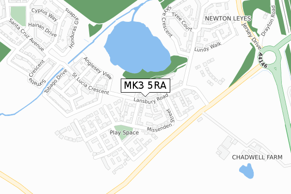
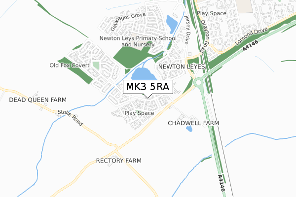
MK3 5RA is located in the Great Brickhill electoral ward, within the unitary authority of Buckinghamshire and the English Parliamentary constituency of Buckingham. The Sub Integrated Care Board (ICB) Location is NHS Bedfordshire, Luton and Milton Keynes ICB - M1J4Y and the police force is Thames Valley. This postcode has been in use since December 2019.


GetTheData
Source: OS Open Zoomstack (Ordnance Survey)
Licence: Open Government Licence (requires attribution)
Attribution: Contains OS data © Crown copyright and database right 2025
Source: Open Postcode Geo
Licence: Open Government Licence (requires attribution)
Attribution: Contains OS data © Crown copyright and database right 2025; Contains Royal Mail data © Royal Mail copyright and database right 2025; Source: Office for National Statistics licensed under the Open Government Licence v.3.0
| Easting | 486992 |
| Northing | 231018 |
| Latitude | 51.970846 |
| Longitude | -0.735051 |
GetTheData
Source: Open Postcode Geo
Licence: Open Government Licence
| Country | England |
| Postcode District | MK3 |
➜ See where MK3 is on a map ➜ Where is Bletchley? | |
GetTheData
Source: Land Registry Price Paid Data
Licence: Open Government Licence
| Ward | Great Brickhill |
| Constituency | Buckingham |
GetTheData
Source: ONS Postcode Database
Licence: Open Government Licence
8, LANSBURY ROAD, NEWTON LEYS, MILTON KEYNES, MK3 5RA 2021 19 MAR £349,125 |
4, LANSBURY ROAD, NEWTON LEYS, MILTON KEYNES, MK3 5RA 2021 23 FEB £471,500 |
2, LANSBURY ROAD, NEWTON LEYS, MILTON KEYNES, MK3 5RA 2021 19 FEB £363,500 |
6, LANSBURY ROAD, NEWTON LEYS, MILTON KEYNES, MK3 5RA 2021 29 JAN £458,375 |
24, LANSBURY ROAD, NEWTON LEYS, MILTON KEYNES, MK3 5RA 2020 20 NOV £459,000 |
54, LANSBURY ROAD, NEWTON LEYS, MILTON KEYNES, MK3 5RA 2020 10 JAN £425,000 |
36, LANSBURY ROAD, NEWTON LEYS, MILTON KEYNES, MK3 5RA 2019 20 DEC £435,000 |
56, LANSBURY ROAD, NEWTON LEYS, MILTON KEYNES, MK3 5RA 2019 13 DEC £410,991 |
38, LANSBURY ROAD, NEWTON LEYS, MILTON KEYNES, MK3 5RA 2019 13 DEC £432,500 |
GetTheData
Source: HM Land Registry Price Paid Data
Licence: Contains HM Land Registry data © Crown copyright and database right 2025. This data is licensed under the Open Government Licence v3.0.
| St Helena Avenue | Newton Leys | 314m |
| Lomond Drive | Bletchley | 695m |
| Tulla Court (Fern Grove) | Bletchley | 873m |
| Arrow Place (Lomond Drive) | Bletchley | 1,184m |
| The Lindens (Stoke Road) | Stoke Hammond | 1,212m |
| Bletchley Station | 2.7km |
| Fenny Stratford Station | 3.5km |
| Bow Brickhill Station | 4.6km |
GetTheData
Source: NaPTAN
Licence: Open Government Licence
GetTheData
Source: ONS Postcode Database
Licence: Open Government Licence


➜ Get more ratings from the Food Standards Agency
GetTheData
Source: Food Standards Agency
Licence: FSA terms & conditions
| Last Collection | |||
|---|---|---|---|
| Location | Mon-Fri | Sat | Distance |
| St. Lucia Crescent | 17:30 | 12:00 | 82m |
| Serpentine Court | 17:30 | 12:00 | 1,245m |
| Laidon Close | 17:15 | 12:00 | 1,401m |
GetTheData
Source: Dracos
Licence: Creative Commons Attribution-ShareAlike
The below table lists the International Territorial Level (ITL) codes (formerly Nomenclature of Territorial Units for Statistics (NUTS) codes) and Local Administrative Units (LAU) codes for MK3 5RA:
| ITL 1 Code | Name |
|---|---|
| TLJ | South East (England) |
| ITL 2 Code | Name |
| TLJ1 | Berkshire, Buckinghamshire and Oxfordshire |
| ITL 3 Code | Name |
| TLJ13 | Buckinghamshire |
| LAU 1 Code | Name |
| E06000060 | Buckinghamshire |
GetTheData
Source: ONS Postcode Directory
Licence: Open Government Licence
The below table lists the Census Output Area (OA), Lower Layer Super Output Area (LSOA), and Middle Layer Super Output Area (MSOA) for MK3 5RA:
| Code | Name | |
|---|---|---|
| OA | E00089194 | |
| LSOA | E01017669 | Aylesbury Vale 006A |
| MSOA | E02003657 | Aylesbury Vale 006 |
GetTheData
Source: ONS Postcode Directory
Licence: Open Government Licence
| MK3 5QP | Lansbury Road | 86m |
| MK3 5QJ | Hopkins Road | 135m |
| MK3 5QB | Clarke Mews | 198m |
| MK3 5AY | Skye Crescent | 222m |
| MK3 5FB | Tiree Court | 222m |
| MK3 5FL | St Helena Avenue | 229m |
| MK3 5FH | Lundy Walk | 235m |
| MK3 5QN | King Close | 247m |
| MK3 5FJ | St Helena Avenue | 248m |
| MK3 5QD | Coleman Road | 252m |
GetTheData
Source: Open Postcode Geo; Land Registry Price Paid Data
Licence: Open Government Licence