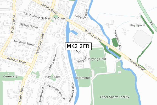
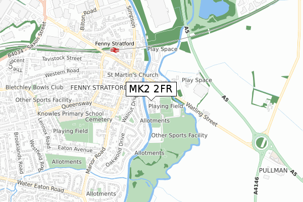
MK2 2FR is located in the Bletchley East electoral ward, within the unitary authority of Milton Keynes and the English Parliamentary constituency of Milton Keynes South. The Sub Integrated Care Board (ICB) Location is NHS Bedfordshire, Luton and Milton Keynes ICB - M1J4Y and the police force is Thames Valley. This postcode has been in use since April 2018.


GetTheData
Source: OS Open Zoomstack (Ordnance Survey)
Licence: Open Government Licence (requires attribution)
Attribution: Contains OS data © Crown copyright and database right 2025
Source: Open Postcode Geo
Licence: Open Government Licence (requires attribution)
Attribution: Contains OS data © Crown copyright and database right 2025; Contains Royal Mail data © Royal Mail copyright and database right 2025; Source: Office for National Statistics licensed under the Open Government Licence v.3.0
| Easting | 488409 |
| Northing | 233859 |
| Latitude | 51.996159 |
| Longitude | -0.713699 |
GetTheData
Source: Open Postcode Geo
Licence: Open Government Licence
| Country | England |
| Postcode District | MK2 |
➜ See where MK2 is on a map ➜ Where is Bletchley? | |
GetTheData
Source: Land Registry Price Paid Data
Licence: Open Government Licence
| Ward | Bletchley East |
| Constituency | Milton Keynes South |
GetTheData
Source: ONS Postcode Database
Licence: Open Government Licence
2022 30 MAY £575,000 |
2021 14 JAN £560,000 |
2019 30 MAY £545,000 |
21, BRICK FIELD, BLETCHLEY, MILTON KEYNES, MK2 2FR 2018 29 OCT £352,000 |
24, BRICK FIELD, BLETCHLEY, MILTON KEYNES, MK2 2FR 2018 21 SEP £550,000 |
22, BRICK FIELD, BLETCHLEY, MILTON KEYNES, MK2 2FR 2018 20 SEP £567,500 |
2018 31 AUG £570,000 |
29, BRICK FIELD, BLETCHLEY, MILTON KEYNES, MK2 2FR 2018 24 AUG £575,000 |
30, BRICK FIELD, BLETCHLEY, MILTON KEYNES, MK2 2FR 2018 3 AUG £595,000 |
GetTheData
Source: HM Land Registry Price Paid Data
Licence: Contains HM Land Registry data © Crown copyright and database right 2025. This data is licensed under the Open Government Licence v3.0.
| Wharfside (Watling Street) | Fenny Stratford | 147m |
| Aylesbury Street | Fenny Stratford | 248m |
| Wharfside (Watling Street) | Fenny Stratford | 257m |
| Aylesbury Street | Fenny Stratford | 271m |
| St Thomas Aquinas Church (Manor Road) | Fenny Stratford | 330m |
| Fenny Stratford Station | 0.5km |
| Bow Brickhill Station | 1.5km |
| Bletchley Station | 1.6km |
GetTheData
Source: NaPTAN
Licence: Open Government Licence
| Percentage of properties with Next Generation Access | 100.0% |
| Percentage of properties with Superfast Broadband | 100.0% |
| Percentage of properties with Ultrafast Broadband | 100.0% |
| Percentage of properties with Full Fibre Broadband | 100.0% |
Superfast Broadband is between 30Mbps and 300Mbps
Ultrafast Broadband is > 300Mbps
| Percentage of properties unable to receive 2Mbps | 0.0% |
| Percentage of properties unable to receive 5Mbps | 0.0% |
| Percentage of properties unable to receive 10Mbps | 0.0% |
| Percentage of properties unable to receive 30Mbps | 0.0% |
GetTheData
Source: Ofcom
Licence: Ofcom Terms of Use (requires attribution)
GetTheData
Source: ONS Postcode Database
Licence: Open Government Licence


➜ Get more ratings from the Food Standards Agency
GetTheData
Source: Food Standards Agency
Licence: FSA terms & conditions
| Last Collection | |||
|---|---|---|---|
| Location | Mon-Fri | Sat | Distance |
| Aylesbury Street | 18:30 | 12:00 | 256m |
| The Limes | 18:30 | 12:00 | 297m |
| Victoria Road | 17:00 | 12:00 | 437m |
GetTheData
Source: Dracos
Licence: Creative Commons Attribution-ShareAlike
The below table lists the International Territorial Level (ITL) codes (formerly Nomenclature of Territorial Units for Statistics (NUTS) codes) and Local Administrative Units (LAU) codes for MK2 2FR:
| ITL 1 Code | Name |
|---|---|
| TLJ | South East (England) |
| ITL 2 Code | Name |
| TLJ1 | Berkshire, Buckinghamshire and Oxfordshire |
| ITL 3 Code | Name |
| TLJ12 | Milton Keynes |
| LAU 1 Code | Name |
| E06000042 | Milton Keynes |
GetTheData
Source: ONS Postcode Directory
Licence: Open Government Licence
The below table lists the Census Output Area (OA), Lower Layer Super Output Area (LSOA), and Middle Layer Super Output Area (MSOA) for MK2 2FR:
| Code | Name | |
|---|---|---|
| OA | E00175383 | |
| LSOA | E01033497 | Milton Keynes 023E |
| MSOA | E02003481 | Milton Keynes 023 |
GetTheData
Source: ONS Postcode Directory
Licence: Open Government Licence
| MK2 2AU | Penn Road | 99m |
| MK2 2HZ | Pinewood Drive | 111m |
| MK2 2AL | Saracens Wharf | 144m |
| MK2 2BS | Watling Street | 159m |
| MK2 2JB | Maple Grove | 161m |
| MK2 2AZ | Wharfside | 167m |
| MK2 2JA | Walnut Drive | 173m |
| MK2 2AW | Watling Street | 197m |
| MK2 2AT | Millward Drive | 207m |
| MK2 2AQ | Aylesbury Street | 216m |
GetTheData
Source: Open Postcode Geo; Land Registry Price Paid Data
Licence: Open Government Licence