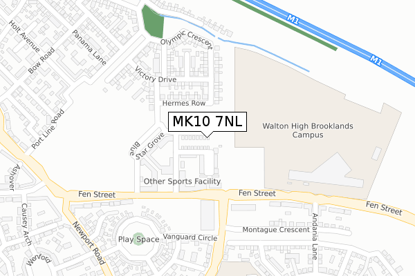
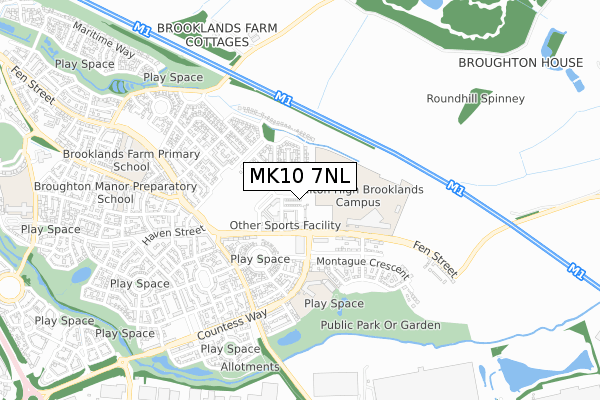
MK10 7NL maps, stats, and open data
MK10 7NL is located in the Broughton electoral ward, within the unitary authority of Milton Keynes and the English Parliamentary constituency of Milton Keynes North. The Sub Integrated Care Board (ICB) Location is NHS Bedfordshire, Luton and Milton Keynes ICB - M1J4Y and the police force is Thames Valley. This postcode has been in use since February 2020.
MK10 7NL maps


Licence: Open Government Licence (requires attribution)
Attribution: Contains OS data © Crown copyright and database right 2025
Source: Open Postcode Geo
Licence: Open Government Licence (requires attribution)
Attribution: Contains OS data © Crown copyright and database right 2025; Contains Royal Mail data © Royal Mail copyright and database right 2025; Source: Office for National Statistics licensed under the Open Government Licence v.3.0
MK10 7NL geodata
| Easting | 490763 |
| Northing | 239637 |
| Latitude | 52.047715 |
| Longitude | -0.677892 |
Where is MK10 7NL?
| Country | England |
| Postcode District | MK10 |
Politics
| Ward | Broughton |
|---|---|
| Constituency | Milton Keynes North |
House Prices
Sales of detached houses in MK10 7NL
11, WINDSOR CASTLE STREET, BROOKLANDS, MILTON KEYNES, MK10 7NL 2025 5 AUG £485,000 |
2024 6 NOV £475,000 |
11, WINDSOR CASTLE STREET, BROOKLANDS, MILTON KEYNES, MK10 7NL 2024 27 MAR £480,000 |
15, WINDSOR CASTLE STREET, BROOKLANDS, MILTON KEYNES, MK10 7NL 2021 8 JAN £450,000 |
7, WINDSOR CASTLE STREET, BROOKLANDS, MILTON KEYNES, MK10 7NL 2020 4 DEC £439,950 |
3, WINDSOR CASTLE STREET, BROOKLANDS, MILTON KEYNES, MK10 7NL 2020 27 NOV £439,950 |
9, WINDSOR CASTLE STREET, BROOKLANDS, MILTON KEYNES, MK10 7NL 2020 3 JUL £449,950 |
2020 12 MAR £459,950 |
11, WINDSOR CASTLE STREET, BROOKLANDS, MILTON KEYNES, MK10 7NL 2020 4 MAR £449,950 |
Licence: Contains HM Land Registry data © Crown copyright and database right 2025. This data is licensed under the Open Government Licence v3.0.
Transport
Nearest bus stops to MK10 7NL
| Broughton Gate (Newport Road) | Broughton | 347m |
| Broughton Gate (Newport Road) | Broughton | 364m |
| Countess Way | Broughton | 666m |
| Countess Way | Broughton | 676m |
| Brooklands Farm (Newport Road) | Broughton | 971m |
Nearest railway stations to MK10 7NL
| Woburn Sands Station | 3.7km |
| Aspley Guise Station | 4.3km |
| Bow Brickhill Station | 5km |
Deprivation
25.3% of English postcodes are less deprived than MK10 7NL:Food Standards Agency
Three nearest food hygiene ratings to MK10 7NL (metres)


➜ Get more ratings from the Food Standards Agency
Nearest post box to MK10 7NL
| Last Collection | |||
|---|---|---|---|
| Location | Mon-Fri | Sat | Distance |
| Swanwick Lane | 17:30 | 11:30 | 1,194m |
| Chippenham Drive | 18:30 | 1,263m | |
| Tanfield Lane | 17:30 | 11:30 | 1,437m |
MK10 7NL ITL and MK10 7NL LAU
The below table lists the International Territorial Level (ITL) codes (formerly Nomenclature of Territorial Units for Statistics (NUTS) codes) and Local Administrative Units (LAU) codes for MK10 7NL:
| ITL 1 Code | Name |
|---|---|
| TLJ | South East (England) |
| ITL 2 Code | Name |
| TLJ1 | Berkshire, Buckinghamshire and Oxfordshire |
| ITL 3 Code | Name |
| TLJ12 | Milton Keynes |
| LAU 1 Code | Name |
| E06000042 | Milton Keynes |
MK10 7NL census areas
The below table lists the Census Output Area (OA), Lower Layer Super Output Area (LSOA), and Middle Layer Super Output Area (MSOA) for MK10 7NL:
| Code | Name | |
|---|---|---|
| OA | E00175435 | |
| LSOA | E01033509 | Milton Keynes 017H |
| MSOA | E02003475 | Milton Keynes 017 |
Nearest postcodes to MK10 7NL
| MK10 7GT | Port Line Road | 287m |
| MK10 7GN | Bow Road | 386m |
| MK10 7AP | Newport Road | 387m |
| MK10 7GQ | Union Castle Row | 393m |
| MK10 7AU | Greenway | 409m |
| MK10 7GR | Doxford Heath | 415m |
| MK10 7DW | Nairn Grove | 436m |
| MK10 7AR | Causey Arch | 448m |
| MK10 7EA | Ashover | 450m |
| MK10 7HG | Countess Way | 450m |